Chesterfield in St. Louis County, Missouri — The American Midwest (Upper Plains)
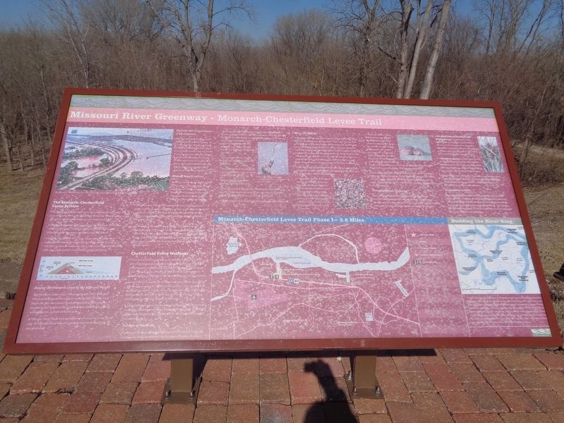
Missouri River Greenway - Monarch-Chesterfield Levee Trail
Inscription.
The Monarch-Chesterfield Levee System
The Monarch-Chesterfield Levee was constructed to protect the City of Chesterfield and adjacent communities from flooding caused by the Missouri River or one of its tributaries.
·The Great Flood of 1993 inundated the Midwest. More than 1,000 levees failed, 70,000 buildings were damaged, and 50 people died. Damages totaled at least $12 billion.
·On July 30, 1993 at 10:17 p.m. the surging Missouri River ruptured the Monarch Levee. Flood waters spilled through a 100 foot section of the Levee, filling the entire Chesterfield Valley with over eight feet of murky flood water and debris.
Raising the Monarch Levee to the 500-year Height
The Monarch Levee was a 100-year levee in 1993 when the Missouri River broke through its western side. In 1994, work began to raise the Levee's flood protection to 500 years by increasing the height of the levee 3-6 fet, widening it, adding seepage berms, gates and flood walls.
A 100-year flood has a 1 percent chance of occurring at any given year. A 500-year flood has a 0.2 percent chance of occurring in any given year.
The Post-1993 Commitment to Development
Although several dozen businesses abandoned the area for higher ground after the devastating flood, others chose to remain. The City of Chesterfield created a tax-increment financing district to rebuild the levee and revitalize the area. As a result, Chesterfield Valley has become one of the region's hottest retail markets and its success has spurred other cities to develop their flood plains.
Missouri River Greenway
The Great Rivers Greenway District's (GRG) system of parks, open spaces and trails will reconnect people in the region with the little known features and resources that exist along the Missouri River corridor.
The Monarch-Chesterfield Levee Trail (MCLT) is key to the City's parks, recreation and trails system. It will connect to other regional trails and is central to the Missouri River Greenway project being developed by GRG along the historic and scenic Missouri River.
The master plan establishes a 17-mile trail, of which approximately 12 miles are on the Monarch-Chesterfield Levee within the 4,100-acre Chesterfield Valley area. On-street bike paths, sidewalks and walking paths connect with the trail and encourage opportunities for non-motorized recreation and transportation.
Chesterfield Valley Wetlands
The Monarch-Chesterfield Levee District and the City of Chesterfield sponsored a 130-acre wetland mitigation project which created wetland sites in Chesterfield
along the Missouri River. The project took two years to complete and has been monitored for several years to ensure the success of the wetlands.
The Zahniser Institute for Environmental Studies in Greenville, Illinois was awarded $770,000 for the project. They created two wetland sites north of Hwy 40 in Chesterfield Valley. The West Wetland Area affected 26 acres out of a 43-acre area. The East Wetland Area affected 104 out of 200 acres.
Wetland construction involves excavating and grading earth to create the water levels at which wetlands thrive. Trees, plants and shrubs that flourish in wet conditions are then introduced to the reworked ground.
The Role of Wetlands
Wetlands are important for the health of our natural resources and provide many benefits to river basins and riparian corridors:
·Help regulate river flow and provide flood and storm control by their capacity to absorb and store water. As rainwater spreads out across the river basin, it is absorbed by organic and mineral deposits and retained by buffer areas of grassland rushes and willow as opposed to flowing rapidly and dumping straight into the river.
·Filter pollutants out of water through biological and chemical oxidation.
·Control erosion by absorbing silt and organic matter, and serving as a sedimentation area.
·Offer
wildlife habitat for breeding, nesting and feeding.
·Generate nutrients upon which fish and other forms of fresh water life feed. As the sun beats down upon standing water, bacteria grows and becomes part of the food cycle.
·Refresh ground water supplies and provide valuable watersheds.
Homes for Wildlife
•Large numbers of waterfowl migrate along the Missouri River corridor and depend on the floodplain in St. Louis County. This area attracts nesting populations of blue wing teal, mallard and wood duck. Bald eagles make their winter residence along the river. The endangered American bittern, a shy bird that inhabits freshwater marshes, also may be found here. Other birds include the snowy egret, northern harrier, king rail, peregrine falcon, loggerhead shrike, pied-billed grebe, little blue heron, marsh wren, Cooper's hawk, Henslow's sparrow and the Virginia rail.
•Fish, like the endangered paillid sturgeon, the sturgeon chub, sicklefin chub, silver chub, plains minnow and ghost shiner use quiet backwater habitats for spawning.
•The Indiana Bat, an endangered species, could roost in the area during the spring and summer. The female bat establishes small colonies near water at forest openings, where tree canopy is sparse. The bats roost beneath the loose bark of hickory or oak trees greater than nine inches in diameter.
•Main tree species within the wetlands area includes black willow, cottonwood, sycamore, slippery elm, green ash and silver maple. Weedy plant species can include the amaranth, curly leaved dock, (unreadable) grass and foxtail. Bulrushes, cattail, false nettle and sedge may also be present. A plant of special concern is the imperiled aquatic dwarf burhead that colonizes receding sandy or rocks shoreline areas.
•Species typical to this wetland habitat include white-tailed deer, opossum, raccoon, muskrat, eastern gray and fox squirrels, moles, meadow (unreadable), cottontail rabbits, box turtles, bullfrogs, cricket frogs, Fowler's toads, garter snakes, black rat snakes and western ribbon snakes.
Managing Natural Resources
Every individual impacts the planet in some way. Good environmental stewardship consists of being mindful of our natural resources. By actively conserving, preserving and recycling resources, we help sustain our environment for generations.
•The Big Muddy National Fish and Wildlife Refuge, established in 1994 was created to help preserve and restore portions of the Missouri River floodplain and its fish and wildlife habitats. The Refuge currently covers 10,396 acres in size, but is authorized to expand to 60,000 acres.
•Boone's Crossing is one of eight units of the Big Muddy National Fish and Wildlife Refuge. It covers 572 acres, including a 400-acre island known as Johnson Island, which is accessible only from the Missouri River.
•Dedicated to environmental educational and conservation restoration efforts, the Zahniser Institute has restored over 1,000 acres of forests and prairies, and has planted over 100,000 trees in Missouri and Illinois.
Recreational Facilities
More that 350,000 people annually utilize the Chesterfield Valley Athletic Complex, which covers 142 acres and includes 14 baseball/softball fields, 10 soccer/football practice fields, two playgrounds and three concession buildings. The CVAC is also home to the Catch-22 Foundation's Miracle Field, designed for use by children with disabilities.
Erected by Great Rivers Greenway.
Topics. This historical marker is listed in these topic lists: Animals • Disasters • Environment • Waterways & Vessels. A significant historical date for this entry is July 30, 1993.
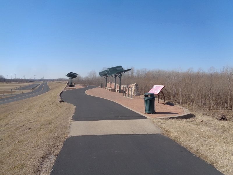
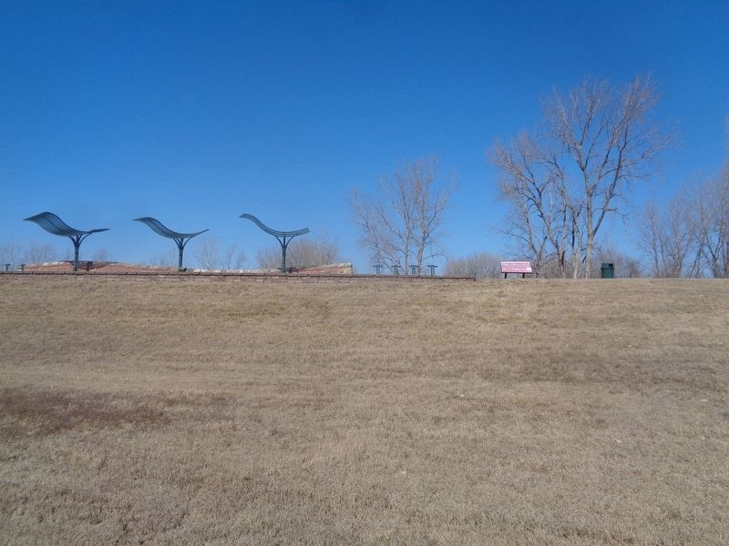
Location. 38° 40.736′ N, 90° 38.342′ W. Marker is in Chesterfield, Missouri, in St. Louis County. Marker is on Loop Road north of North Outer 40 Road, on the left when traveling east. Marker is located on the Monarch-Chesterfield Levee Trail, behind Chesterfield Valley Athletic Complex. Touch for map. Marker is in this post office area: Chesterfield MO 63005, United States of America. Touch for directions.
Other nearby markers. At least 8 other markers are within 5 miles of this marker, measured as the crow flies. Historic Monarch (approx. 2.8 miles away); Historic Westland Acres (approx. 2.9 miles away); Historic Orrville (approx. 3.2 miles away); John L. LeCave Memorial Trailhead (approx. 3.4 miles away); "TNT" (approx. 3.9 miles away); Historic Centaur (approx. 4 miles away); Greens Bottom to Weldon Spring (approx. 4.6 miles away); Greens Bottom to St. Charles (approx. 4.6 miles away).
Also see . . . Missouri Greenway - Monarch-Chesterfield Levee Trail. From Great Rivers Greenway's website, this gives you a map of the trail as well as future planned extensions. (Submitted on February 15, 2024, by Jason Voigt of Glen Carbon, Illinois.)
Credits. This page was last revised on February 15, 2024. It was originally submitted on February 15, 2024, by Jason Voigt of Glen Carbon, Illinois. This page has been viewed 63 times since then. Photos: 1, 2, 3. submitted on February 15, 2024, by Jason Voigt of Glen Carbon, Illinois.


