Bowery in Manhattan in New York County, New York — The American Northeast (Mid-Atlantic)
M'Finda Kalunga Garden
Sara D. Roosevelt Park
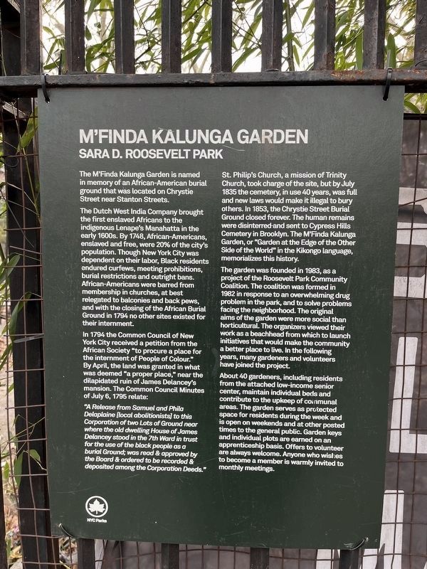
The M'Finda Kalunga Garden is named in memory of an African-American burial ground that was located on Chrystie Street near Stanton Streets.
The Dutch West India Company brought the first enslaved Africans to the indigenous Lenape's Manhatta in the early 1600s. By 1748, AFrican-Americans, enslaved and free, were 20% of the city's population. Though New York City was dependent on their labor, Black residents endured curfews, meeting prohibitions, burial restrictions and outright bans. African-Americans were barred from membership in churches, at best relegated to balconies and back pews, and with the closing of the African Burial Ground in 1794 no other sites existed for their internment.
By 1794 the Common Council of New York City received a petition from the African Society "to procure a place for the internment of People of Colour." By April, the land was granted in what was deemed "a proper place," near the dilapidated ruin of James Delancey's mansion. The Common Council Minutes of July 6, 1795 relate:
"A Release from Samuel and Phila Delaplaine [local abolitionists] to this Corporation of two Lots of Ground near where the old dwelling House of James Delancey stood in the 7th Ward in trust for the use of the black people as a burial Ground; was read & approved by the Board & ordered to be recorded & deposited among the Corporation Deeds."
St. Philip's Church, a mission of Trinity Church, took charge of the site, but by July 1835 the cemetery, in use 40 years, was full and new laws would make it illegal to bury others. In 1853, the Chrystie Street Burial Ground closed forever. The human remains were disinterred and sent to Cypress Hills Cemetery in Brooklyn. The M'Finda Kalunga Garden, or "Garden at the Edge of the Other Side of the World" in the Kikongo language, memorializes this history.
The garden was founded in 1983, as a project of the Roosevelt Park Community Coalition. The coalition was formed in 1982 in response to an overwhelming drug problem in the park, and to solve problems facing the neighborhood. The original aims of the garden were more social than horticultural. The organizers viewed their work as a beachhead from which to launch initiatives that would make the community a better place to live. In the following years, many gardeners and volunteers have joined the project.
About 40 gardeners, including residents from the attached low-income senior center, maintain individual beds and contribute to the upkeep of communal areas. The garden serves as protected space for residents during the week and is open on weekends and at other posted times to the general public. Garden keys

Photographed By Devry Becker Jones (CC0), February 15, 2024
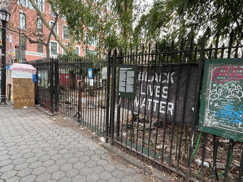
2. M'Finda Kalunga Garden entrance on the grounds of Sara D. Roosevelt Park
Erected by NYC Parks.
Topics and series. This historical marker is listed in these topic lists: African Americans • Cemeteries & Burial Sites • Churches & Religion • Parks & Recreational Areas. In addition, it is included in the NYC Parks series list. A significant historical date for this entry is July 6, 1795.
Location. 40° 43.265′ N, 73° 59.507′ W. Marker is in Manhattan, New York, in New York County. It is in the Bowery. Marker is on Rivington Street just west of Forsyth Street, on the left when traveling west. Touch for map. Marker is at or near this postal address: 165 Forsyth St, New York NY 10002, United States of America. Touch for directions.
Other nearby markers. At least 8 other markers are within walking distance of this marker. M'Finda Kalunga Community Garden (here, next to this marker); University Settlement House (about 400 feet away, measured in a direct line); Longest-Running Catalogue In America (about 500 feet away); “Big Tim” Sullivan’s Clubhouse (about 500 feet away); Italian Renaissance Palazzo On Bowery (about 500 feet away); Yiddish Theatre’s 1st American Home (about 500 feet away); Birthplace Of Vaudeville? (about 500 feet away); A Bowery Flop (about 500 feet away). Touch for a list and map of all markers in Manhattan.
Related marker. Click here for another marker that is related to this marker. This marker has replaced the linked marker.
Credits. This page was last revised on February 19, 2024. It was originally submitted on February 19, 2024, by Devry Becker Jones of Washington, District of Columbia. This page has been viewed 40 times since then. Photos: 1, 2. submitted on February 19, 2024, by Devry Becker Jones of Washington, District of Columbia.
