West Bronx in Bronx County, New York — The American Northeast (Mid-Atlantic)
Transportation Links of the Market

Photographed By Devry Becker Jones (CC0), February 17, 2024
1. Transportation Links of the Market Marker
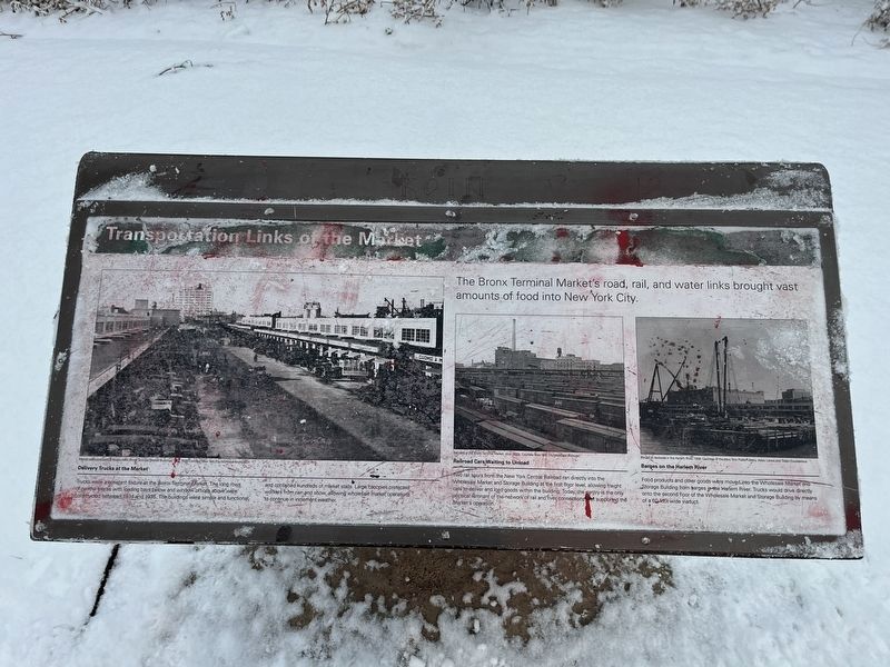
The Bronx Terminal Market's road, rail, and water links brought vast amounts of food into New York City.
Delivery Trucks at the Market
Trucks were a constant fixture at the Bronx Terminal Market. The long rows of narrow stores with loading bays below and window offices above were constructed between 1934 and 1935. The buildings were simple and functional and contained hundreds of market stalls. Large canopies protected workers from rain and snow, allowing wholesale market operations to continue in inclement weather.
Railroad Cars Waiting to Unload
Two rail spurs from New York Central Railroad ran directly into the Wholesale Market and Storage Building at the first floor level, allowing freight cars to deliver and load goods within the building. Today, the pantry is the only physical remnant of the network of rail connections that supported the Market's operation.
Barges on the Harlem River
Food products and other goods were moved into the Wholesale Market and Storage Building from barges into the Harlem River. Trucks would drive directly onto the second floor of the Wholesale Market and Storage Building by means of a 60-foot-wide viaduct.
Erected by NYC Parks.
Topics and series. This historical marker is listed in these topic lists: Industry & Commerce • Railroads & Streetcars • Roads & Vehicles • Waterways & Vessels. In addition, it is included in the NYC Parks series list. A significant historical year for this entry is 1934.
Location. 40° 49.313′ N, 73° 55.931′ W. Marker is in Bronx, New York, in Bronx County. It is in West Bronx. Marker can be reached from Exterior Street north of East 150th Street, on the left when traveling north. The marker stands on the grounds of Mill Pond Park. Touch for map. Marker is at or near this postal address: 5968 E 150th St, Bronx NY 10451, United States of America. Touch for directions.
Other nearby markers. At least 8 other markers are within walking distance of this marker. Products and Goods of the Market (within shouting distance of this marker); Before the Bronx Terminal Market (about 600 feet away, measured in a direct line); The Power House (approx. 0.2 miles away); 9/11 Memorial Mural (approx. ¼ mile away); Eugenio María de Hostos (approx. 0.3 miles away); Bronx Post Office (approx. 0.3 miles away); 369th Infantry Regiment Monument

Photographed By Devry Becker Jones (CC0), February 17, 2024
2. Transportation Links of the Market Marker
Credits. This page was last revised on February 21, 2024. It was originally submitted on February 21, 2024, by Devry Becker Jones of Washington, District of Columbia. This page has been viewed 39 times since then. Photos: 1, 2. submitted on February 21, 2024, by Devry Becker Jones of Washington, District of Columbia.