
Long Island City in Queens in Queens County, New York — The American Northeast (Mid-Atlantic)
Railroad Traffic on the River
Gantry Plaza State Park
| — | New York Parks, Recreation and Historic Preservation | — |
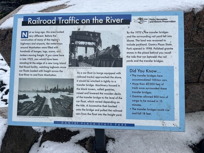
Not so long ago, this area looked very different. Before the construction of many of the region's highways and airports, the waterways around Manhattan, were filled with hundreds of barges, tugs, scows, and tanker moving freight. If you came here in late 1925, you would have been standing at the edge of a new Long Island Rail Road facility, watching tugboats move car floats loaded with freight across the East River to and from Manhattan.
As a car float (a barge equipped with railroad tracks) approached the shore, it would be winched in tightly to a transfer bridge. Machinery housed in the black towers, called gantries, raised and lowered the wooden decks of the transfer bridge to the level of the car float, which varied depending on the tide. A locomotive then backed onto the bridge and pulled the railroad cars from the float into the freight yard.
By the 1970's, the transfer bridges and the surrounding rail yard fell into disuse. The land was re-zoned to include parkland. Gantry Plaza State Park opened in 1998. Polished Granite stones in the plaza behind you recall the rails that ran between the rail yards and
this page online
Did You Know…
• The transfer bridges here accommodated 100-ton cars.
• More than 40,000 feet of track once surrounded these transfer bridges.
• Gantries allowed 800 tons of cargo to be moved in 15 minutes.
• The transfer bridges could rise and fall 18 feet.
Erected by New York Parks, Recreation and Historic Preservation.
Topics. This historical marker is listed in these topic lists: Industry & Commerce • Parks & Recreational Areas • Railroads & Streetcars • Waterways & Vessels. A significant historical year for this entry is 1925.
Location. 40° 44.671′ N, 73° 57.529′ W. Marker is in Queens, New York, in Queens County. It is in Long Island City. It can be reached from Center Boulevard north of 49th Avenue, on the left when traveling north. Touch for map. Marker is at or near this postal address: 4-09 47th Rd, Long Island City NY 11101, United States of America. Touch for directions.

Regionally, this marker is in New York City and on Long Island. It is also in the American Northeast, in the Mid-Atlantic, and on the Eastern Seaboard. Globally, it is in the North Atlantic Region,
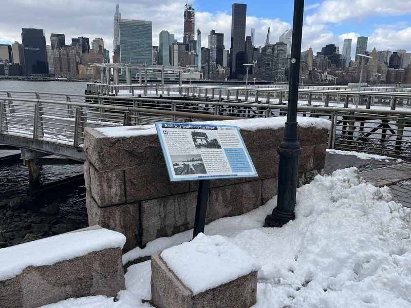
Other nearby markers. At least 8 other markers are within walking distance of this marker: In Memory of Bill Bylewski (about 300 feet away, measured in a direct line); History of Hunter's Point (about 600 feet away); Franklin Delano Roosevelt (approx. 0.4 miles away); Hunter's Point South Salt Marsh (approx. 0.4 miles away); Newtown Creek - Brooklyn (approx. 0.4 miles away); New York State Coasts and Waterways (approx. 0.4 miles away); Newtown Creek Directory and Map (approx. 0.4 miles away); National Sugar Refining Company (approx. 0.4 miles away). Touch for a list and map of all markers in Queens.
Photographed by Devry Becker Jones (CC0), February 17, 2024
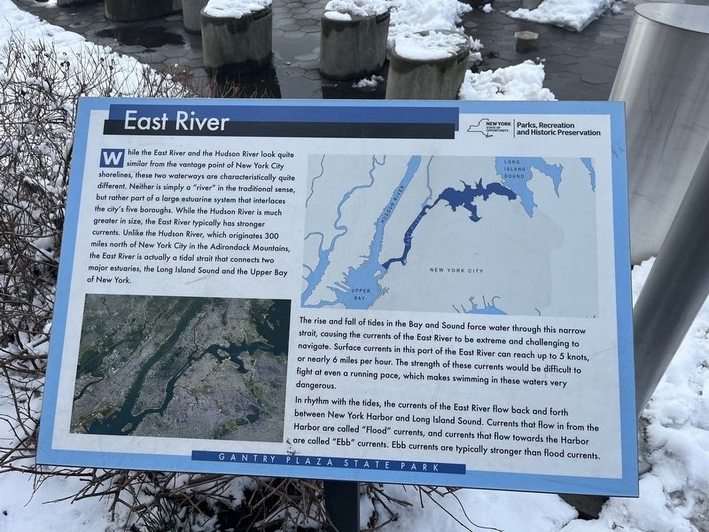
3. East River interpretive signage
This additional signage in the park shares only the natural history of the East River and does not serve as a historical marker.
Credits. This page was last revised on February 22, 2024. It was originally submitted on February 22, 2024, by Devry Becker Jones of Washington, District of Columbia. This page has been viewed 341 times since then and 17 times this year. Photos: 1, 2, 3. submitted on February 22, 2024, by Devry Becker Jones of Washington, District of Columbia.
