Cedar City in Iron County, Utah — The American Mountains (Southwest)
Escalante Trail
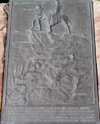
Photographed by Dawn Bowen, June 20, 2007
1. Escalante Trail Marker
Topics and series. This historical marker is listed in these topic lists: Colonial Era • Exploration • Religion & Religious Structures • Settlements & Settlers. In addition, it is included in the Dominguez y Escalante Expedition series list. A significant historical month for this entry is July 1776.
Location. Marker has been reported missing. It was located near 37° 40.871′ N, 113° 3.69′ W. Marker was in Cedar City, Utah, in Iron County. It was at the intersection of Main Street and 200 North on Main Street. Touch for map. Marker was at or near this postal address: 200 N Main Street, Cedar City UT 84720, United States of America. Touch for directions.

Regionally, this marker was in Color Country. It was also in the American Mountain West and on the Colorado Plateau. Globally, it was in North America, the Rocky Mountains, the Western Hemisphere, the
this page online
Other nearby markers. At least 8 other markers are within walking distance of this location: Heroine of China (a few steps from this marker); El Escalante Hotel (within shouting distance of this marker); The Utah Parks Company (within shouting distance of this marker); Cedar City Railroad Depot (within shouting distance of this marker); Palace Drug Building (about 500 feet away, measured in a direct line); The Utah Parks Company Commissary (about 600 feet away); The Southern Paiute People (about 700 feet away); Pioneer Stockman (approx. 0.2 miles away). Touch for a list and map of all markers in Cedar City.
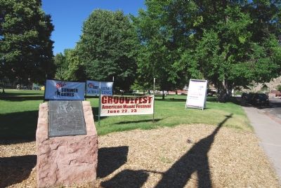
Photographed by Dawn Bowen, June 20, 2007
2. Escalante Trail Marker
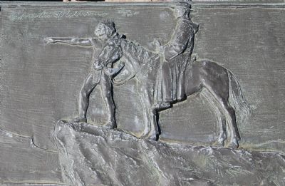
Photographed by Dawn Bowen, June 20, 2007
3. Escalante Trail Marker detail
The artwork is by artist Christian Petersen (Danish-American, 1885-1961).
Credits. This page was last revised on February 23, 2024. It was originally submitted on June 28, 2007, by Dawn Bowen of Fredericksburg, Virginia. This page has been viewed 2,567 times since then and 47 times this year. Last updated on February 23, 2024, by Jeremy Snow of Cedar City, Utah. Photos: 1, 2, 3. submitted on June 28, 2007, by Dawn Bowen of Fredericksburg, Virginia. • Devry Becker Jones was the editor who published this page.
