Northern Waterfront in San Francisco City and County, California — The American West (Pacific Coastal)
Egg War of the Farallones
Photographed by Brock Wiley
1. Egg War of the Farallones Marker
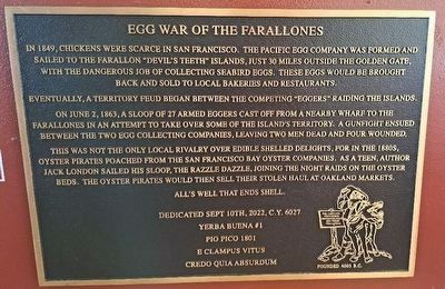
Eventually, a territory feud began between the competing "Eggers" raiding the islands.
On June 2, 1863, a sloop of 27 armed eggers cast off from a nearby wharf to the Farallones in an attempt to take over some of the island’s territory. A gunfight ensued between the two egg collecting companies, leaving two men dead and four wounded.
This was not the only local rivalry over edible shelled delights, for in the 1880s, oyster pirates poached from the San Francisco Bay oyster companies. As a teen, author Jack London sailed his sloop, the Razzle Dazzle, joining the night raids on the oyster beds. The oyster pirates would then sell their stolen haul at Oakland markets.
Alls well that ends shell.
Dedicated Sept 10th 2022, C.Y. 6027
Yerba Buena #1
Pio Pico 1801
E Clampus Vitus
Credo Quia Absurdum
Erected 2022
this page online
Topics and series. This historical marker is listed in these topic lists: Animals • Wars, Non-US. In addition, it is included in the E Clampus Vitus series list.
Location. 37° 48.202′ N, 122° 24.053′ W. Marker is in San Francisco, California, in San Francisco City and County. It is in Northern Waterfront. It can be reached from The Embarcadero. Touch for map. Marker is at or near this postal address: 23 The Embarcadero, San Francisco CA 94111, United States of America. Touch for directions.

Regionally, this marker is on the Coast Ranges. It is also on the American Pacific Coast. Globally, it is in North America, on the Ring of Fire, on the Pacific Rim, in the Western Hemisphere, in the Western World, and in the Anglosphere. Historically, it finds itself in what was once New Spain and also Mexico’s Alta California.
Other nearby markers. At least 8 other markers are within walking distance of this marker: White Angel (within shouting distance of this marker); Gold Mountain (within shouting distance of this marker); Those Who Harvest the Sea (about 500 feet away, measured in a direct line); Buried Ships (about 500 feet away); Down to the Sea in Ships (approx. 0.2 miles away); Belt Line Railroad (approx. 0.2 miles away); Discarded Treasure (approx. 0.2 miles away); Green Street (approx. 0.2 miles away). Touch for a list and map of all markers in San Francisco.
Credits. This page was last revised on February 25, 2024. It was originally submitted on February 23, 2024, by Brock Wiley of Modesto, California. This page has been viewed 336 times since then and 36 times this year. Photo 1. submitted on February 23, 2024, by Brock Wiley of Modesto, California. • Andrew Ruppenstein was the editor who published this page.
