West Sahara in Las Vegas in Clark County, Nevada — The American Mountains (Southwest)
Old Spanish Trail Park
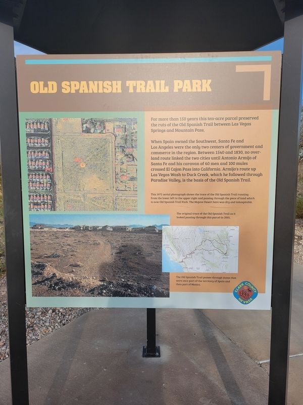
For more than 150 years this ten-acre parcel preserved the ruts of the Old Spanish Trail between Las Vegas Springs and Mountain Pass.
When Spain owned the Southwest, Santa Fe and Los Angeles were the only two centers of government and commerce in the region. Between 1540 and 1830, no over land route linked the two cities until Antonio Armijo of Santa Fe and his caravan of 60 men and 100 mules crossed El Cajon Pass into California. Armijo's route up Las Vegas Wash to Duck Creek, which he followed through Paradise Valley, is the basis of the Old Spanish Trail.
This 1972 aerial photograph shows the trace of the Old Spanish Trail from the lower left to the upper right and passing through the piece of land which is now Old Spanish Trail Park. The Mojave Desert here was dry and inhospitable.
(caption) The original trace of the Old Spanish Trail as it looked passing through this parcel in 2001.
(caption) The Old Spanish Troll passes through states that were once part of the territory of Spain and then part of Mexico.
Erected by Clark County.
Topics and series. This historical marker is listed in these topic lists: Colonial Era • Exploration • Roads & Vehicles. In addition, it is included in the Old Spanish National Trail series list. A significant historical year for this entry is 1831.
Location. 36° 8.331′ N, 115° 16.131′ W. Marker is in Las Vegas, Nevada, in Clark County. It is in West Sahara. Marker can be reached from Tara Avenue. Can be seen at entrance of the park from the parking lot. Touch for map. Marker is at or near this postal address: 8150 Tara Ave, Las Vegas NV 89117, United States of America. Touch for directions.
Other nearby markers. At least 8 other markers are within walking distance of this marker. The Old Spanish Trail Through Clark County (within shouting distance of this marker); Frémont and His Scouts (within shouting distance of this marker); Native People Knew the Old Spanish Trail (within shouting distance of this marker); Las Vegas Ranches 1865-1905 (within shouting distance of this marker); Children and the Old Spanish Trail (within shouting distance of this marker); From Old Spanish Trail to I-15 (within shouting distance of this marker); Outlaws and Horse Thieves on the Old Spanish Trail (about 300 feet away, measured in a direct line); The Mormon Battle & The Old Spanish Trail (about 300 feet away). Touch for a list and map of all markers in Las Vegas.

Photographed By Jeremy Snow, February 16, 2024
2. Old Spanish Trail Park Marker
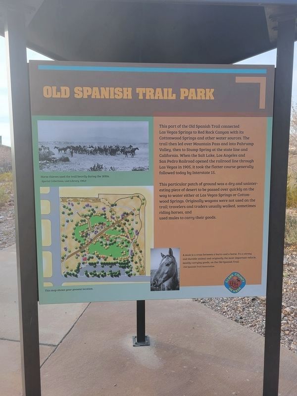
This part of the Old Spanish Trial connected Las Vegas Springs to Red Rock Canyon with its Cottonwood Springs and other water sources. The trail then led over Mountain Pass and into Pahrump Valley, then to Stump Spring at the state line and California. When the Salt Lake, Los Angeles and San Pedro Railroad opened the railroad line through Las Vegas in 1905, it took the flatter course generally followed today by Interstate 15.
This particular patch of ground was a dry and uninteresting peice of desert to be passed over quickly on the way to water either at Las Begas Springs or Cottonwood Springs. Orgiginally wagons were not used on the trail; travelers and traders usually walked, sometimes riding horses, and used mules to carry their goods.
A mule is a cross between a burron and a horse. It's a strong and durable animal and orignally the most important vehicle, mostly carrying good, on the Old Spanish Trail - Old Spanish Trail Association.

Photographed By Jeremy Snow, February 16, 2024
3. Old Spanish Trail Park Marker
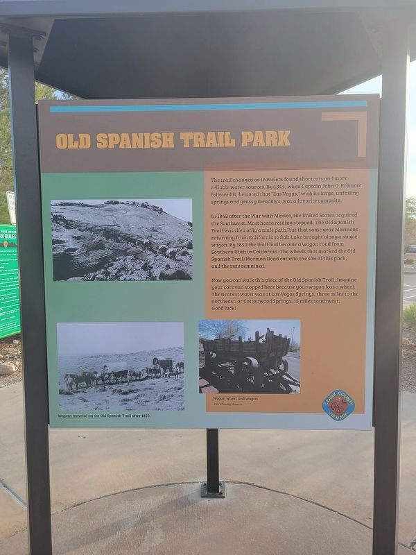
The trail changed as travelers found shortcuts and more reliable water sources. By 1844, when Captain John C. Fremont followed it, he noted that "Las Vegas," with its large, unfailing springs and grassy meadows, was a favorite campsite.
In 1848 after the War with Mexico, the United States acquired the Southwest. Most horse raiding stopped. The Old Spanish Trail was then only a mule path, but that same year Mormons returning from California to Salt Lake brought along a single wagon. By 1850 the trail had become a wagon road from Southern Utah to Califorani. The wheels that marked the Old Spanish Trail/Mormon Road cut into the soild of this park, and the ruts remained.
Now you can walk this piece of the Old Spanish Trail. Imagine your caravan stopped here because your wagon lost a sheel. The nearest water was at Las Vegas Springs, three miles to the northeast, or Corronwood Springs, 15 miles southwest. Good luck!
Credits. This page was last revised on March 11, 2024. It was originally submitted on February 23, 2024, by Jeremy Snow of Cedar City, Utah. This page has been viewed 31 times since then. Photos: 1, 2, 3, 4. submitted on February 23, 2024, by Jeremy Snow of Cedar City, Utah. • Bill Pfingsten was the editor who published this page.

