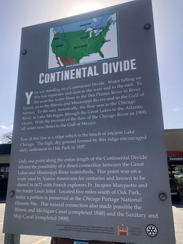
Oak Park in Cook County, Illinois — The American Midwest (Great Lakes)
Continental Divide
East of this line is a ridge which is the beach of ancient Lake Chicago. The high, dry ground formed by this ridge encouraged early settlement in Oak Park in 1837.
Only one point along the entire length of the Continental Divide offered the possibility of a direct connection between the Great Lakes and Mississippi River watersheds. This point was on a route used by Native Americans for centuries and known to be shared in 1673 with French explorers Fr. Jacques Marquette and fur trader Louis Joliet. Located five miles south of Oak Park, today a portion is preserved as the Chicago Portage National Historic Site. This natural connection also made possible the Illinois and Michigan Canal (completed 1848) and the Sanitary and Ship Canal (completed 1900).
Erected 1999 by Rotary Club of Oak Park; Oak Park River Forest Museum.
Topics and series. This historical marker is listed in these topic lists: Environment • Exploration • Native Americans • Settlements & Settlers. In addition, it is included in the Rotary International series list. A significant historical year for this entry is 1837.
Location. 41° 54.544′ N, 87° 47.074′ W. Marker is in Oak Park, Illinois, in Cook County. Marker is at the intersection of North Avenue (Illinois Route 64) and Narragansett Avenue, on the right when traveling east on North Avenue. The marker is in front of the North Ridge strip mall, a short distance from the beginning of Ridgeland Avenue. Touch for map. Marker is at or near this postal address: 6325 W North Ave, Oak Park IL 60302, United States of America. Touch for directions.
Other nearby markers. At least 8 other markers are within walking distance of this marker. Galewood Community War Memorial (about 800 feet away, measured in a direct line); a different marker also named Continental Divide (approx. 0.4 miles away); Henry A. Taylor (approx. half a mile away); Taylor Park (approx. half a mile away); Gold Star Men of the World War (approx. 0.6 miles away); The Fairy Tales of Hans Christian Andersen (approx. 0.6 miles away); a different marker also named The Fairy Tales of Hans Christian Andersen
(approx. 0.6 miles away); The Life and Times of Hans Christian Andersen (approx. 0.6 miles away). Touch for a list and map of all markers in Oak Park.
More about this marker. The marker is one of at least five in Oak Park that line the approximate path of the continental divide through Oak Park. The back of the marker points to the two watersheds (the Great Lakes and the Mississippi) and notes that it is 630 feet above sea level.
Related markers. Click here for a list of markers that are related to this marker. Continental Divide Markers in Oak Park
Also see . . . The Continental Divide in Oak Park. From the Historical Society of Oak Park & River Forest (Submitted on February 24, 2024, by Sean Flynn of Oak Park, Illinois.)
Credits. This page was last revised on February 24, 2024. It was originally submitted on February 24, 2024, by Sean Flynn of Oak Park, Illinois. This page has been viewed 47 times since then. Photos: 1, 2, 3, 4. submitted on February 24, 2024, by Sean Flynn of Oak Park, Illinois.


