Inner Harbor in Baltimore, Maryland — The American Northeast (Mid-Atlantic)
Baltimore Riot Trail
Death at President Street Station
| — | Baltimore – A House Divided | — |
Photographed by William Pfingsten, September 9, 2007
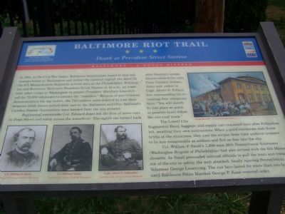
1. Baltimore Riot Trail Marker
In 1861, as the Civil War began, Baltimore secessionists hoped to stop rail transportation to Washington and isolate the national capital. On April 19, the 6th Massachusetts Regiment arrived here at the Philadelphia, Wilmington and Baltimore Railroad’s President Street Station at 10 a.m. en route with other troops to Washington to answer President Abraham Lincoln’s call for 75,000 volunteers to counter the “rebellion.” Because of anti-Unionist demonstrations the day before, the 720 soldiers were ordered to load their weapons while horses pulled their cars to the Baltimore and Ohio Railroad’s Camden Station (locomotives were banned from the city streets).
Regimental commander Col. Edward Jones led the first of seven cars to Pratt Street and safely across the waterfront. The eighth car turned back after Southern sympathizers blocked the rails. From Camden Station, Jones sent orders to Capt. Albert S. Follansbee, commanding the remaining four companies here: “You will march to this place as quick as possible [and] follow the rail-road track.”
The Lowell City Regimental Band, baggage, and supply cars remained here after
this page online
Col. William F. Small’s 1,200-man 26th Pennsylvania Volunteers (Washington Brigade of Philadelphia) had also arrived with the 6th Massachusetts. As Small persuaded railroad officials to pull the train and troops out of the city to safety, the mob attacked, fatally injuring Pennsylvania Volunteer George Leisenring. The riot here lasted for more than two hours until Baltimore Police Marshal George P. Kane restored order.
Erected by Maryland Civil War Trails.
Topics and series. This historical marker is listed in these topic lists: Railroads & Streetcars • War, US Civil. In addition, it is included in the Maryland Civil War Trails series list. A significant historical month for this entry is April 1909.
Location. This marker has been replaced by another marker nearby. It was located near 39° 17.044′ N, 76° 36.143′ W. Marker was in Baltimore, Maryland. It was in the Inner Harbor. It was at the intersection of
Photographed by William Pfingsten, September 9, 2007
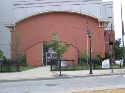
2. President Street Station
The station was the Baltimore Civil War Museum, but had to close due to budget cuts Sept. 1, 2007. President-Elect Abraham Lincoln had to make the same trip from President Street Station to Camden Station on the way to his inauguration. It was reported that he disguised himself as a woman to avoid secessionists. In actuality, he arrived on an earlier train and passed through the city unnoticed.

Regionally, this marker was in Central Maryland. It was also in the American Mid-Atlantic, in the Chesapeake Bay Region, and on the Eastern Seaboard. Globally, it was in the North Atlantic Region, North America, the Western Hemisphere, the Western World, and the Anglosphere. Historically, it found itself in what was once one of the original Thirteen Colonies and also the Antebellum South.
Other nearby markers. At least 10 other markers are within walking distance of this location: A different marker also named Baltimore Riot Trail (here, next to this marker); President Street Station (here, next to this marker); On to Yorktown (here, next to this marker); a different marker also named President Street Station (a few steps from this marker); Mr. Trash Wheel (about 400 feet away); Baltimore Public Works Museum (about 400 feet away); The National Katyń Memorial (about 400 feet away); The Katyń Massacre, 1940
Photographed by Devry Becker Jones (CC0), October 8, 2021
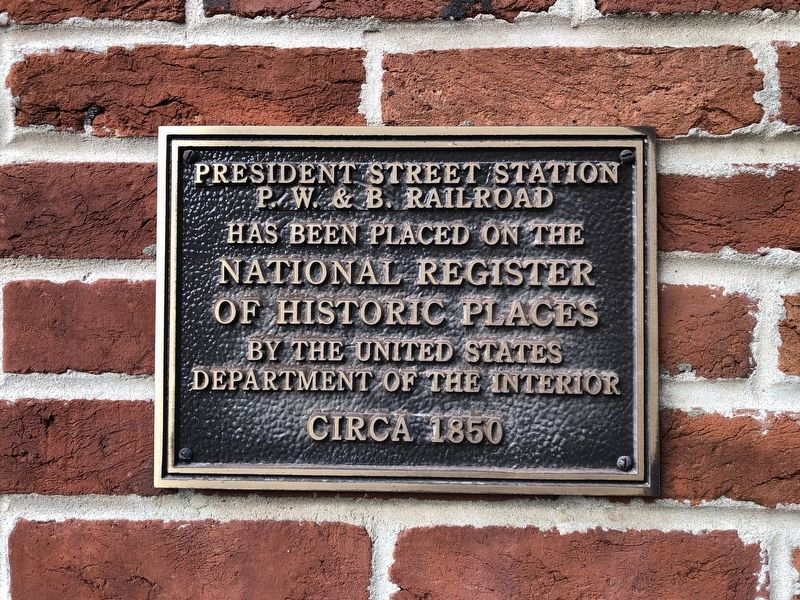
3. National Register of Historic Places plaque for the President Street Station
Another marker is no longer nearby. The Inner Harbor Water Wheel (was about 400 feet away, measured in a direct line but has been replaced with another marker now near it).
Related marker. Click here for another marker that is related to this marker. This marker has been replaced with the linked marker which has a slightly different subtitle.
Credits. This page was last revised on April 2, 2023. It was originally submitted on September 10, 2007, by Bill Pfingsten of Bel Air, Maryland. This page has been viewed 7,583 times since then and 52 times this year. Photos: 1, 2. submitted on September 10, 2007, by Bill Pfingsten of Bel Air, Maryland. 3. submitted on October 8, 2021, by Devry Becker Jones of Washington, District of Columbia. • J. J. Prats was the editor who published this page.
