Port Huron in St. Clair County, Michigan — The American Midwest (Great Lakes)
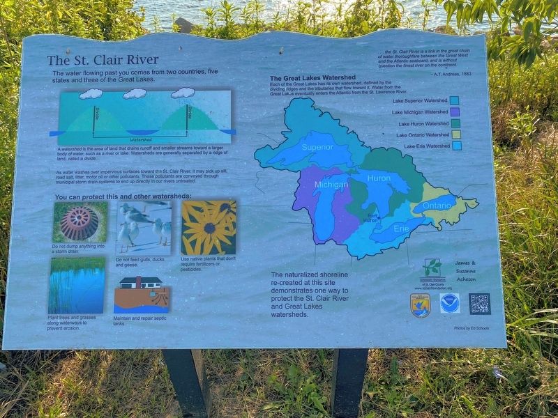
The St. Clair River
The water flowing past you comes from two countries, five states and three of the Great Lakes.
A watershed is the area of land that drains runoff and smaller streams toward a larger body of water, such as a river or lake. Watersheds are generally separated by a ridge of land, called a divide.
As water washes over impervious surfaces toward the St. Clair River, it may pick up silt, road salt, litter, motor oil or other pollutants. These pollutants are conveyed through municipal storm drain systems to end up directly in our rivers untreated.
You can protect this and other watersheds:
•Do not dump anything into a storm drain.
•Do not feed gulls, ducks and geese.
•Plant trees and grasses along waterways to prevent erosion.
•Maintain and repair septic tanks.
•Use native plants that don't require fertilizers or pesticides.
…the St. Clair River is a link in the great chain of water thoroughfare between the Great West and the Atlantic seaboard, and is without question the finest river on the continent.
-A.T. Andreas, 1883
The Great Lakes Watershed
Each of the Great Lakes has its own watershed, defined by the dividing ridges and the tributaries that flow toward it. Water from the Great Lakes eventually enters the Atlantic from the St. Lawrence River.
The naturalized shoreline re-created at this site demonstrates one way to protect the St. Clair River and Great Lakes watersheds.
Erected by Community Foundation.
Topics. This historical marker is listed in these topic lists: Environment • Waterways & Vessels. A significant historical year for this entry is 1883.
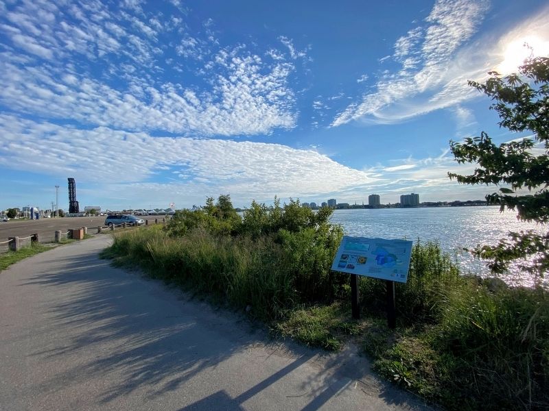
Location. 42° 58.214′ N, 82° 25.223′ W. Marker is in Port Huron, Michigan, in St. Clair County. Marker is on Court Street near Griswold Street. The marker is along the Blue Water River Walk. Touch for map. Marker is at or near this postal address: 51 Court Street, Port Huron MI 48060, United States of America. Touch for directions.
Other nearby markers. At least 8 other markers are within walking distance of this marker. The Port Huron Carferry: crossing the St. Clair River (within shouting distance of this marker); Woman's Benefit Association (approx. 0.2 miles away); Woman's Life Insurance Society (approx. 0.2 miles away); Bina M. West (approx. 0.2 miles away); Harrington Hotel / Truman Honeymoon (approx. ¼ mile away); Hammond American Legion Post 8 Memorial (approx. 0.3 miles away); Port Huron Public Library (approx. 0.3 miles away); Davidson House (approx. 0.4 miles away). Touch for a list and map of all markers in Port Huron.
Credits. This page was last revised on February 29, 2024. It was originally submitted on March 5, 2023, by J.T. Lambrou of New Boston, Michigan. This page has been viewed 84 times since then and 27 times this year. Last updated on February 26, 2024, by Carl Gordon Moore Jr. of North East, Maryland. Photos: 1, 2. submitted on March 5, 2023, by J.T. Lambrou of New Boston, Michigan. • Devry Becker Jones was the editor who published this page.

