New Bloomfield in Perry County, Pennsylvania — The American Northeast (Mid-Atlantic)
Founding of New Bloomfield
Perry County Bicentennial
— Perry County Heritage Trail —
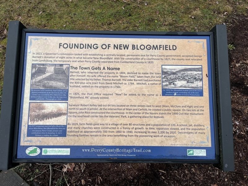
In 1832, a Governor's commission tasked with establishing a centrally located, permanent seat for Perry County government, accepted George Barnett's donation of eight acres in what became New Bloomfield. With the construction of a courthouse in 1827, the county seat relocated from Landisburg, the temporary seat when Perry County separated from Cumberland County in 1820.
The Town Gets a Name
Barnett, who inherited the property in 1804, declined the name to town after himself. His wife offered the the name "Bloom Field," taken from the land title selected by his father, Thomas Barnett. The elder Barnett had purchased the 400-plus acre tract from David Mitchell ca. 1784. Mitchell, a native of Scotland, settled on the property in 1750s.
In 1825, the Post Office required "New" to be added to the name as a "Bloomfield, PA" already existed.
Surveyor Robert Kelley laid out 64 lots located on three streets east to west (Main, McClure and High) and one north to south (Carlisle). At the intersection of Main and Carlisle, he created a public square. On two lots at the Square, John Rice constructed the courthouse. In the center of the Square stands the 1898 Civil War monument. On the southeast corner lies the Veterans' Park, a gathering place for festivals.
By 1829, farm fields gave way to a village of over 80 structures and a population of 220. A school, jail, distillery, and many churches were constructed in a frenzy of growth. In time, expansion followed, and the population stabilized at approximately 700 from 1860 to 1940, increasing to over 1,200 by 2020. Descendants of many founding families remain in the area benefitting from the pioneering work of ancestors.
[Captions:]
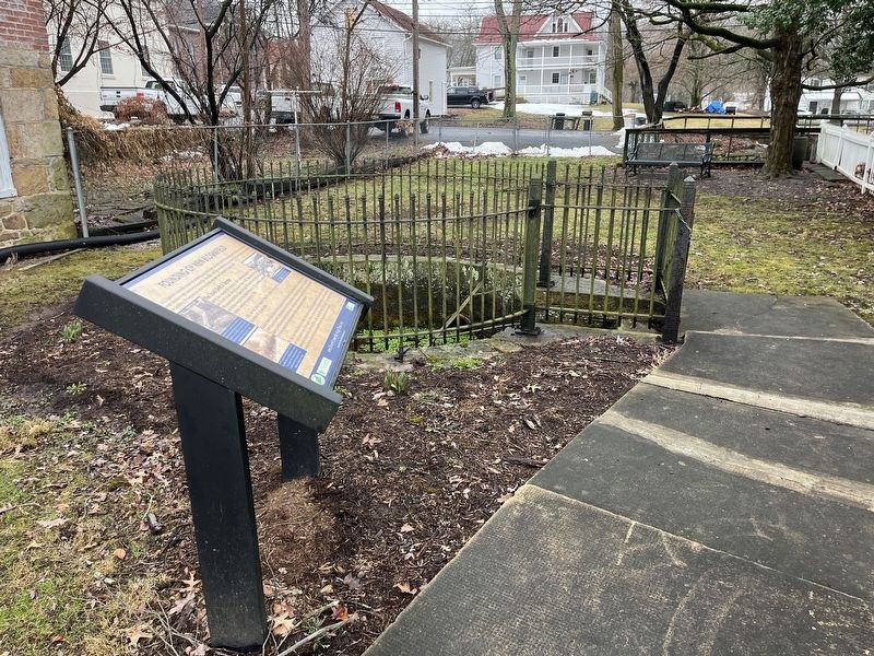
The presence of a continuous, high-volume spring figured prominently in the decision to place the county seat. Located on West Main Street, Big Spring produces water to this day, but long since undrinkable. Photograph ca. 1910.
In 1917, young men marched off to World War I down Main Street. New Bloomfield has been the site of many Perry County parades and celebrations since its founding. Lt. Ed L. Holman is leading the column.
Ca. 1910, New Bloomfield Academy graced the town's northern hillside overlooking one of the most attractive communities in Central Pennsylvania.
Erected 2020 by CNESTA Group, LLC; Historical Society of Perry County.
Topics and series. This historical marker is listed in these topic lists: Colonial Era • Political Subdivisions • Settlements & Settlers

Photographed By Devry Becker Jones (CC0), February 23, 2024
2. Founding of New Bloomfield marker in front of the spring
Location. 40° 25.145′ N, 77° 11.304′ W. Marker is in New Bloomfield, Pennsylvania, in Perry County. Marker is on West Main Street (Pennsylvania Route 274) just west of Spring Alley, on the left when traveling west. Touch for map. Marker is at or near this postal address: 31 W Main St, New Bloomfield PA 17068, United States of America. Touch for directions.
Other nearby markers. At least 8 other markers are within walking distance of this marker. The Big Spring (a few steps from this marker); The Old County Jail (about 300 feet away, measured in a direct line); Stoops' Barber Shop (about 300 feet away); The Civil War Monument (about 300 feet away); The Rhinesmith Building (about 400 feet away); Original site of Bloomfield Academy (about 400 feet away); The Academies on the Hill (about 400 feet away); Perry County Civil War Memorial (about 400 feet away). Touch for a list and map of all markers in New Bloomfield.
Credits. This page was last revised on February 27, 2024. It was originally submitted on February 27, 2024, by Devry Becker Jones of Washington, District of Columbia. This page has been viewed 66 times since then. Photos: 1, 2. submitted on February 27, 2024, by Devry Becker Jones of Washington, District of Columbia.
