Spring Township near Elliottsburg in Perry County, Pennsylvania — The American Northeast (Mid-Atlantic)
Life in the Pennsylvania Backcountry
Perry County Bicentennial
— 1820 - 2020 —

Photographed By Devry Becker Jones (CC0), February 23, 2024
1. Life in the Pennsylvania Backcountry Marker
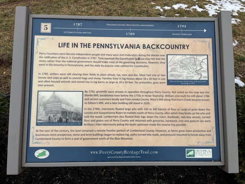
1787: US Constitution written.
1789: President George Washington inaugurated.
1794: Whiskey Rebellion.
Perry Countians were fiercely independent people and many were Anti-Federalists during the debate over the ratification of the U.S. Constitution in 1787. They opposed the Constitution because they felt that the states rather than the national government should make most of the governing decisions. However, they were in the minority in Pennsylvania, and the state by popular vote ratified the Constitution.
In 1792, settlers were still clearing their fields to plant wheat, rye, corn and flax. Most had one or two horses and cows as well as several hogs and sheep. Families lived in log houses about 18 × 20 feet in size and often housed animals and stored hay in log barns as large as 20 × 50 feet. For protection, guns were ever present.
By 1792, gristmills were already in operation throughout Perry County. Not used on the map was the Martin Mill, established before the 1770s in Howe Township. William Linn built his mill about 1786 and served customers locally and from Juniata County. West's Mill along Sherman's Creek became known as Gibson's Mill, and a later building still stood in 2020.
In the 1790s, merchants floated large arks with 100 to 300 barrels of flour or sacks of grain down the Juniata and Susquehanna Rivers to markets south of Perry County, after which they broke up the arks and sold the wood. Lumbermen also floated their logs down the rivers. Keelboats, two-way vessels carried flour and grains out of Perry County and returned with groceries, hardware, iron and gypsum (an early fertilizer.) Men laboriously poling the boats upstream made the reverse trip possible.
At the turn of the century, the land remained a remote frontier portion of Cumberland County. However, as farms grew more productive and businesses more prosperous, stone and brick buildings began replacing log, paths turned into roads, and pressure mounted to break away from Cumberland County to form a seat of government nor the of the Blue Mountain.
Erected 2020 by Historical Society of Perry County. (Marker Number 5.)
Topics and series. This historical marker is listed in these topic lists: Agriculture • Government & Politics • Industry & Commerce • Waterways & Vessels. In addition, it is included in the Perry County Heritage Trail in Pennsylvania. series list. A significant historical year for this entry is 1787.
Location. 40° 23.084′ N, 77° 17.861′ W. Marker is near Elliottsburg, Pennsylvania, in Perry County

Photographed By Devry Becker Jones (CC0), February 23, 2024
2. Life in the Pennsylvania Backcountry Marker
Other nearby markers. At least 8 other markers are within walking distance of this marker. A Perry County Civil War Soldier: Sergeant John Jones (here, next to this marker); Birth of a New County! (here, next to this marker); The Greatest Generation Goes to War (here, next to this marker); Life in the Great Depression (here, next to this marker); Perry Countians in the Revolutionary War (here, next to this marker); WW I and Its Aftermath (here, next to this marker); Perry County Covered Bridges (here, next to this marker); A New Century (a few steps from this marker). Touch for a list and map of all markers in Elliottsburg.
Credits. This page was last revised on February 28, 2024. It was originally submitted on February 28, 2024, by Devry Becker Jones of Washington, District of Columbia. This page has been viewed 43 times since then. Photos: 1, 2. submitted on February 28, 2024, by Devry Becker Jones of Washington, District of Columbia.