Chambersburg in Franklin County, Pennsylvania — The American Northeast (Mid-Atlantic)
Flashpoint for Invasion
Franklin County's Civil War
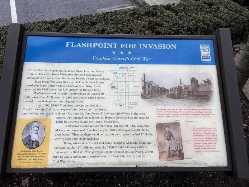
With its Southern border on the Mason-Dixon Line, and located in the middle of the Great Valley that stretched back through Maryland to Virginia, Franklin County became a Civil War hotspot.
Even before war came this way, abolitionist John Brown boarded at Mary Ritner's house a block away on King Street, planning his 1859 raid on the U.S. Armory at Harpers Ferry.
Hoofbeats echoed through Chambersburg on October 10, 1862, when Gen. J.E.B. Stuart's 1,00 cavalrymen raided stores, burned railroad shops, and cut telegraph wires.
In June 1863, 75,000 Confederate troops marched into Franklin County, and many people of color fled rather than being sent south to slavery. On June 26, Gen. Robert E. Lee met with officers in the town square, then camped one mile east at Shetters Woods and set the stage for battle by ordering troops east toward Gettysburg.
Confederates came yet one more time. On July 30, 1864, Gen. John McCausland ransomed Chambersburg for $100,000 in gold or $500,000 in greenbacks. When residents could not pay, his cavalrymen torched 12 blocks, leaving more than 2,000 homeless.
Today, where generals met and flames crackled, Memorial Fountain, dedicated on July 17, 1868, to honor the 5,000 Franklin County citizens that served in the Civil War, provides a more tranquil setting. Now it is your turn to plan a campaign to explore beautiful Franklin County and its Civil War history.
[Captions:]
Abolitionist John Brown planned his Harpers Ferry raid at a Chambersburg boarding house at 225 E. King Street.
Confederate Gen. John McCausland's July 1864 raid destroyed large portions of Chambersburg. When resident Anna Mellinger heard the "Rebs was coming" she and her husband "loaded our Wagon with Corn and hay" and fled the town.
An unidentified injured U.S. soldier had this image taken at J. Keagy's Chambersburg photographic studio located at the corner of Market and Main Streets. Was he a local resident, or just one of the thousands of soldiers that passed thorugh the town?
Erected by Pennsylvania Civil War Trails.
Topics and series. This historical marker is listed in these topic lists: Abolition & Underground RR • African Americans • Industry & Commerce • War, US Civil. In addition, it is included in the Pennsylvania Civil War Trails series list. A significant historical month for this entry is June 1863.
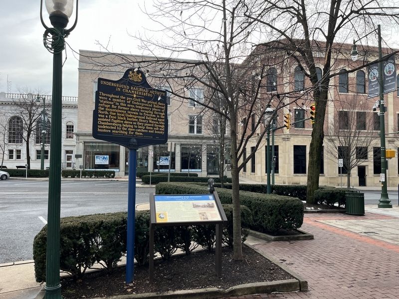
Location. 39° 56.233′ N, 77° 39.692′ W. Marker is in Chambersburg, Pennsylvania, in Franklin County. Marker is on South Main Street (U.S. 11) just south of Lincoln Way West (U.S. 30), on the
Other nearby markers. At least 8 other markers are within walking distance of this marker. Confederate Conference (here, next to this marker); Underground Railroad Activity in Chambersburg (here, next to this marker); The Franklin County Community Foundation (FCCF) (a few steps from this marker); Memorial Fountain and Union Soldier Statue (a few steps from this marker); Union Soldiers of Franklin County (within shouting distance of this marker); World War II – Korean Conflict – Vietnam Conflict (within shouting distance of this marker); Mexican War – Spanish American War – World War (within shouting distance of this marker); U.S.S. Maine Memorial (within shouting distance of this marker). Touch for a list and map of all markers in Chambersburg.
Credits. This page was last revised on March 1, 2024. It was originally submitted on March 1, 2024, by Devry Becker Jones of Washington, District of Columbia. This page has been viewed 47 times since then. Photos: 1, 2. submitted on March 1, 2024, by Devry Becker Jones of Washington, District of Columbia.

