Somerset in Orange County, Virginia — The American South (Mid-Atlantic)
James Madison and Dolley Madison
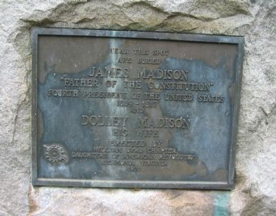
Photographed by Craig Swain, September 6, 2009
1. James Madison and Dolley Madison Marker
are buried
James Madison
"Father of the Constitution"
Fourth President of the United States
1809-1817
and
Dolley Madison
his wife
Erected 1930 by William Byrd Chapter Daughters of the American Revolution, Richmond, Virginia.
Topics and series. This historical marker is listed in these topic lists: Cemeteries & Burial Sites • Patriots & Patriotism. In addition, it is included in the Daughters of the American Revolution (DAR), and the Former U.S. Presidents: #04 James Madison series lists.
Location. 38° 13.32′ N, 78° 11.359′ W. Marker is in Somerset, Virginia, in Orange County. It is at the intersection of Constitution Highway (State Highway 20) and Jacksontown Road (County Route 655), on the right when traveling east on Constitution Highway. Touch for map. Marker is in this post office area: Somerset VA 22972, United States of America. Touch for directions.

Regionally, this marker is in Northern Virginia and in the Piedmont. It is also in the American South and specifically in the Upper South. Globally, it is in North America, the Western Hemisphere,
this page online
Other nearby markers. At least 8 other markers are within walking distance of this marker: Gilmore Farm: A Freedman's Home (approx. half a mile away); Post-Emancipation: A Promise Unfulfilled (approx. half a mile away); a different marker also named Gilmore Farm (approx. half a mile away); Confederate Encampment (approx. 0.6 miles away); Dolley Madison (approx. 0.6 miles away); Gilmore Family Cemetery (approx. 0.6 miles away); a different marker also named Confederate Encampment (approx. ¾ mile away); Montpelier Train Station (approx. 0.8 miles away).
Other markers no longer nearby. Gilmore Farm (was approx. half a mile away but has been replaced with another marker now near it); Post-Emancipation (was approx. half a mile away but has been replaced with another marker now near it); Civil War Encampment (was approx. ¾ mile away but has been replaced with another marker now near it).
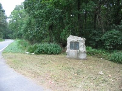
Photographed by Craig Swain, September 6, 2009
2. James Madison and Dolley Madison Marker

Photographed by PaulwC3, September 20, 2014
3. Graves of James and Dolley Madison
Located in the Madison Family Cemetery on nearby Montpelier estate.
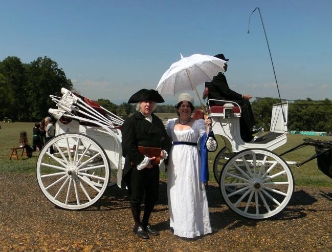
Photographed by PaulwC3, September 20, 2014
4. James and Dolley Madison
Renactors portray James and Dolley Madison during 2014 Constitution Day Celebration at Montpelier.
Credits. This page was last revised on December 26, 2019. It was originally submitted on November 7, 2009, by Craig Swain of Leesburg, Virginia. This page has been viewed 1,359 times since then and 43 times this year. Photos: 1, 2. submitted on November 7, 2009, by Craig Swain of Leesburg, Virginia. 3, 4. submitted on September 22, 2014, by PaulwC3 of Northern, Virginia.
