Mail in Paris in Département de Paris, Île-de-France, France — Western Europe
La Rue Montmartre
| — | Histoire de Paris | — |
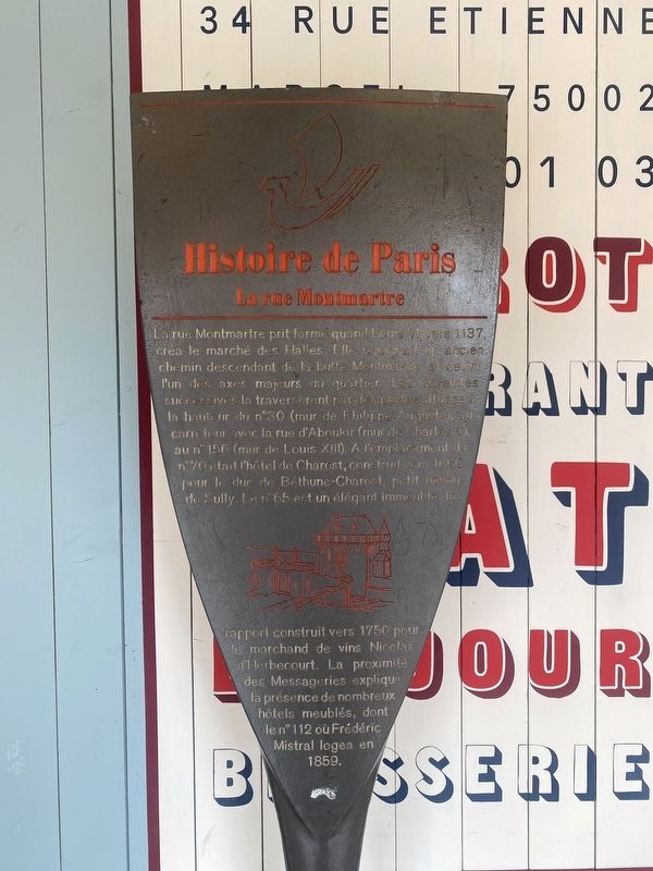
Photographed by Andrew Ruppenstein, July 26, 2022
1. La Rue Montmartre Marker

Rue Montmartre took shape when Louis VI, around 1137, created the Halles market. It followed an old path descending from the Montmartre Butte, and became one of the major axes of the district. It traversed several city walls in succession - through gates located at number 30 (wall of Philippe Auguste), at the crossroads with rue d'Aboukir (wall of Charles V), and at number 156 (wall of Louis XIII). On the site of No. 70 was the Hôtel de Charost, built around 1660 for
this page online
Topics and series. This historical marker is listed in this topic list: Roads & Vehicles. In addition, it is included in the Histoire de Paris series list.
Location. 48° 51.895′ N, 2° 20.71′ E. Marker is in Paris, Île-de-France, in Département de Paris. It is in Mail. It is at the intersection of Rue Montmartre and Rue Étienne Marcel, on the right when traveling north on Rue Montmartre. Touch for map. Marker is at or near this postal address: 34 Rue Étienne Marcel, Paris, Île-de-France 75002, France. Touch for directions.

Regionally, it is in the North Atlantic Region, Europe, the European Union, Atlantic Europe, the Schengen Area, Western Europe, a coastal Mediterranean country, and the Western World. Historically, it finds itself in what was once a French colony and also the Roman Empire.
Other nearby markers. At least 8 other markers are within walking distance of this marker: La rue de la Jussienne (about 90

Photographed by Andrew Ruppenstein, July 26, 2022
2. La Rue Montmartre Marker - wide view
The marker is visible here on the rue Montmartre side of the cafe exterior. Note that at times the marker may be inaccessible if the café is crowded.
Additional keywords. panneau

Photographed by Andrew Ruppenstein, July 26, 2022
3. Rue Montmartre - looking north along the street from the marker site

Photographed by L.l., circa 1900
4. La Rue Montmartre
Credits. This page was last revised on April 24, 2025. It was originally submitted on March 6, 2024, by Andrew Ruppenstein of Lamorinda, California. This page has been viewed 179 times since then and 28 times this year. Photos: 1, 2, 3, 4. submitted on March 6, 2024, by Andrew Ruppenstein of Lamorinda, California.
