
Near Garfield in Benton County, Arkansas — The American South (West South Central)
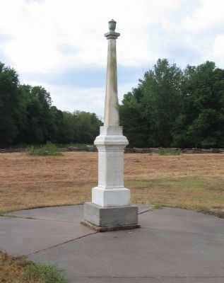
Pea Ridge Confederate Monument
Photographed by Craig Swain, August 30, 2010
1. Pea Ridge Confederate Monument
At one time a road passed just behind the memorial. Years before the park was established, the memorial was damaged by vehicle traffic on at least one occasion. Sections of the memorial are out of place, with the Texas star on the front, instead of over McCulloch's name. Furthermore, the "left" side may have been the back at one point.
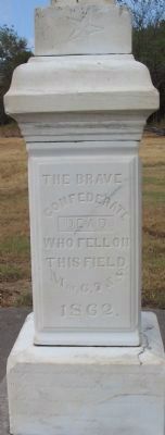
(Front):
CONFEDERATE
DEAD,
WHO FELL ON
THIS FIELD,
Mar. 6, 7, & 8,
1862.
May yet form the footstool of Liberty's throne;
And each single wreck in the war-path of Might,
Shall yet be a rock in the Temple of Right.
BASS&GARRISON.
BENTONVILLE, ARK.
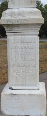
(Right):
JAMES
McINTOSH
OF ARKANSAS
And names in the graves that shall not be forgot;
Yes give me the land of the wreck and the tomb,
There's a grandeur in graves-there's a glory in gloom.
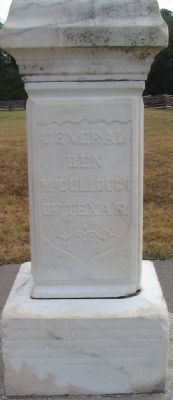
(Back):
BEN
McCULLOUGH
OF TEXAS.
And the living tread light on the hearts of the dead;
Yes give me a land that is blest by the dust,
And bright with the deeds of down-trodden just.
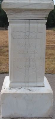
(Left):
W.Y.
SLACK
OF MISSOURI
Erected 1887.
Topics and series. This monument and memorial is listed in this topic list: War, US Civil. In addition, it is included in the Battlefield Trails - Civil War series list.
Location. 36° 27.177′ N, 94° 1.005′ W. Monument is near Garfield, Arkansas, in Benton County. It is on Military
this page online

Regionally, this memorial monument is in Northwest Arkansas, on the Ozark Plateau, in the Cherokee Heritage Region, and in Osage Territory. It is also in the American South, specifically in the Upper South, and in the Ozarks. Globally, it is in North America, the Western Hemisphere, the Western World, and the Anglosphere. Historically, it finds itself in what was once the territory of the Mississippian Culture, the Louisiana Purchase, one of the Confederate States of America, and the Antebellum South.
Other nearby markers. At least 8 other markers are within walking distance of this marker: Remembrance and Reunion (a few steps from this marker); A Reunited Soldiery Monument (within shouting distance of this marker); Pea Ridge and the Trail of Tears (within shouting distance of this marker); Lifeline for Two Armies (about 300 feet away, measured
Photographed by Craig Swain, August 30, 2010
2. Front of Memorial
Note the star at the top of this side.
Related markers. Click here for a list of markers that are related to this marker. This is a list of Pea Ridge Battlefield Markers
Also see . . .
1. Pea Ridge National Military Park. National Park Service website entry (Submitted on September 12, 2010, by Craig Swain of Leesburg, Virginia.)
2. Pea Ridge (Elkhorn Tavern). American Battlefield Trust website entry (Submitted on May 8, 2021, by Larry Gertner of New York, New York.)
Photographed by Craig Swain, August 30, 2010
3. Right Side
Photographed by Craig Swain, August 30, 2010
4. Back of Memorial
Photographed by Craig Swain, August 30, 2010
5. Left Side of Memorial
There is no lower inscription on this side.
Photographed by Duane Hall, June 1, 2015
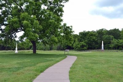
6. Pea Ridge Confederate Monument,
Remembrance and Reunion marker,
and Reunited Soldiery Monument
Remembrance and Reunion marker,
and Reunited Soldiery Monument
Credits. This page was last revised on March 10, 2024. It was originally submitted on September 12, 2010. This page has been viewed 2,575 times since then and 56 times this year. Last updated on March 9, 2024. Photos: 1, 2, 3, 4, 5. submitted on September 12, 2010, by Craig Swain of Leesburg, Virginia. 6. submitted on February 23, 2016, by Duane Hall of Abilene, Texas. • J. J. Prats was the editor who published this page.
