Wallisville in Chambers County, Texas — The American South (West South Central)
Wallisville Cemetery
Photographed by Brian Anderson, March 9, 2024
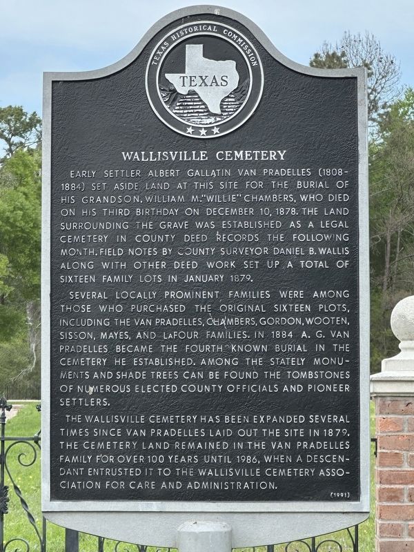
1. Wallisville Cemetery Marker
Several locally prominent families were among those who purchased the original sixteen plots, including the van Pradelles, Chambers, Gordon, Wooten, Sisson, Mayes, and LaFour families. In 1884 A. G. van Pradelles became the fourth known burial in the cemetery he established. Among the stately monuments and shade trees can be found the tombstones of numerous elected county officials and pioneer settlers.
The Wallisville Cemetery has been expanded several times since van Pradelles laid out the site in 1879. The cemetery land remained in the van Pradelles family for over 100 years until 1986, when a descendant entrusted it to the Wallisville Cemetery Association for care and administration.
Erected 1991
this page online
Topics. This historical marker is listed in this topic list: Cemeteries & Burial Sites. A significant historical month for this entry is January 1879.
Location. 29° 49.926′ N, 94° 43.588′ W. Marker is in Wallisville, Texas, in Chambers County. It is on Wallisville-Turtle Bayou Road, on the right when traveling west. Touch for map. Marker is in this post office area: Wallisville TX 77597, United States of America. Touch for directions.

Regionally, this marker is in the Houston Metropolitan Area. It is also in the American South and on the Gulf Coast. Globally, it is in North America, a Gulf of Mexico state, the Western Hemisphere, the Western World, and the Anglosphere. Historically, it finds itself in what was once New Spain, the Republic of Texas, and one of the Confederate States of America.
Other nearby markers. At least 8 other markers are within 5 miles of this marker, measured as the crow flies: Site of Old Wallisville (approx. 0.7 miles away); Mission Nuestra Señora de la Luz (approx. ¾ mile away); Mission Nuestra Senora de la Luz del Orcoquisac and Presidio San Agustin de Ahumada
Photographed by Brian Anderson, March 9, 2024
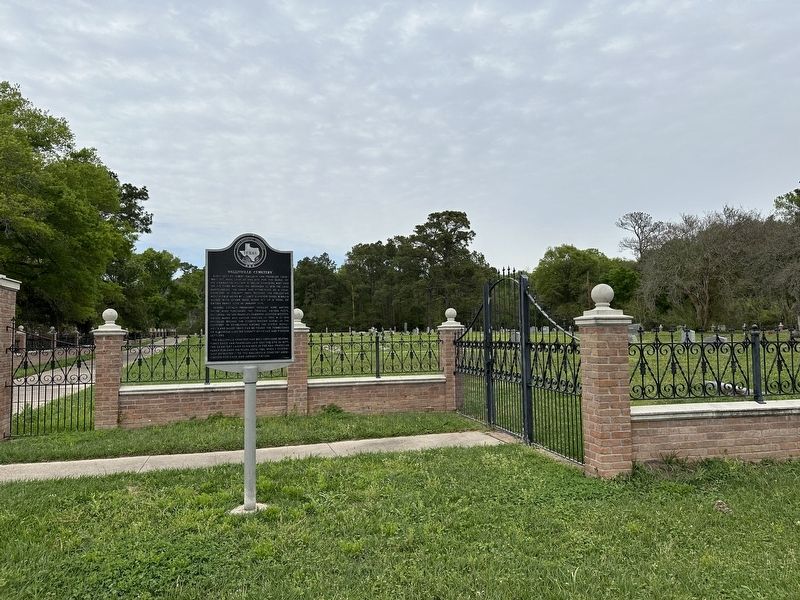
2. Wallisville Cemetery Marker
Credits. This page was last revised on March 10, 2024. It was originally submitted on March 10, 2024, by Brian Anderson of New Albany, Ohio. This page has been viewed 334 times since then and 29 times this year. Photos: 1, 2. submitted on March 10, 2024, by Brian Anderson of New Albany, Ohio.
