Newton in Dale County, Alabama — The American South (East South Central)
Newton
Town on the Hill 1834
⎯⎯⎯
Newton
Third County Seat of Dale County
Photographed by David J Gaines, January 25, 2014
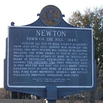
1. Newton - Town on the Hill 1834 Marker
Town on the Hill - 1843. Newton was hub of Dale County activities from 1843 until 1870. During War Between the States (1861-1865), Newton was center of recruiting, including the Home Guards. In March 1865, local militia repulsed attack by band of irregulars. Board of Physicians established 1856 to issue licenses. The Southern Star first published here in 1867. Newton was port for river boats (until railroad built in 1890). Home of Killebrew's Mill, Kill Kare Kamp, Methodist Academy, and Baptist Collegiate Institute (operating 1898-1929).
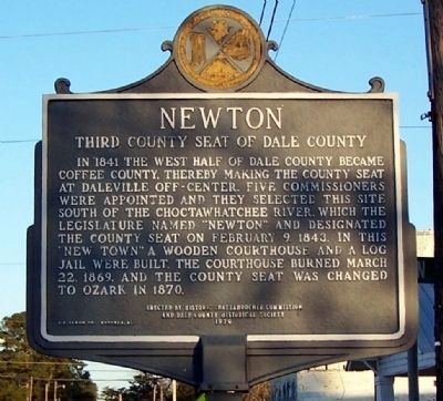
Third County Seat of Dale County. In 1841 the west half of Dale County became Coffee County, thereby making the county seat at Daleville off-center. Five commissioners were appointed and they selected this site south of the Choctawhatchee River, which the legislature named “Newton” and designated the county seat on February 9, 1843. In this “new town” a wooden courthouse and a log jail were built. The courthouse burned March 22, 1869, and the county seat was changed to Ozark in 1870.
Erected 1979 by Historic Chattahoochee Commission and Dale County Historical Society.
Topics.
this page online
Location. 31° 20.114′ N, 85° 36.255′ W. Marker is in Newton, Alabama, in Dale County. It is at the intersection of College Street (Alabama Route 134) and Queen Street, on the right when traveling south on College Street. Touch for map. Marker is in this post office area: Newton AL 36352, United States of America. Touch for directions.

Regionally, this marker is in the American South, specifically in the Deep South, and in the Wiregrass. Globally, it is in North America, a Gulf of Mexico state, the Western Hemisphere, the Western World, and the Anglosphere. Historically, it finds itself in what was once the territory of the Mississippian Culture, one of the Confederate States of America, and the Antebellum South.
Other nearby markers. At least 8 other markers are within 9 miles of this marker, measured as the crow flies: Newton Confederate Memorial (within shouting distance of this marker); Baptist Collegiate Institute (approx. 0.6 miles away); The Hanging of Bill Sketoe
Photographed by David J Gaines, January 25, 2014
2. Newton - Third County Seat of Dale County Marker
Photographed by David J Gaines, January 25, 2014
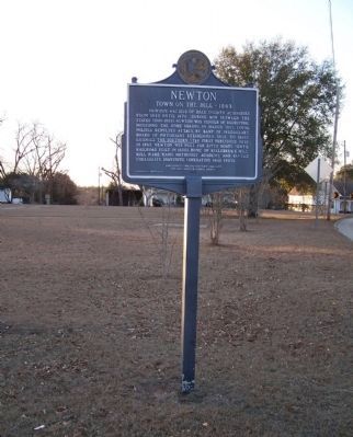
3. Newton Marker
Credits. This page was last revised on December 9, 2024. It was originally submitted on February 3, 2014, by David J Gaines of Pinson, Alabama. This page has been viewed 2,469 times since then and 143 times this year. Last updated on March 10, 2024, by James L.Whitman of Eufaula, Alabama. Photos: 1, 2, 3. submitted on February 3, 2014, by David J Gaines of Pinson, Alabama. • Devry Becker Jones was the editor who published this page.
