East Bradford Township in West Chester in Chester County, Pennsylvania — The American Northeast (Mid-Atlantic)
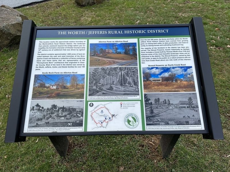
The Worth / Jefferis Rural Historic District
Inscription.
This location marks the approximate eastern boundary of the Worth / Jefferis Rural Historic District. The landscape that extends westward beyond the bridge before you exemplifies the formative character of Chester County's early 18th century era of settlement that was driven by agriculture.
The district contains approximately 1,800 acres of land situated between the east and west branches of the Brandywine Creek and features a collection of farms containing stone and frame barns that are representative of the "Pennsylvania Barn" architecture that originated in Chester County. Most of the land in the district was owned by the Worth, Jefferis, Carter, and Seeds families for over 150 years.
Over the last 300 years, the farms and fields within the Worth / Jefferis Rural Historic District have evolved from growing grain, to raising beef cattle, to dairy production, and most recently, to raising horses and cultivating mushroom hay.
The majority of the farmland in the district has been preserved. The Stroud Preserve, known historically as Georgia Farm, includes a house built by Thomas Worth circa 1740 and features some of the most beautiful landscape views and architecture in the district. The Stroud Preserve, owned by Natural Lands, is open to the public as a nature preserve with access from Creek Road about one mile north of this intersection.
Captions:
Seeds Rock Farm on Allerton Road
Upper Left Photo: Photograph of Seeds Rock Farm taken in 2022 by Mark J. Lucas. Courtesy of East Bradford Township.
Lower Left Photo: "Residence of Emmor Seeds, East Bradford" facing page 181, from History of Chester County, Pennsylvania (1881) by J. Smith Futhey and Gilbert Cope, Facsimile Reprint Edition 1986, Whipporwill Publications
Allerton Farm on Allerton Road
Upper Middle Photo: Photograph of Allerton Farm taken in 2022 by Mark J. Lucas. Courtesy of East Bradford Township
Lower Middle Photo: "Residence of E.H. Holley, East Bradford" facing page 75, from History of Chester County, Pennsylvania (1881) by J. Smith Futhey and Gilbert Cope, Facsimile Reprint Edition 1986, Whipporwill Publications
Stroud Preserve on North Creek Road
Upper Right Photo: Photograph of Georgia Farm, now part of the Stroud Preserve, taken in 2022 by Mark J. Lucas. Courtesy of East Bradford Township
Lower Right Photo: "Residence of Samuel Worth, East Bradford" facing page 16, from History of Chester County, Pennsylvania (1881) by J. Smith Futhey and Gilbert Cope, Facsimile Reprint Edition 1986, Whipporwill Publications
Erected by
East Bradford Township.
Topics. This historical marker is listed in these topic lists: Agriculture • Architecture • Colonial Era • Settlements & Settlers.
Location. 39° 56.364′ N, 75° 38.091′ W. Marker is in West Chester, Pennsylvania, in Chester County. It is in East Bradford Township. Marker is on Allerton Road, on the right when traveling west. Touch for map. Marker is at or near this postal address: 1000 W Miner St, West Chester PA 19382, United States of America. Touch for directions.
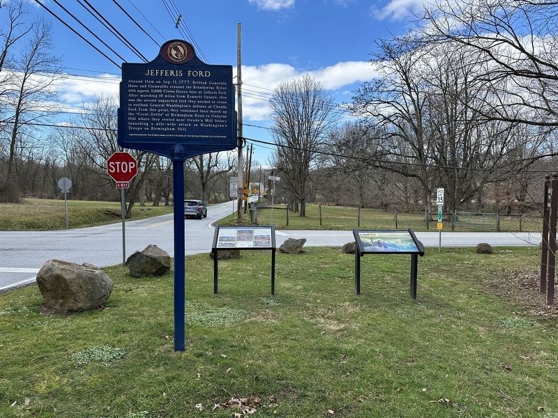
Other nearby markers. At least 8 other markers are within 2 miles of this marker, measured as the crow flies. Battle of the Brandywine (a few steps from this marker); Jefferis Ford (within shouting distance of this marker); a different marker also named Jefferis Ford (about 400 feet away, measured in a direct line); Sconnelltown. (approx. 0.6 miles away); Jean Kane Foulke (approx. ¾ mile away); Down by the Water’s Edge (approx. 1.1 miles away); Stroud Preserve (approx. 1.1 miles away); Gilbert Cope (approx. 1½ miles away). Touch for a list and map of all markers in West Chester.
Credits. This page was last revised on March 11, 2024. It was originally submitted on March 10, 2024, by Pete Skillman of Townsend, Delaware. This page has been viewed 83 times since then. Photos: 1, 2. submitted on March 10, 2024, by Pete Skillman of Townsend, Delaware. • Bill Pfingsten was the editor who published this page.

