Devils Lake in Ramsey County, North Dakota — The American Midwest (Upper Plains)
The Lake “Mníwakháŋ”
Devils Lake
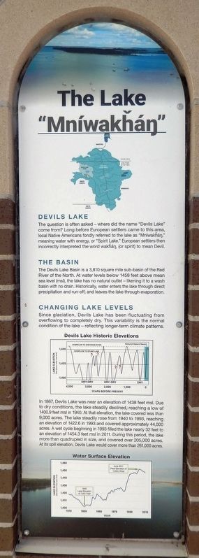
The question is often asked where did the name "Devils Lake" come from? Long before European settlers came to this area, local Native Americans fondly referred to the lake as "Mníwakháŋ," meaning water with energy, or "Spirit Lake." European settlers then incorrectly interpreted the word wakháŋ, (or spirit) to mean Devil.
The Basin
The Devils Lake Basin is a 3,810 square mile sub-basin of the Red River of the North. At water levels below 1458 feet above mean sea level (msl), the lake has no natural outlet — likening it to a wash basin with no drain. Historically, water enters the lake through direct precipitation and run-off, and leaves the lake through evaporation.
Changing Lake Levels
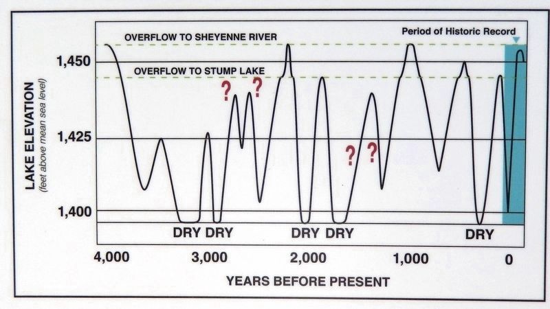
Since glaciation, Devils Lake has been fluctuating from overflowing to completely dry. This variability is the normal condition of the lake — reflecting longer-term climate patterns.
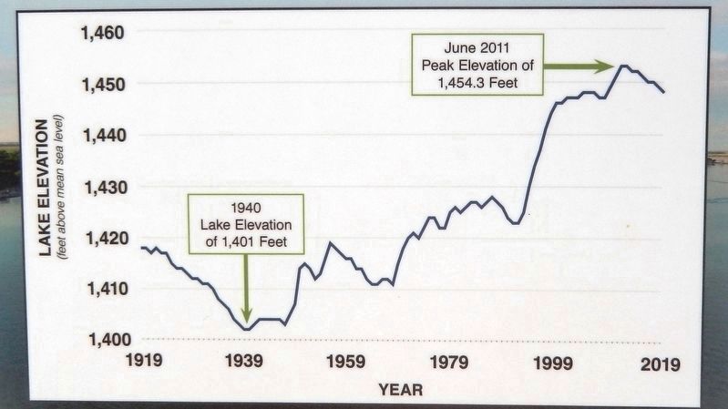
In 1867, Devils Lake was near an elevation of 1438 feet msl. Due to dry conditions, the lake steadily declined, reaching a low of 1400.9 feet msl in 1940. At that elevation, the lake covered less than 9,000 acres. The lake steadily rose from 1940 to 1993, reaching an elevation of 1422.6 in 1993 and covered approximately 44,000 acres. A wet cycle beginning in 1993 filled the lake nearly 32 feet to an elevation of 1454.3 feet msl in 2011. During this period, the lake more than quadrupled in size, and covered over 205,000 acres. At its spill elevation, Devils Lake would cover more than 261,000 acres.
Topics. This historical marker is listed in these topic lists: Native Americans • Natural Features • Settlements & Settlers. A significant historical year for this entry is 1867.
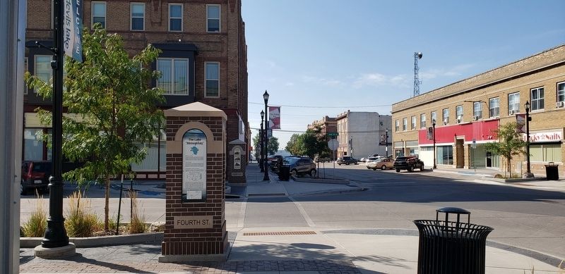
Location. 48° 6.711′ N, 98° 51.613′ W. Marker is in Devils Lake, North Dakota, in Ramsey County. Marker is at the intersection of 4th Avenue Northeast and 4th Street Northeast, on the left when traveling south on 4th Avenue Northeast. The marker is located on the sidewalk at the northeast corner of the intersection, facing north. Touch for map. Marker is at or near this postal address: 410 4th Avenue Northeast, Devils Lake ND 58301, United States of America. Touch for directions.
Other nearby markers. At least 8 other markers are within walking distance of this marker. History of Devils Lake (here, next to this marker); The Origin of Devils Lake (a few steps from this marker); Bangs-Wineman Block (a few steps from this marker); Historic Devils Lake Commercial District (within shouting distance of this marker); Devils Lake Flood Management (within shouting distance of this marker); Ye Old Tavern (within shouting distance of this marker); Devils Lake State Bank
(within shouting distance of this marker); Antiques Store (within shouting distance of this marker). Touch for a list and map of all markers in Devils Lake.
Also see . . . Runaway Devils Lake (American Scientist). Excerpt:
During the centuries that followed the lake’s origin, climate shifts caused water levels to fluctuate between 6 and 12 meters every few hundred years. After the lake last rose to its maximum elevation and began overflowing, water levels continued to fluctuate in response to alternating dry and wet periods. A persistently dry climate 500 to 600 years ago held levels at relatively low elevations for perhaps as long as 200 years. Wetter conditions followed, raising the lake to levels that prevailed until the late 1800s. Levels then began dropping precipitously, falling to the lowest-recorded elevation by 1940 before rising again.(Submitted on March 12, 2024, by Cosmos Mariner of Cape Canaveral, Florida.)
Whether Lake Minnewaukan was completely dry at times or not, periodic drawdowns during dry conditions reduced its immense volume to numerous remnant lakes scattered across the south-central region of the basin. Nonindigenous people who settled the region beginning in the mid-1800s named the largest and most prominent of these remnants “Devils Lake,” perhaps because of the lake’s highly saline, undrinkable water, or perhaps in tribute to Sioux warriors whose canoes were often capsized in the lake’s treacherous, storm-tossed waters.
Credits. This page was last revised on March 17, 2024. It was originally submitted on March 11, 2024, by Cosmos Mariner of Cape Canaveral, Florida. This page has been viewed 65 times since then. Photos: 1, 2, 3, 4. submitted on March 12, 2024, by Cosmos Mariner of Cape Canaveral, Florida.


