Bedford-Stuyvesant in Brooklyn in Kings County, New York — The American Northeast (Mid-Atlantic)
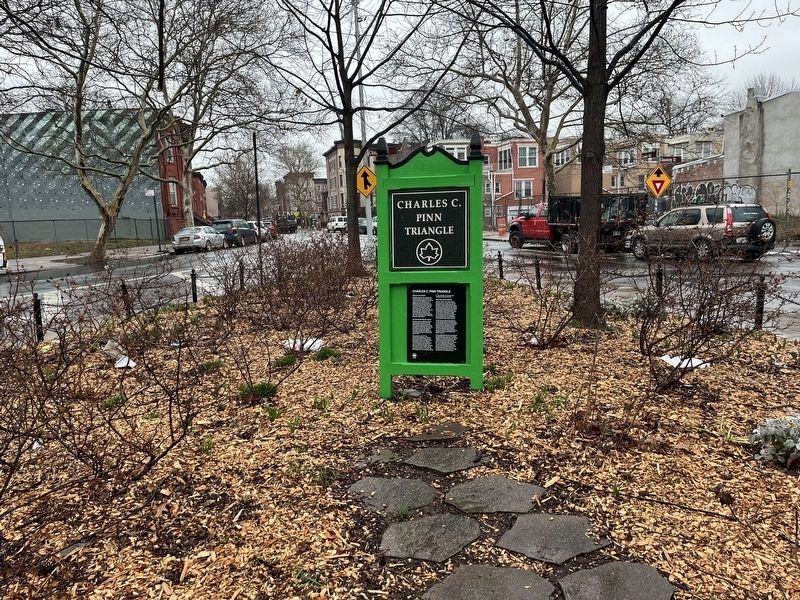
Charles C. Pinn Triangle
This Greenstreet located at Lewis Avenue and Fulton Street in the neighborhood of Bedford-Stuyvesant in Brooklyn, is named in honor of community advocate Charles C. Pinn (1966- 1995).
Charles "Chris" Pinn first served as an intern for Council Member Al Vann while a student at Samuel J. Tilden High School. In 1980 he founded the Young Peoples Macon-Macdonough-Stuyvesant-Lewis Block Association in Bedford Stuyvesant. He attended Howard University and on his return to Brooklyn in 1985, continued to pursue his interest in community work, helping to create new forums for discussion, organization and community involvement. He organized block associations, Parent-Teacher Associations and tenants groups. His outreach touched many people — both fellow citizens and elected officials.
In 1991 he was elected Chairperson of Community Board 3 and Secretary of the Brooklyn branch of the National Association of the Advancement of Colored People (NAACP). He was a member of the Board of Directors of the Fort Greene Senior Citizens Council as well as a consultant for the Malcolm X, Marcy and Risley Dent Senior Centers. He joined Our Lady of Charity Roman Catholic church in 1995.
In his professional career as assistant to Assemblyman Al Vann and Council Member Annette Robinson, he worked diligently to improve conditions and opportunities, particularly for the youth of Central Brooklyn. He formed the Junior Vanguard Independent Democratic Association (VIDA) and was also the first Chairperson of the Bedford-Stuyvesant Community Conference Youth Task Force. In 1995 he passed after prolonged illness.
In 2011, Community Board #3 of Brooklyn voted unanimously to name this Greenstreet after Charles Pinn. The replanting of the triangle was completed in the fall of 2016. The dedication with family, neighbors and elected officials was held in that same season to honor Pinn for his devoted service to the local community.
Erected by NYC Parks.
Topics. This historical marker is listed in these topic lists: African Americans • Charity & Public Work • Civil Rights • Parks & Recreational Areas. A significant historical year for this entry is 1980.
Location. This marker has been replaced by another marker nearby. It was located near 40° 40.787′ N, 73° 56.071′ W. Marker was in Brooklyn, New York, in Kings County. It was in Bedford-Stuyvesant. Marker was at the intersection of Fulton Street and Lewis Avenue, on the right when traveling west on Fulton Street. Touch for map. Marker was at or near this postal address: 39 Lewis Ave, Brooklyn NY 11213, United States of America. Touch for directions.
Other nearby markers. At least 8 other markers are within walking

Photographed By Devry Becker Jones (CC0), March 9, 2024
2. Charles C. Pinn Triangle
This is a photo of how Charles C. Pinn Triangle appears in 2024. The new marker (linked) is on display.
Click for more information.
Click for more information.
Related marker. Click here for another marker that is related to this marker. This marker has been replaced with the linked marker.
Credits. This page was last revised on March 13, 2024. It was originally submitted on March 13, 2024, by Devry Becker Jones of Washington, District of Columbia. This page has been viewed 44 times since then. Photos: 1. submitted on January 17, 2023. 2. submitted on March 13, 2024, by Devry Becker Jones of Washington, District of Columbia.
Editor’s want-list for this marker. A clear, legible of this prior iteration of the marker (not the current marker). • Can you help?
