Lake Buena Vista in Orange County, Florida — The American South (South Atlantic)
The Liberty Tree

Photographed by Bradley Owen, March 11, 2024
1. The Liberty Tree Marker
The original Liberty Tree, a stately elm, was a rallying point for pre-revolutionary activities. The open space under its branches was called "Liberty Hall" and a flag pole was erected through its branches with a hoisted flag the symbol for action.
Countless inflammatory cartoons and verses were nailed to its trunk and many Tories hung in effigy from its branches. Perhaps its proudest moment was the repeal of the Stamp Act when innumerable lanterns blazed among its branches for all to see.
For more information about The Liberty Tree, please see the plaque at its base.
Topics and series. This historical marker is listed in this topic list: Colonial Era. In addition, it is included in the Historic Trees series list.
Location. 28° 25.156′ N, 81° 34.942′ W. Marker is in Lake Buena Vista, Florida, in Orange County. It can be reached from World Drive north of Seven Seas Drive, on the left when traveling north. Marker is located in Liberty Square within Disney's Magic Kingdom Theme Park and requires a paid admission fee. Touch for map. Marker is at or near this postal
this page online

Regionally, this marker is in Greater Orlando and in Central Florida. It is also in the American South. Globally, it is in the North Atlantic Region, North America, a Gulf of Mexico state, the Western Hemisphere, the Western World, and the Anglosphere. Historically, it finds itself in what was once New Spain, the territory of the Mississippian Culture, one of the Confederate States of America, and the Antebellum South.
Other nearby markers. At least 8 other markers are within 4 miles of this marker, measured as the crow flies: A different marker also named The Liberty Tree (here, next to this marker); a different marker also named The Liberty Bell (a few steps from this marker); Tom Sawyer Island (about 700 feet away, measured in a direct line); Sharing the Magic (approx. 0.2 miles away); Visit Carousel of Progress (approx. ¼ mile away); Forced Eastward (approx. 3 miles away); Live Oak (approx. 3.6 miles away); The Legend of Ol' Man Island (approx. 3.6 miles away). Touch for a list and map of all markers in Lake Buena Vista.
Another

Photographed by Bradley Owen, March 11, 2024
2. The Liberty Tree Marker
Related marker. Click here for another marker that is related to this marker.
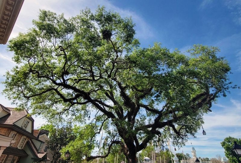
Photographed by Bradley Owen, March 11, 2024
3. The Liberty Tree
Credits. This page was last revised on March 13, 2024. It was originally submitted on March 13, 2024, by Bradley Owen of Morgantown, West Virginia. This page has been viewed 365 times since then and 58 times this year. Photos: 1, 2, 3. submitted on March 13, 2024, by Bradley Owen of Morgantown, West Virginia.
