Dryden in Kenora District, Ontario — Central Canada (North America)
Beginnings
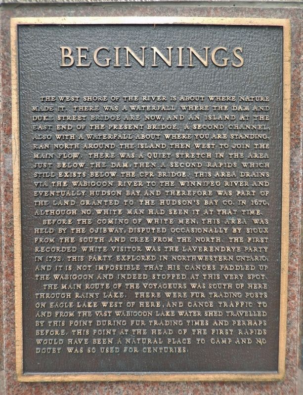
The west shore of the river is about where nature made it. There was a waterfall where the dam and Duke Street Bridge are now, and an island at the east end of the present bridge. A second channel, also with a waterfall about where you are standing, ran north around the island then west to join the main flow. There was a quiet stretch in the area just below the dam, then a second rapids which still exists below the CPR Bridge. This area drains via the Wabigoon River to the Winnipeg River and eventually Hudson Bay and therefore was part of the land granted to the Hudson’s Bay Co. in 1670, although no white man had seen it at that time.
Before the coming of white men, this area was held by the Ojibway, disputed occasionally by Sioux from the south and Cree from the north. The first recorded white visitor was the Laverendrye party in 1732. This party explored in Northwestern Ontario, and it is not impossible that his canoes paddled up the Wabigoon and indeed stopped at this very spot.
The main route of the voyageurs was south of here through Rainy Lake. There were fur trading posts on Eagle Lake west of here, and canoe traffic to and from the vast Wabigoon Lake Water Shed travelled by this point during fur trading times and perhaps before. This point at the head of the first rapids would have been a natural place to camp and no doubt was so used for centuries.
Topics. This historical marker is listed in these topic lists: Exploration • Industry & Commerce • Native Americans • Waterways & Vessels. A significant historical year for this entry is 1732.
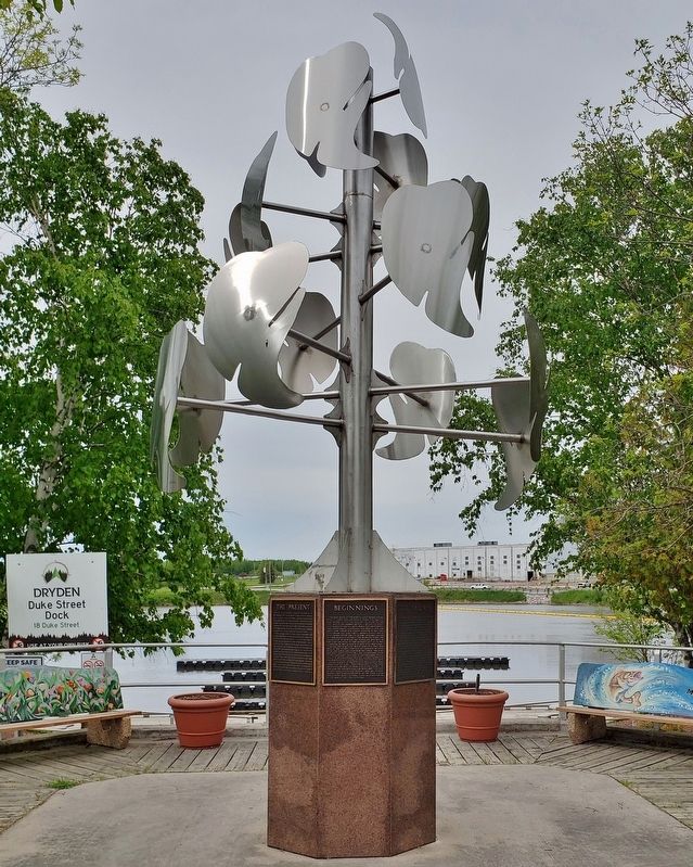
Location. 49° 46.915′ N, 92° 50.462′ W. Marker is in Dryden, Ontario, in Kenora District. Marker is at the intersection of West River Road (Duke Street) (Provincial Highway 594) and Earl Avenue, on the right when traveling east on West River Road (Duke Street). The marker is mounted on the base of a metal sculpture at the southwest corner of the intersection, overlooking the Duke Street Dock. Touch for map. Marker is at or near this postal address: 18 Duke Street, Dryden ON P8N 1Y1, Canada. Touch for directions.
Other nearby markers. At least 8 other markers are within walking distance of this marker. The Railway (here, next to this marker); The Present (here, next to this marker); Recreation (here, next to this marker); Gold Fever (here, next to this marker); Agriculture (here, next to this marker); Booming Wood (here, next to this marker); Pulp and Paper (here, next to this marker); Alan Durance (within shouting distance of this marker). Touch for a list and map of all markers in Dryden.
Also see . . .
1. King Charles II grants charter to Hudson’s Bay Company (History.com). Excerpt:
May 2, 1670: King Charles II of England grants a permanent charter to the Hudson’s Bay Company, made up of the group of French explorers who opened the lucrative North American fur trade to London merchants. The charter conferred on them not only a trading monopoly but also effective control over the vast region surrounding North America’s Hudson Bay. Although contested by other English traders and the French in the region, the Hudson’s Bay Company was highly successful in exploiting what would become eastern Canada.(Submitted on March 15, 2024, by Cosmos Mariner of Cape Canaveral, Florida.)
2. Pierre Gaultier de Varennes, sieur de La Vérendrye (Wikipedia). Excerpt:
In 1730 he met Governor Beauharnois at Quebec and worked out a plan. La Vérendrye would build a post on Lake Winnipeg. The expedition would be paid for by Quebec merchants who hoped to profit from the resulting fur trade. In 1731 La Vérendrye, three of his sons and 50 engagés left Montreal. That autumn his son Jean-Baptiste built Fort St. Pierre on Rainy Lake. Next year they built Fort St. Charles on Lake of the Woods, which became his headquarters for the next several years.(Submitted on March 15, 2024, by Cosmos Mariner of Cape Canaveral, Florida.)
Credits. This page was last revised on March 15, 2024. It was originally submitted on March 14, 2024, by Cosmos Mariner of Cape Canaveral, Florida. This page has been viewed 22 times since then. Photos: 1, 2. submitted on March 15, 2024, by Cosmos Mariner of Cape Canaveral, Florida.

