Leeds in Washington County, Utah — The American Mountains (Southwest)
From Native American Trail to Interstate Exit
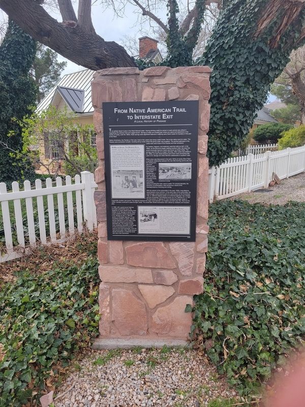
From Native American Trail to Interstate Exit
A Local History of Passage
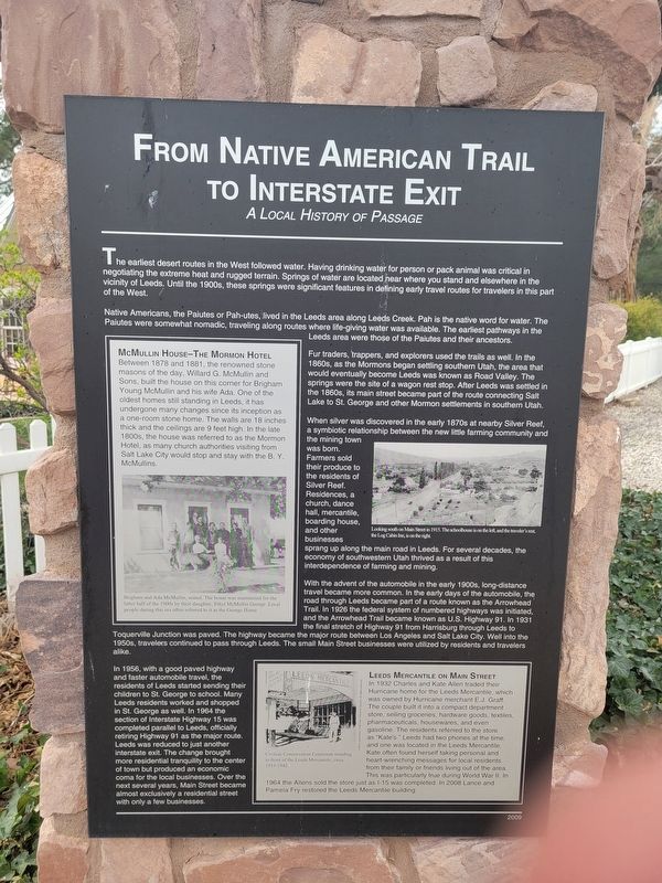
The earliest desert routes in the West followed water. Having drinking water for person or pack animal was critical in negotiating the extreme heat and rugged terrain. Springs of water are located hear where you stand and elsewhere in the vicinity of Leeds. Until the 1900s, these springs were significant features in defining early travel routes for travelers in this part of the West.
Native Americans, the Paiutes or Pah-utes, lived in the Leeds area along Leeds Creek. Pah is the native word for water. The Paiutes were somewhat nomadic, traveling along routes where life-giving water was available. The earliest pathways in the Leeds area were those of the Paiutes and their ancestors.
Fur traders, trappers, and explorers used the trails as well. In the 1860s, as the Mormons began settling southem Utah, the area that would eventually become Leeds was known as Road Valley. The springs were the site of a wagon rest stop. After Leeds was settled in the 1860s, its main street became part of the route connecting Salt Lake to St. George and other Mormon settlements in southem Utah.
When silver was discovered in the early 1870s at nearby Silver Reef, a symbiotic relationship between the new little farming community and the mining town was born. Farmers sold their produce to the residents of Silver Reef. Residences, a church, dance hall mercantile, boarding house, and other businesses sprang up along the main road in Leeds. For several decades, the economy of southwestern Utah thrived as a result of this interdependence of farming and mining.
With the advent of the automobile in the early 1900s, long-distance travel became more common. In the early days of the automobile, the road through Leeds became part of a route known as the Arrowhead Trail. In 1926 the federal system of numbered highways was initiated and the Arrowhead Trail became known as U.S. Highway 91. In 1931 the final stretch of Highway 91 from Harrisburg through Leeds to Toquerville Junction was paved. The highway became the major route between Los Angeles and Salt Lake City. Well into the 1950s, travelers continued to pass through Leeds. The small Main Street businesses were utilized by residents and travelers alike.
In 1956, with a good paved highway and faster automobile travel, the residents of Leeds started sending their children to St. George to school. Many Leeds residents worked and shopped in St. George as well. In 1964 the section of Interstate Highway 15 was completed parallel to Leeds, officially retiring Highway 91 as the major route. Leeds was reduced to just another Interstate exit. The change brought more residential tranquility to the center of town but produced an economic coma for the local businesses. Over the next several years, Main Street became almost exclusively a residential street with only a few businesses.
McMullin House - the Mormon Hotel
Between 1878 and 1881, the renowned stone masons of the day, Willard G. McMullin and Sons, built the house on this corner for Brigham Young McMullin and his wife Ada. One of the oldest homes stil standing in Leeds, it has undergone many changes since its inception as a one-room stone home. The walls are 18 inches thick and the ceilings are 9 feet high. In the late 1800s, the house was referred to as the Mormon Hotel, as many church authorities visiting from Salt Lake City would stop and stay with the B. Y. McMullins.
[caption] Brigham and Ada McMullin, seated. The house was maintained for the latter half of the 1900s by their daughter, Ethyl McMullin George. Local people during this era often referred to it as the George Home.
Leeds Mercantile on Main Street
In 1932 Charles and Kate Allen traded the Humcane home for the Leeds Mercantile, which was owned by Hurricane merchan E.J. Graff. The couple built it into a compact department store selling groceries, hardware goods textiles, pharmaceuticals, housewares, and even gasoline. The readents referred to the store as "Kate's." Leeds had two phones at the time and one was located in the Leeds Mercantile. Kate often found herself taking personal and heart wenching messages for local residents from their family or trends wing out of the area. This was particularly true during World War. 1964 the Allens sold the store just as 1-15 was completed. In 2008 Lance and Pamela Fry restored the Leeds Mercantile building.
Erected 2009.
Topics. This historical marker is listed in these topic lists: Industry & Commerce • Native Americans • Roads & Vehicles • Settlements & Settlers. A significant historical year for this entry is 1860.
Location. 37° 14.161′ N, 113° 21.79′ W. Marker is in Leeds, Utah, in Washington County. Marker is at the intersection of Center Street and Main St., on the right when traveling west on Center Street. Touch for map. Marker is at or near this postal address: 89-91 W Center Street, Leeds UT 84746, United States of America. Touch for directions.
Other nearby markers. At least 8 other markers are within walking distance of this marker. The Leeds Tithing Office (a few steps from this marker); Water Is Life...The Shovel Is Divine (within shouting distance of this marker); The Sarah Ann and William Stirling Home (within shouting distance of this marker); Civilian Conservation Corps, Leeds, Utah (approx. ¼ mile away); Leeds CCC Camp (approx. ¼ mile away); Leeds Historic CCC Camp (approx. ¼ mile away); "They Were Poor, Hungry, and They Built to Last" (approx. ¼ mile away); From Schoolhouse to Town Hall (approx. 0.3 miles away). Touch for a list and map of all markers in Leeds.
Credits. This page was last revised on April 3, 2024. It was originally submitted on March 17, 2024, by Jeremy Snow of Cedar City, Utah. This page has been viewed 46 times since then. Photos: 1. submitted on March 17, 2024, by Jeremy Snow of Cedar City, Utah. 2. submitted on March 18, 2024, by Jeremy Snow of Cedar City, Utah. • Andrew Ruppenstein was the editor who published this page.

