Erin in Wellington County, Ontario — Central Canada (North America)
Mill History in Erin Village
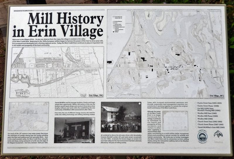
Welcome to the Village of Erin. As you can observe from the maps, the village is nestled in the valley of the West Credit River. Beginning in the 1820s, European settlers began to harness the power of the river to drive early mills. Erin prospered and developed into a thriving regional centre. Today, the West Credit River continues to play an important role in the health and prosperity of the local community.
For much of the 19th century it was water power that drove the machinery of Canada, sawing logs into lumber, grinding grain into flour and carding wool into spinnable fibres. Here in this small wooded valley, the West Credit River abruptly twists and drops, racing eastwards to hurtle over the edge of the Niagara Escarpment. And here, between 1828 and 1849, Daniel McMillan and his younger brothers, Charles and Hugh, seized their opportunity. Within 500 metres of this site the brothers would repair, design and construct three dams, three lengthy millraces and seven mills, thus establishing the new community of McMillan's Mills (renamed Erin after 1852).
Over time, the use of different energy sources, the need for costly new milling technology and shifting, declining markets all combined to silence the old water-driven mills. Remarkably, however, Mundell Lumber still used water power occasionally into the 1980s. Gradually the forests began to reclaim the once-bare valley, but the river environment had been adversely affected by 100 years of milling activity.
Today, with increased environmental awareness and through responsible land management practices, our community is working together to restore the original health and beauty of the West Credit River.
Although the power of the West Credit River is no longer harnessed for energy, it continues to contribute to the health and prosperity of Erin residents and visitors in other ways: supplying a source of fresh clean water, contributing to a multi-million dollar recreational fishery and providing a natural corridor for wildlife and habitat connectivity. We invite you to further investigate the West Credit River and its connection to Erin's milling history along the interpretive walking trail at the Woollen Mills Conservation Area.
[photo captions]
• Erin Village, 1906
• Erin Village, 2007
• Sources for all map data within Woolen Mills Conservation Area: Conservation Area boundary, and trail data provided by Credit Valley Conservation. Elevation and wooded area (forest) data provided by Ontario Ministry of Natural Resources. Land Use data based on The Town of Erin Official Plan. Cartography and sign layout by As the Crow Flies Cartography.
• Charles Street Dam (1825-1833)
• Charles StreetFlume (1838)
• Oat Mill (1838) [later Mundell's Planing Mill (1896)]
• Woollen Mill Dam (1840)
• Woollen Mill Flume (1840)
• Woollen Mill (1840)
• Church Street Dam (1842-1844)
• Church Street Flume (1847-1849)
• Daniel McMillan's Grist Mill (1849)
Topics. This historical marker is listed in these topic lists: Environment • Industry & Commerce • Settlements & Settlers • Waterways & Vessels. A significant historical year for this entry is 1828.
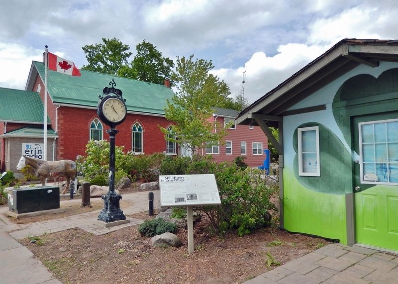
Location. 43° 46.222′ N, 80° 3.831′ W. Marker is in Erin, Ontario, in Wellington County. Marker is on Main Street (County Road 124) just south of East Church Street, on the left when traveling south. The marker is located beside the sidewalk on the west side of McMillan Park. Touch for map. Marker is at or near this postal address: 109 Main Street, Erin ON N0B 1T0, Canada. Touch for directions.
Other nearby markers. At least 6 other markers are within 18 kilometers of this marker, measured as the crow flies. Future Past 2412 (a few steps from this marker); Stanley Park Gates and Arch (approx. 1.2 kilometers away); Stanley Park (approx. 1.2 kilometers away); Erin Township Park (approx. 3 kilometers away); Acton Town Hall (approx. 15.6 kilometers away); Dufferin County Court House (approx. 16.9 kilometers away).
Also see . . . Erin, Ontario (Wikipedia). Excerpt:
The first settlers of European descent in the area then known as Erin Township were George and Nathaniel Roszel from Pennsylvania who arrived in November 1820; Most of the settlers during the township's development were Scottish. The urban community now called Erin developed after mills were built on the Credit River between 1826 and 1829. By 1839 a post-office had opened. The Credit Valley Railway reached Erin in 1879 and the same year, Erin was incorporated as a village.(Submitted on March 22, 2024, by Cosmos Mariner of Cape Canaveral, Florida.)
Credits. This page was last revised on March 23, 2024. It was originally submitted on March 21, 2024, by Cosmos Mariner of Cape Canaveral, Florida. This page has been viewed 53 times since then. Photos: 1, 2. submitted on March 22, 2024, by Cosmos Mariner of Cape Canaveral, Florida.

