Near Syracuse in Davis County, Utah — The American Mountains (Southwest)
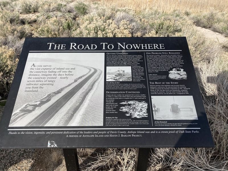
The Road To Nowhere
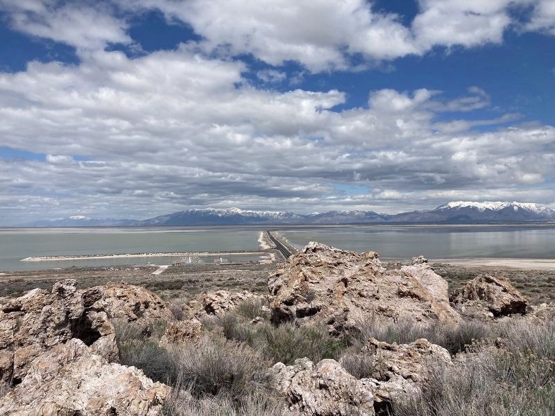
As you survey the vast expanse of inland sea and the causeway fading off into the distance, imagine the days before the causeway existed - nearly seven miles of tangy saltwater separating you from the mainland.
Getting Underway
For over 100 years, Antelope Island belonged to private industry and was virtually inaccessible to the curious public. Construction of the road to connect Antelope Island with the mainland didn't begin until February 1964. Support and help came through County Legislators, including Representative Bill Holt, known as Antelope Bill, and many other county citizens. Without determined effort in the early 1960s made by Davis County Commission and the combined efforts of Davis County Commissioners Wayne M. Winegar, G. Evan Taylor, and Glen W. Flint, Dale Smedley Construction, and volunteers from Hill Air Force Base and local communities, the road would not have been started.
Determination Continued
Despite sub-zero weather, the equipment drove across a sandbar to within 1½ miles of the island where men and machines began an around-the-clock labor to complete the 5½ mile road back to the mainland. Through the determination and hard work of many people, the road reached the Syracuse shore three months later.
One Problem Still Remains
The road led to nowhere. (Remember, the road ended within 1½ miles of the island.) Commissioner Winegar, chairman, solicited the support and financial aid of local communities to finish the final 1 1/2 mile stretch while Senator Haven J. Barlow worked diligently with state legislators and two governors to sell the idea of purchasing part of the island as a state park. After a delay of almost 3 years, Governor Calvin Rampton signed the bill calling for the purchase of the north 2,000 acres of the island for $210,000 in 1967. The state built a bridge, raised the surface level, widened and paved the causeway for improved access, and Antelope Island State Park opened to the public on January 15, 1969.
[Captions:]
How did they do that?
With about sixty feet between them, two draglines, like the one you see above, were positioned parallel to each other on wooden platforms to keep them from sinking into the lake muck. The machines "walked on these mats, swinging them from back to the front of the machine when the bucket could no longer reach to scoop the trench. As the fall from the trench dried, it created a road base as solid as cement.
Bridging the Gap
Following the completion of the causeway, the lake level began to rise on the south side by an inch a day. After several failed attempts to use drain culverts to allow the incoming fresh water free passage to the north arm of the lake, the engineers determined that the only workable solution was to remove part of the road and build a bridge to span the gap.
The Rest of the Story
With the passing of the legislation and Governor Scott M. Matheson's concurrence, the state purchased the remaining 26,000 acres from the Anschutz Corporation in 1981. During the floods of 1983, the lake levels rose dramatically, completely covering the causeway. Once the waters receded, the county raised the causeway you see before you. It reopened in 1993.
Labor of Love Their love of the island drove volunteers like Ira Thurgood to donate equipment and to dedicate thousands of hours to complete the project.
All that Remained Following years of heavy flooding, the upper half of the gatehouse peeking out of the waves was all that indicated a road had ever existed.
Thanks to the vision, ingenuity, and persistent dedication of the leaders and people of Davis County, Antelope Island was and is a crown jewel of Utah State Parks.
Erected by A Friends of Antelope Island and Haven J. Barlow Project.
Topics. This historical marker is listed in these topic lists: Parks & Recreational Areas • Roads & Vehicles. A significant historical year for this entry is 1967.
Location. 41° 3.549′ N, 112° 14.25′ W. Marker is near Syracuse, Utah, in Davis County. Marker is at the intersection of Antelope Island Road and Davis County Causeway, on the left when traveling south on Antelope Island Road. Touch for map. Marker is in this post office area: Syracuse UT 84075, United States of America. Touch for directions.
Other nearby markers. At least 8 other markers are within 7 miles of this marker, measured as the crow flies. William S. Holt (approx. ¼ mile away); Brine Shrimp and the Great Salt Lake (approx. ¼ mile away); Hollywood Comes to Antelope Island (approx. 3.7 miles away); Antelope Island (approx. 6.4 miles away); Antelope Island Causeway (approx. 6.4 miles away); Great Salt Lake (approx. 6.4 miles away); Our Desert Island Home (approx. 7 miles away); Welcome to the Frary Homestead (approx. 7 miles away). Touch for a list and map of all markers in Syracuse.
Credits. This page was last revised on March 22, 2024. It was originally submitted on April 29, 2021, by Connor Olson of Kewaskum, Wisconsin. This page has been viewed 426 times since then and 43 times this year. Last updated on March 22, 2024, by Jeremy Snow of Cedar City, Utah. Photos: 1, 2. submitted on April 29, 2021, by Connor Olson of Kewaskum, Wisconsin. • Devry Becker Jones was the editor who published this page.
Editor’s want-list for this marker. Wide area view of the marker and its surroundings. • Can you help?

