Near Oktaha in Muskogee County, Oklahoma — The American South (West South Central)
The Artillery
Honey Springs Battlefield
| — | Interpretive Trail Two · Federal Artillery Line | — |
Photographed by Mark Hilton, March 20, 2024
1. The Artillery Marker
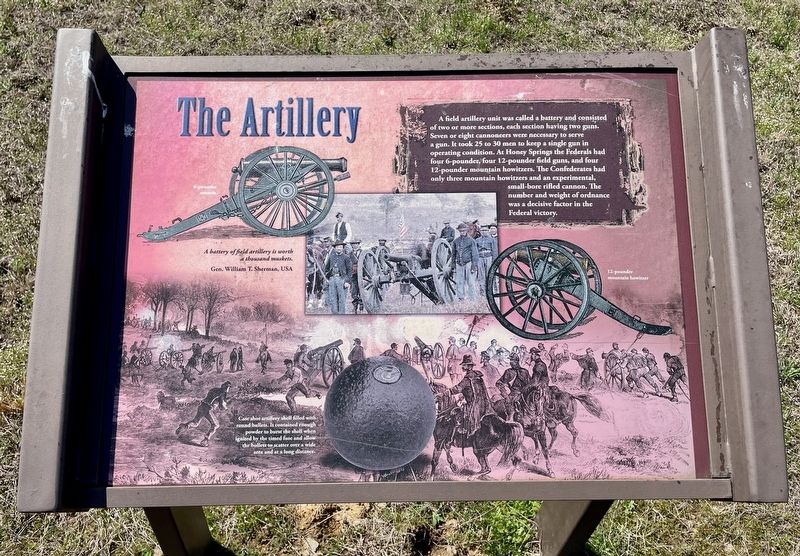
Case shot artillery shell filled with round bullets. It contained enough powder to burst the shell when ignited by the timed fuse and allow the bullets to scatter over a wide area and at a long distance.
A battery of field artillery is worth a thousand muskets.
Gen. William T. Sherman, USA
Erected 2019 by Friends of Honey Springs Battlefield.
Topics and series. This historical marker is listed in this topic list: War, US Civil. In addition, it is included in the Honey Springs Battlefield series list.
Location. 35° 33.767′ N, 95° 28.293′ W.
this page online

Regionally, this marker is in the Muscogee Nation, specifically in the Cherokee Nation, and in Northeast Oklahoma—Green Country. It is also in the American South, specifically on the prairies, and on the Southern Plains. Globally, it is in North America, the Western Hemisphere, the Western World, and the Anglosphere. Historically, it finds itself in what was once the territory of the Mississippian Culture and also the Louisiana Purchase.
Other nearby markers. At least 8 other markers are within walking distance of this marker: The Cavalry (within shouting distance of this marker); Breaking the Confederate Line (within shouting distance of this marker); The Federal Left · The Phillips' Brigade (within shouting distance of this marker); "Follow Me!" · The U.S. Infantry and their Weapons (within shouting distance of this marker); The Federal Right · Judson's Brigade
Photographed by Mark Hilton, March 20, 2024
2. The Artillery Marker
Credits. This page was last revised on March 23, 2024. It was originally submitted on March 23, 2024, by Mark Hilton of Montgomery, Alabama. This page has been viewed 188 times since then and 17 times this year. Photos: 1, 2. submitted on March 23, 2024, by Mark Hilton of Montgomery, Alabama.
