Dupont Circle in Northwest Washington in Washington, District of Columbia — The American Northeast (Mid-Atlantic)
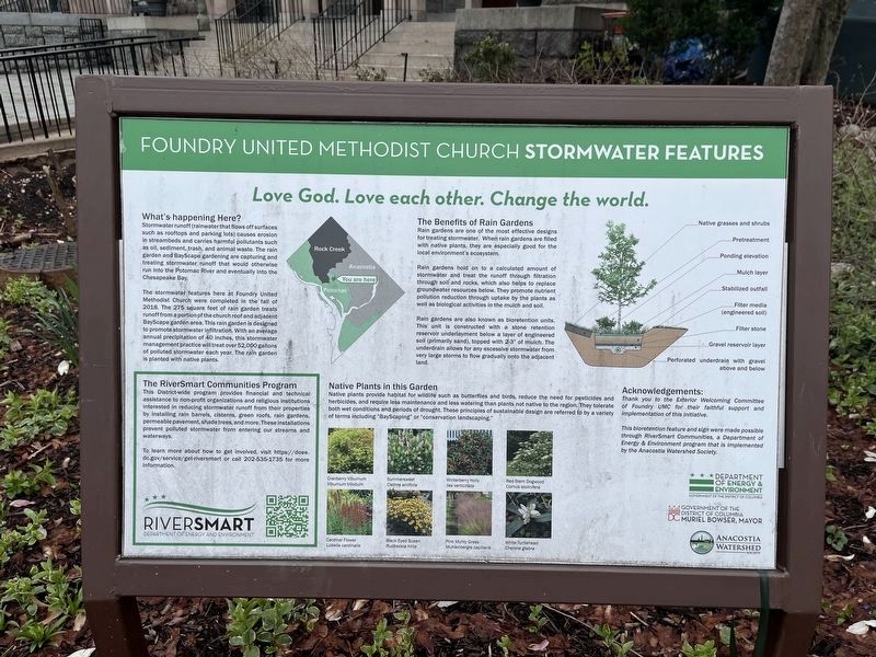
Foundry United Methodist Church Stormwater Features
Love God. Love each other. Change the world.

Photographed By Devry Becker Jones (CC0), March 23, 2024
1. Foundry United Methodist Church Stormwater Features Marker
What's happening Here?
Stormwater runoff (rainwater that flows off surfaces such as rooftops and parking lots) causes erosion in streambeds and carries harmful pollutants such as oil, sediment, trash, and animal waste. The rain garden and BayScape gardening are capturing and treating stormwater runoff that would otherwise run into the Potomac River and eventually into the Chesapeake Bay.
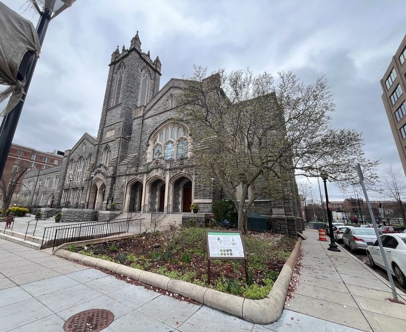
The stormwater features here at Foundry United Methodist Church were completed in the fall of 2018. The 275 square feet of rain garden treats runoff from a portion of the church roof and adjacent BayScape garden area. This rain garden is designed to promote stormwater infiltration. With an average annual precipitation of 40 inches, this stormwater management practice will treat over 52,000 gallons of polluted stormwater each year. The rain garden is planted with native plants.
The Benefits of Rain Gardens
Rain gardens are one of the most effective designs for treating stormwater. When rain gardens are filled with native plants, they are especially good for the local environment's ecosystem.
Rain gardens hold on to a calculated amount of stormwater and treat the runoff through filtration through soil and rocks, which also helped to replace groundwater resources below. They promote nutrients pollution reduction through uptake by the plants as well as biological activities in the mulch and soil.
Rain gardens are also known as bioretention units. This unit is constructed with a stone retention reservoir underlayment below a layer of engineered soil (primarily sand), topped with 2-3" of mulch. The underdrain allows for any excessive stormwater from very large storms to flow gradually onto the adjacent land.
Native Plants in this Garden
Native plants provide habitat for wildlife such as butterflies and birds, reduce the need for pesticides & herbicides, and require less maintenance and less watering than plants not native to the region. They tolerate both wet conditions and periods of drought. These principles of sustainable design are referred to by a variety of terms including "BayScaping" or "conservation landscaping."
Cranberry Viburnum Viburnum trilobum • Summersweet Clethra alnfolia • Winterberry Holly Ilex verticillata • Red Stem Dogwood Cornus stolinifera • Cardinal Flower Lobelia cardinalis • Black Eyed Susan Rudbeckla hirta • Pink Muhly Grass Muhlenbergia capillaris • White Turtlehead Chelone glabra
Acknowledgements:
Thank you to the Exterior Welcoming Committee of Foundry UMC for their faithful support
This bioretention feature and sign were made possible through RiverSmart Communities, a Department of Energy & Environment program that is implemented by the Anacostia Watershed Society.
The RiverSmart Communities Program
This District-wide program provides financial and technical assistance to non-profit organizations and religious institutions interested in reducing stormwater runoff from their properties by installing rain barrels, cisterns, green roofs, rain gardens, permeable pavement, shade trees, and more. These installations prevent polluted stormwater from entering our streams and waterways.
To learn more about how to get involved, visit https://doee.dc.gov/service/get-riversmart or call 202-535-1735 for more information.
Erected by DC Department of Environment, Government of the District of Columbia, Mural Bowser, Mayor; Anacostia Watershed Society; Foundry United Methodist Church.
Topics. This historical marker is listed in these topic lists: Churches & Religion • Environment • Waterways & Vessels. A significant historical year for this entry is 2018.
Location. 38° 54.62′ N, 77° 2.201′ W. Marker is in Northwest Washington in Washington, District of Columbia. It is in Dupont Circle. Marker is at the intersection of 16th Street Northwest and Church Street Northwest, on the right when traveling south on 16th Street Northwest. Touch for map. Marker is at or near this postal address: 1520 16th St NW, Washington DC 20036, United States of America. Touch for directions.
Other nearby markers. At least 8 other markers are within walking distance of this marker. The Stonesdale (within shouting distance of this marker); Administration Building, Carnegie Institution of Washington (within shouting distance of this marker); See You at the Center (about 300 feet away, measured in a direct line); The Cairo (about 400 feet away); St. Luke's Episcopal Church / Alexander Crummel (about 500 feet away); After the Civil War (about 600 feet away); Independence of Kazakhstan (about 600 feet away); Thomas Family Home (about 600 feet away). Touch for a list and map of all markers in Northwest Washington.
Additional commentary.
1. About the marker
This sign serves as a historical marker because it demonstrates how this community has made a choice in addressing concerns of environmental stewardship. It shares at length how, why and when it worked on this project.
— Submitted March 23, 2024, by Devry Becker Jones of Washington, District of Columbia.
Credits. This page was last revised on March 23, 2024. It was originally submitted on March 23, 2024, by Devry Becker Jones of Washington, District of Columbia. This page has been viewed 47 times since then. Photos: 1, 2. submitted on March 23, 2024, by Devry Becker Jones of Washington, District of Columbia.
