Near Oktaha in Muskogee County, Oklahoma — The American South (West South Central)
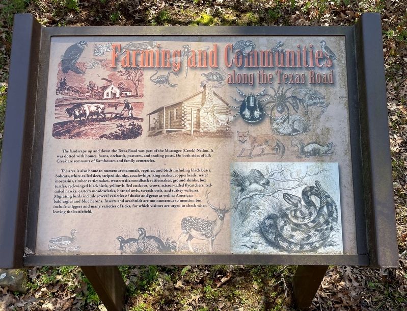
Farming and Communities · along the Texas Road
Honey Springs Battlefield
— Interpretive Trail Four · Battle at the Bridge —
The area is also home to numerous mammals, reptiles, and birds including black bears, bobcats, white-tailed deer, striped skunks, coachwhips, king snakes, copperheads, water moccasins, timber rattlesnakes, western diamondback rattlesnakes, ground skinks, box turtles, red-winged blackbirds, yellow-billed cuckoos, crows, scissor-tailed flycatchers, red-tailed hawks, eastern meadowlarks, horned owls, screech owls, and turkey vultures. Migrating birds include several varieties of ducks and geese as well as American bald eagles and blue herons. Insects and arachnids are too numerous to mention but include chiggers and many varieties of ticks, for which visitors are urged to check when leaving the battlefield.
Erected 2019 by Friends of Honey Springs Battlefield.
Topics and series. This historical marker is listed in these topic lists: Agriculture • Animals • Native Americans. In addition, it is included in the Honey Springs Battlefield series list.
Location. 35° 33.071′ N, 95° 28.441′ W. Marker is near Oktaha, Oklahoma, in Muskogee County. Marker can be reached from Honey Springs Battlefield Road, 1˝ miles north of East 1020 Road, on the right when traveling north. Touch for map. Marker is in this post office area: Oktaha OK 74450, United States of America. Touch for directions.
Other nearby markers. At least 8 other markers are within walking distance of this marker. How We Know What We Know · Archeological Surveys & Interviews (about 300 feet away, measured in a direct line); How We Know What We Know · Letters, Diaries, & On-The-Spot Reporting (about 300 feet away); Battle for the Bridge (about 400 feet away); The Toll Bridge and Fords · Crossing Elk Creek (about 600 feet away); How We Know What We Know · Official Reports (about 600 feet away); Defending the Bridge · and other Fighting along Elk Creek (about 600 feet away); Southern Camps (about 600 feet away); 1st and 2nd Regiments of Cherokee Mounted Rifles (approx. 0.4 miles away). Touch for a list and map of all markers in Oktaha.
Credits. This page was last revised on March 25, 2024. It was originally submitted on March 24, 2024, by Mark Hilton of Montgomery, Alabama. This page has been viewed 43 times since then. Photos: 1, 2. submitted on March 24, 2024, by Mark Hilton of Montgomery, Alabama.

