Fayetteville in Cumberland County, North Carolina — The American South (South Atlantic)
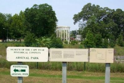
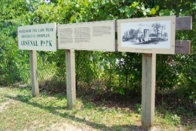
Arsenal Park
Inscription.
Crises cause us to act. The crisis created by the United States' military unpreparedness during the War of 1812 resulted in the planning and building of additional arsenals for the nation's defense. Congress appropriated monies in 1836 for an “arsenal of deposite and general construction” (manufacture of arms) in Fayetteville. Many workshops and buildings were completed in the initial phase of construction (1839-1842); however, the town's inability to attract a railroad line enabling arms to be easily shipped resulted in reassessment of the facility. The army demoted the arsenal to one of only deposit. Political pressure from southern politicians resulted in a second period of arsenal construction between 1846 and 1853. Although structurally complete, the arsenal lacked the machinery necessary for the construction of arms.
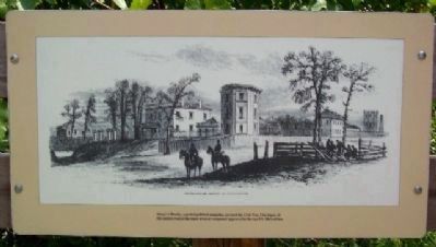
The outbreak of the American Civil War resulted in the arsenal being surrendered to North Carolina and turned over to the Confederacy. The facility was quickly manufacturing ammunition, repairing rifles, and modernizing muskets. The fall of the Harper's Ferry Arsenal and Armory to Virginia troops resulted in some of its gun-making machinery and many of its artisans being moved to Fayetteville. The Confederate government expanded the arsenal and soon produced the Fayetteville rifle. Scarcity of raw materials during the war limited the arsenal's production to 10,000 rifles. The facility's greatest contribution to the Confederate war effort was the production of millions of rounds of ammunition. The Fayetteville Arsenal was destroyed by United States troops in March of 1865.
In 1874 the U.S. government sold the property. Prior to this, townspeople salvaged brick and other usable materials from the site. The area became residential by the 1890s and remained so until the late 1960s when plans were made to construct a highway through the neighborhood. The destruction of this historic site raised public concern that resulted in an archaeological exploration and saving of the main compound's western wall.
Erected by Museum of the Cape Fear.
Topics. This historical marker is listed in these topic lists: Industry & Commerce • Man-Made Features • Military • War, US Civil. A significant historical month for this entry is March 1865.
Location. 35° 3.274′ N, 78° 53.599′ W. Marker is in Fayetteville, North Carolina, in Cumberland County. Markers are located between the Museum of the Cape Fear (Arsenal Avenue and Bradford Avenue) and the Martin Luther King, Jr. Freeway (U.S. 401), about sixty feet NE of the pedestrian bridge over U.S. 401. Touch for map. Marker is in this post office area: Fayetteville NC 28305, United States of America. Touch for directions.
Other nearby markers. At least 8 other markers are within walking distance of this marker. Arsenal Stones (a few steps from this marker); North Carolina Arsenal (within shouting distance of this marker); 1897 Poe House (within shouting distance of this marker); Arsenal (within shouting distance of this marker); The "Ghost" Tower (about 300 feet away, measured in a direct line); Forging and Casting [and] Smith's Shops (1839 - 1842) (about 300 feet away); Fayetteville Arsenal (about 400 feet away); North Carolina (about 400 feet away). Touch for a list and map of all markers in Fayetteville.
Also see . . . Fayetteville Arsenal. (Submitted on November 10, 2009, by William Fischer, Jr. of Scranton, Pennsylvania.)

Photographed By William Fischer, Jr., July 27, 2009
5. Arsenal Park Marker Detail
"This diagram is derived from an 1849 site map located in the National Archives, Washington, D.C." The X marks location of marker, with U.S. 401 running through arsenal site. The top right tower on the diagram is reconstructed as the "Ghost Tower."
Credits. This page was last revised on June 16, 2016. It was originally submitted on November 10, 2009, by William Fischer, Jr. of Scranton, Pennsylvania. This page has been viewed 1,009 times since then and 18 times this year. Photos: 1, 2, 3, 4, 5, 6, 7. submitted on November 10, 2009, by William Fischer, Jr. of Scranton, Pennsylvania.
