
Near Oktaha in Muskogee County, Oklahoma — The American South (West South Central)
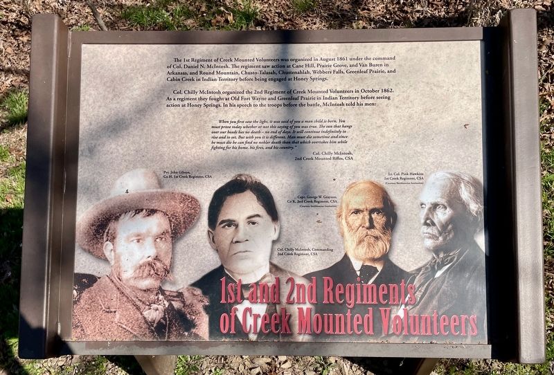
1st and 2nd Regiments of Creek Mounted Volunteers
Honey Springs Battlefield
| — | Interpretive Trail Three · Confederate Line | — |
Photographed by Mark Hilton, March 20, 2024
1. 1st and 2nd Regiments of Cherokee Mounted Rifles Marker
The 1st Regiment of Creek Mounted Volunteers was organized in August 1861 under the command of Col. Daniel N. McIntosh. The regiment saw action at Cane Hill, Prairie Grove, and Van Buren in Arkansas, and Round Mountain, Chusto-Talasah, Chustenahlah, Webbers Falls, Greenleaf Prairie, and Cabin Creek in Indian Territory before being engaged at Honey Springs.
Col. Chilly McIntosh organized the 2nd Regiment of Creek Mounted Volunteers in October 1862. As a regiment they fought at Old Fort Wayne and Greenleaf Prairie in Indian Territory before seeing action at Honey Springs. In his speech to the troops before the battle, McIntosh told his men:
When you first saw the light, it was said of you a man child is born. You must prove today whether or not this saying of you was true. The sun that hangs over our heads has no death -no end of days. It will continue indefinitely to rise and to set. But with you it is different. Man must die sometime and since he must die he can find no nobler death than that which overtakes him while fighting for his home, his fires, and his country."
Col. Chilly McIntosh,
2nd Creek Mounted Rifles, CSA
[Captions: L to R]
Pvt. John Gibson,
Co H, 1st Creek Regiment, CSA
Col. Chilly McIntosh, Commanding
2nd Creek Regiment, CSA
Capt. George W. Grayson,
Co K, 2nd Creek Regiment, CSA
(Courtesy Smithsonian Institution)
Lt. Col. Pink Hawkins
1st Creek Regiment, CSA
(Courtesy Smithsonian Institution)
Erected 2019
this page online
Topics and series. This historical marker is listed in these topic lists: Indigenous Peoples and Communities • War, US Civil. In addition, it is included in the Honey Springs Battlefield series list. A significant historical month for this entry is August 1861.
Location. 35° 33.47′ N, 95° 28.387′ W. Marker is near Oktaha, Oklahoma, in Muskogee County. It can be reached from Honey Springs Battlefield Road 1.9 miles north of East 1020 Road, on the right when traveling north. Touch for map. Marker is in this post office area: Oktaha OK 74450, United States of America. Touch for directions.

Regionally, this marker is in Oklahoma’s Muscogee Nation and specifically in the Cherokee Nation. It is also in the American South, specifically on the prairies, and on the Southern Plains. Globally, it is
Photographed by Mark Hilton, March 20, 2024
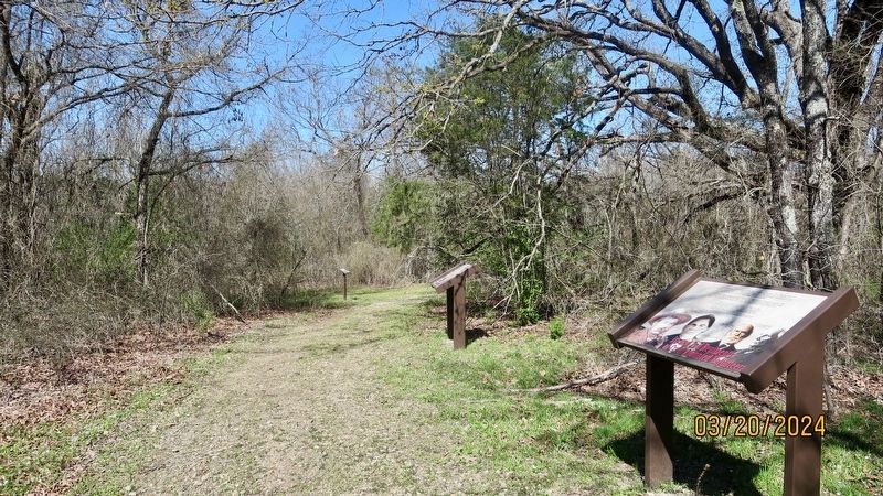
2. 1st and 2nd Regiments of Cherokee Mounted Rifles Marker (on nearest right)
Other nearby markers. At least 8 other markers are within walking distance of this marker: Primitive Trail to Elk Creek Overlook (a few steps from this marker); Waiting for History (within shouting distance of this marker); The Confederate Center (within shouting distance of this marker); 5th Texas Partisan Rangers and Lee's Light Battery (within shouting distance of this marker); Breaking the Line, Hand-to-Hand Combat (within shouting distance of this marker); The Texas Road (about 300 feet away, measured in a direct line); 29th Texas Cavalry & 20th Texas Cavalry (about 300 feet away); 1st and 2nd Regiments of Cherokee Mounted Rifles (about 400 feet away). Touch for a list and map of all markers in Oktaha.
Credits. This page was last revised on July 19, 2025. It was originally submitted on March 25, 2024, by Mark Hilton of Montgomery, Alabama. This page has been viewed 627 times since then and 105 times this year. Photos: 1, 2. submitted on March 25, 2024, by Mark Hilton of Montgomery, Alabama.
