Near Marietta in Cobb County, Georgia — The American South (South Atlantic)
Assault on Pigeon Hill
September 27, 2023
1. Assault on Pigeon Hill Marker
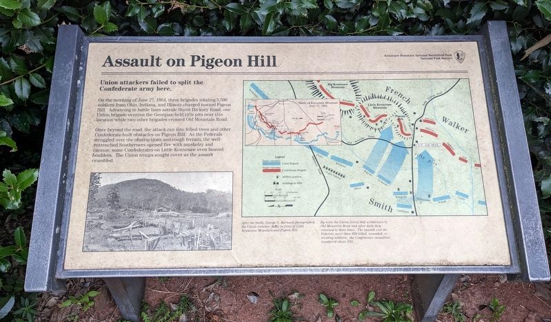
Union Attackers failed to split the Confederate army here.
On the morning of June 27, 1864, three brigades totaling 5,500 soldiers from Ohio, Indiana and Illinois charged toward Pigeon Hill. Advancing in battle lines astride Burnt Hickory Road, one Union brigade overran the Georgian held rifle pits near this location while two other brigades crossed Old Mountain Road.
Once beyond the road, the attack ran into felled trees and other Confederate-built obstacles on Pigeon Hill. As the Federals struggled over the obstructions and rough terrain, the well-entrenched Southerners opened fire with musketry and cannon; some Confederates on Little Kennesaw even heaved boulders. The Union troops sought cover as the assault crumbled.
(captions)
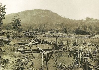
After the battle, George N. Barnard photographed the Union trenches (left) in front of Little Kennesaw Mountain and Pigeon Hill.
By noon the Union forces had withdrawn to Old Mountain Road and after dark they returned to their lines. The assault cost the Federals more than 850 killed, wounded, or missing soldiers; the Confederate casualties numbered about 250.
Erected by National
this page online
Topics. This historical marker is listed in this topic list: War, US Civil. A significant historical date for this entry is June 27, 1864.
Location. 33° 57.794′ N, 84° 35.608′ W. Marker is near Marietta, Georgia, in Cobb County. It is at the intersection of Burnt Hickory Road Northwest and Old Mountain Road Northwest, on the right when traveling east on Burnt Hickory Road Northwest. The marker is located in Kennesaw Mountain National Battlefield Park. Touch for map. Marker is at or near this postal address: 1520 Burnt Hickory Rd NW, Marietta GA 30064, United States of America. Touch for directions.

Regionally, this marker is in the Piedmont and in Metro Atlanta. It is also in the American South and specifically in the Deep South. Globally, it is in North America, the Western Hemisphere, the Western World, and the Anglosphere. Historically, it finds itself in what was once the original Cherokee Nation, the territory of the Mississippian Culture, one of the original Thirteen Colonies, one of the Confederate States of America, and the Antebellum South.
Other nearby markers. At least
September 27, 2023
2. Assault on Pigeon Hill Marker
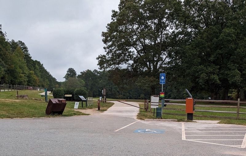
The marker can be seen in this view to the left of the sidewalk and surrounded by bushes. It is behind another marker.
Also see . . . Kennesaw Mountain National Battlefield Park. National Park Service (Submitted on August 20, 2015.)
Photographed by Brandon Fletcher, October 17, 2008
3. Pigeon Hill Trail
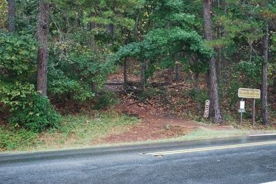
Located across the road from marker.
Courtesy of the Library of Congress, February 21, 2011
4. George Barnard's photo of Kennesaw Mountain
Credits. This page was last revised on July 8, 2024. It was originally submitted on August 19, 2015, by Brandon Fletcher of Chattanooga, Tennessee. This page has been viewed 2,378 times since then and 133 times this year. Last updated on March 29, 2024. Photos: 1. submitted on March 28, 2024. 2. submitted on March 27, 2024. 3, 4. submitted on August 19, 2015, by Brandon Fletcher of Chattanooga, Tennessee. • Bernard Fisher was the editor who published this page.
