Lyndon Township in Chelsea in Washtenaw County, Michigan — The American Midwest (Great Lakes)
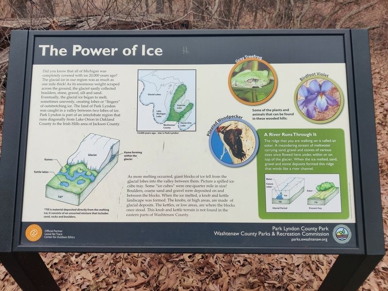
The Power of Ice
Did you know that all of Michigan was completely covered with ice 20,000 years ago? The glacial ice in our region was as much as one mile thick! As its enormous weight scraped across the ground, the glacier easily collected boulders, stone, gravel, silt and sand. Eventually, the glacial ice began to melt, sometimes unevenly, creating lobes or "fingers" of outstretching ice. The land of Park Lyndon was caught in a valley between two lobes of ice. Park Lyndon is part of an interlobate region that runs diagonally from Lake Orion in Oakland County to the Irish Hills area of Jackson County.
As more melting occurred, giant blocks of ice fell from the glacial lobes into the valley between them. Picture a spilled ice cube tray. Some of the "ice cubes" were one-quarter mile in size! Boulders, course sand and gravel were deposited on and between the blocks. When the ice melted, a knob and kettle landscape was formed. The knobs, or high areas, are made of glacial deposits. The kettles, or low areas, are where the blocks once stood. This knob and kettle terrain is not found in the eastern parts of Washtenaw County.
A River Runs Through It
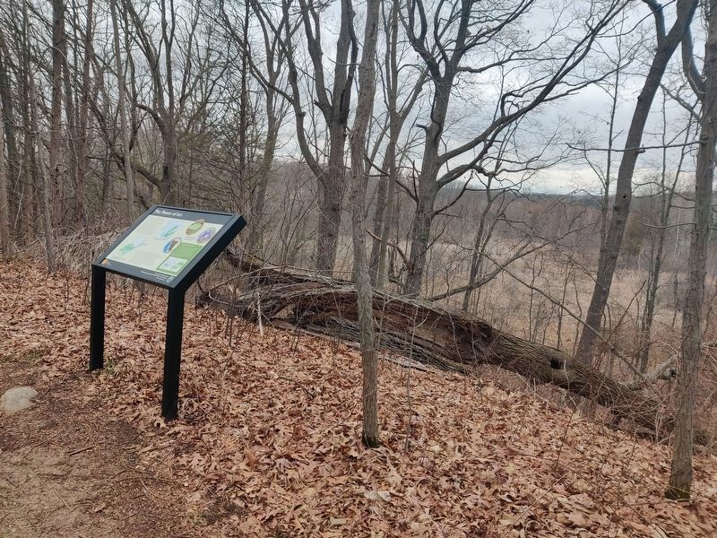
The ridge that you are walking on is called an esker. A meandering stream of meltwater carrying sand, gravel and stones of various sizes once flowed here under, within or on top of the glacier. When the ice melted, sand, gravel and stone deposits formed this ridge that winds like a river channel.
Topics. This historical marker is listed in these topic lists: Environment • Parks & Recreational Areas.
Location. 42° 22.993′ N, 84° 3.768′ W. Marker is in Chelsea, Michigan, in Washtenaw County. It is in Lyndon Township. Marker can be reached from Waterloo-Pinckney Hiking Trail, 0.2 miles north of North Territorial Road. Touch for map. Marker is at or near this postal address: Waterloo-Pinckney Hiking Trail, Chelsea MI 48118, United States of America. Touch for directions.
Other nearby markers. At least 8 other markers are within 4 miles of this marker, measured as the crow flies. History of Lyndon Township (about 500 feet away, measured in a direct line); The Beauty of Biodiversity (approx. ¼ mile away); A Good Home for Oaks (approx. 0.4 miles away); Shaping the Land (approx. half a mile away); North Lake Methodist Church (approx. 2.7 miles away); Unadilla Baseline Cemetery (approx. 2.8 miles away); Park Lawn Beach (approx. 3 miles away); First Presbyterian Church (approx. 3.2 miles away). Touch for a list and map of all markers in Chelsea.
Additional keywords. geology, glacier
Credits. This page was last revised on March 31, 2024. It was originally submitted on March 29, 2024, by John Ridley of Chelsea, Michigan. This page has been viewed 39 times since then. Photos: 1. submitted on March 29, 2024, by John Ridley of Chelsea, Michigan. 2. submitted on March 31, 2024, by John Ridley of Chelsea, Michigan. • J. Makali Bruton was the editor who published this page.

