Lyndon Township in Chelsea in Washtenaw County, Michigan — The American Midwest (Great Lakes)
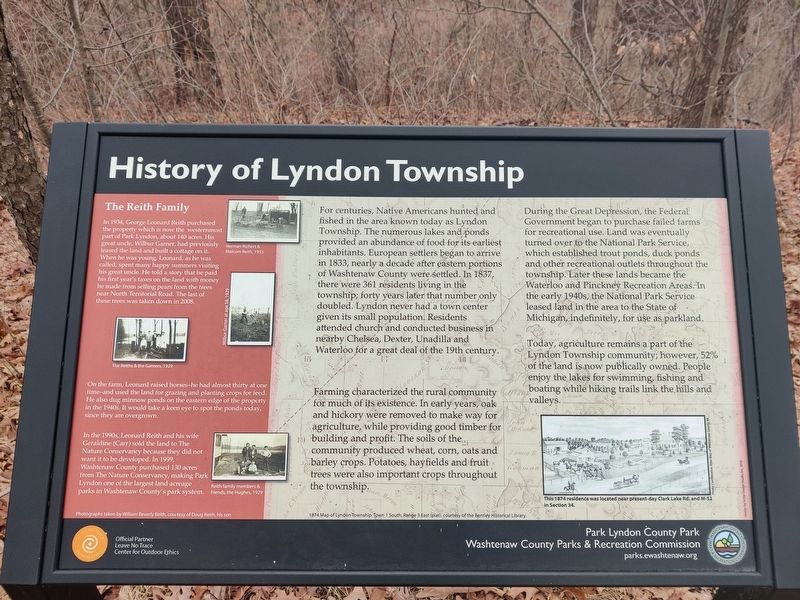
History of Lyndon Township
For centuries, Native Americans hunted and fished in the area known today as Lyndon Township. The numerous lakes and ponds provided an abundance of food for its earliest inhabitants. European settlers began to arrive in 1833, nearly a decade after eastern portions of Washtenaw County were settled. In 1837, there were 361 residents living in the township; forty years later that number only doubled. Lyndon never had a town center given its small population. Residents attended church and conducted business in nearby Chelsea, Dexter, Unadilla and Waterloo for a great deal of the 19th century.
Farming characterized the rural community for much of its existence. In early years, oak and hickory were removed to make way for agriculture, while providing good timber for building and profit. The soils of the community produced wheat, corn, oats and barley crops. Potatoes, hayfields and fruit trees were also important crops throughout the township.
During the Great Depression, the Federal Government began to purchase failed farms for recreational use. Land was eventually turned over to the National Park Service, which established trout ponds, duck ponds and other recreational outlets throughout the township. Later these lands became the Waterloo and Pinckney Recreational Areas. In the early 1940s, the National Park Service leased land in the area to the State of Michigan, indefinitely, for use as a parkland.
Today, agriculture remains a part of the Lyndon Township Community; however, 52% of the land is now publically owned. People enjoy the lakes for swimming, fishing and boating while hiking trails link the hills and valleys.
The Reith Family
In 1934, George Leonard Reith purchase the property which is now the westernmost part of Park Lyndon, about 140 acres. His great uncle, Wilber Garner, had previously leased the land and built a cottage on it. When he was young, Leonard, as he was called, spent many happy summers visiting his great uncle. He told a story that he paid his first year's taxes on the land with money he made from selling pears from the trees near North Territorial Road. The last of these trees was taken down in 2008.
On the farm, Leonard raised horses - he had almost thirty at one time - and used the land for grazing and planting crops for food. He also dug minnow ponds on the eastern edge of the property in the 1940s. It would take a keen eye to spot the ponds today, since they are overgrown.
In the 1990s, Leonard Reith and his wife Geraldine (Carr) sold the land to The Nature Conservancy because they did not want it to be developed. In 1999, Washtenaw County purchased 130 acres from The Nature Conservancy, making Park Lyndon one of the largest land acreage parks in Washtenaw County's park system.
Erected by Washtenaw County Parks and Recreation Commission.
Topics. This historical marker is listed in these topic lists: Native Americans • Parks & Recreational Areas • Settlements & Settlers.
Location. 42° 23.073′ N, 84° 3.801′ W. Marker is in Chelsea, Michigan, in Washtenaw County. It is in Lyndon Township. Marker can be reached from Waterloo-Pinckney Hiking Trail, 0.2 miles north of North Territorial Road. Touch for map. Marker is at or near this postal address: Waterloo-Pinckney Hiking Trail, Chelsea MI 48118, United States of America. Touch for directions.
Other nearby markers. At least 8 other markers are within 3 miles of this marker, measured as the crow flies. The Power of Ice (about 500 feet away, measured in a direct line); The Beauty of Biodiversity (approx. 0.3 miles away); A Good Home for Oaks (approx. half a mile away); Shaping the Land (approx. 0.6 miles away); Unadilla Baseline Cemetery (approx. 2.8 miles away); North Lake Methodist Church (approx. 2.8 miles away); Park Lawn Beach (approx. 3 miles away); First Presbyterian Church (approx. 3.1 miles away). Touch for a list and map of all markers in Chelsea.
Credits. This page was last revised on March 29, 2024. It was originally submitted on March 29, 2024, by John Ridley of Chelsea, Michigan. This page has been viewed 43 times since then. Photo 1. submitted on March 29, 2024, by John Ridley of Chelsea, Michigan. • J. Makali Bruton was the editor who published this page.
