
Fayetteville in Cumberland County, North Carolina — The American South (South Atlantic)
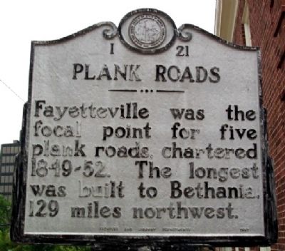
Plank Roads
Photographed by William Fischer, Jr., July 27, 2009
1. Plank Roads Marker
Erected 1957 by Archives and Highway Departments. (Marker Number I-21.)
Topics and series. This historical marker is listed in these topic lists: Roads & Vehicles • Settlements & Settlers. In addition, it is included in the North Carolina Division of Archives and History series list.
Location. 35° 3.181′ N, 78° 52.677′ W. Marker is in Fayetteville, North Carolina, in Cumberland County. It is on Green Street north of Person Street, on the right when traveling north. Touch for map. Marker is at or near this postal address: 116 Green Street, Fayetteville NC 28301, United States of America. Touch for directions.

Regionally, this marker is in North Carolina’s Coastal Plain. It is also in the American South and specifically in the Upper South. Globally, it is in North America, the Western Hemisphere, the Western World, and the Anglosphere. Historically, it finds itself in what was once the territory of the Mississippian Culture,
this page online
Other nearby markers. At least 8 other markers are within walking distance of this marker: 1963 Protests (here, next to this marker); Flora MacDonald (within shouting distance of this marker); James Dobbin McNeill (within shouting distance of this marker); Fayetteville’s 250th Anniversary (within shouting distance of this marker); Old Town Hall (within shouting distance of this marker); The Market House (within shouting distance of this marker); Town House (within shouting distance of this marker); Liberty Row (within shouting distance of this marker). Touch for a list and map of all markers in Fayetteville.
Related marker. Click here for another marker that is related to this marker. To better understand the relationship, study the marker shown.
Photographed by William Fischer, Jr., July 27, 2009
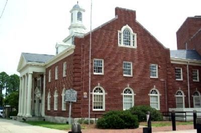
2. Plank Roads Marker
Looking north, with Fascinate-U Children's Museum in background.
Credits. This page was last revised on March 2, 2025. It was originally submitted on November 11, 2009, by William Fischer, Jr. of Reynoldsburg, Ohio. This page has been viewed 1,170 times since then and 22 times this year. Photos: 1, 2. submitted on November 11, 2009, by William Fischer, Jr. of Reynoldsburg, Ohio.
