Bridgeport in Chicago in Cook County, Illinois — The American Midwest (Great Lakes)
Bridgeport and the Development of Chicago's Infrastructure
The Story of a Neighborhood
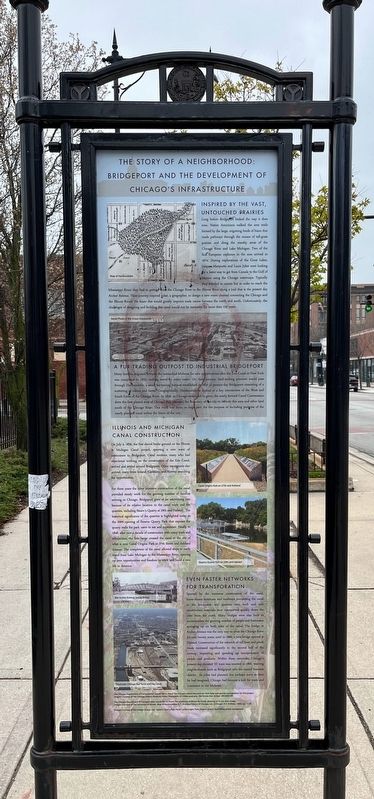
Long before Bridgeport looked the way it does now, Native Americans walked the area trails formed by the large, migrating herds of bison that made pathways through the oceans of tall-grass prairies and along the marshy areas of the Chicago River and Lake Michigan. Two of the first European explorers in the area arrived in 1674. During explorations of the Great Lakes, Jacques Marquette and Louis Joliet were looking for a faster way to get from Canada to the Gulf of Mexico using the Chicago waterways. Typically they traveled in canoes but in order to reach the Mississippi River, they had to portage from the Chicago River to the Illinois River along a trail that is the present day Archer Avenue. Their journey inspired Joliet, a geographer, to design a new water channel connecting the Chicago and the Illinois Rivers. He knew this would greatly improve trade routes between the north and south. Unfortunately, the challenges of designing and building this canal would not be overcome for more than 150 years.
A Fur-Trading Outpost to Industrial Bridgeport
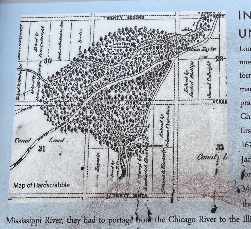
Many families migrated towards the untouched Midwest for new opportunities after the Erie Canal in New York was completed in 1825, making travel by water easier. On their journey, land-seeking pioneers would pass through Hardscrabble, a small fur-trading outpost established in 1816 in present-day Bridgeport consisting of a scattering of cabins and farms. Geographically, Hardscrabble is located at a key intersection of the West and South Forks of the Chicago River. In 1830, as Chicago continued to grow, the newly formed Canal Commission drew the first platted map of Chicago that extended the Boundary of the city to include this area and other land south of the Chicago River. This work was done, in large part, for the purpose of including portions of the newly planned canal within the limits of the city.
Illinois and Michigan Canal Construction
On July 4, 1836, the first shovel broke ground on the Illinois & Michigan Canal project, spurring a new wave of newcomers to Bridgeport. Canal workers, many who had experience working on the construction of the Erie Canal, arrived and settled around Bridgeport. Other immigrants also arrived, many from Ireland, Germany, and Norway searching for opportunities.
For three years the labor intensive construction of the canal provided steady work for the growing number of families arriving in Chicago. Bridgeport grew at an astonishing rate because of its relative location to the canal work and the quarries, including Stearn's Quarry at 29th and Halsted. The historical significance of the quarries is highlighted today in the 2009
opening of Stearns Quarry Park that exposes the quarry walls for park users to see and experience. Finally in 1848, after over a decade of construction with many trials and tribulations, the first barge crossed the canal at the site of what is now Canal Origins Park at 27th Street and Ashland Avenue. The completion of the canal allowed ships to easily travel from Lake Michigan to the Mississippi River, opening up new opportunities and freedom to work and build a new life in America.
Even Faster Networks for Transportation
Spurred by the immense construction of the canal, horse-drawn streetcars and roadways connecting the canal to the brickyards and quarries were built and new construction materials were transported quickly down the river from the north. Many bridges were also built to accommodate the growing number of people and businesses springing up on both sides of the canal. The bridge at Archer Avenue was the only way to cross the Chicago River for over twenty years, until in 1860, a new bridge opened at Halsted. Construction of the network of rail lines and plank roads increased significantly in the second half of the century, improving and speeding up transportation of people and products. Within these networks, Chicago's present-day elevated 'El' train was inserted in 1892, weaving neighborhoods such as Bridgeport into the central business district.

Photographed By Sean Flynn, April 1, 2024
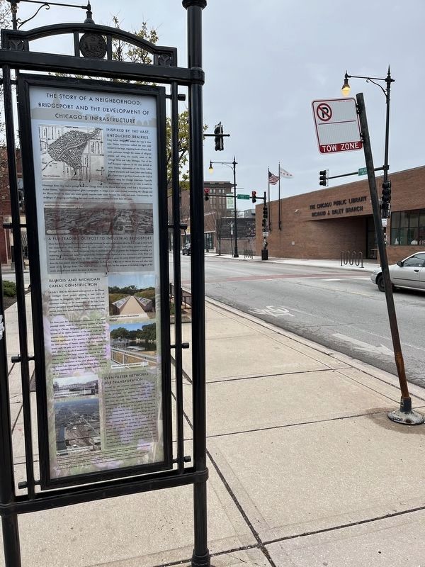
3. Bridgeport and the Development of Chicago's Infrastructure Marker
The Richard J. Daley branch of the Chicago Public Library is across Halsted Street. Daley famously was born and raised in Bridgeport and lived there his entire life, including during his 21 years at Chicago mayor.
Erected by Chicago Department of Transportation.
Topics. This historical marker is listed in these topic lists: Bridges & Viaducts • Native Americans • Settlements & Settlers • Waterways & Vessels. A significant historical year for this entry is 1674.
Location. 41° 49.971′ N, 87° 38.764′ W. Marker is in Chicago, Illinois, in Cook County. It is in Bridgeport. Marker is on South Halsted Street north of West 34th Street when traveling north. Touch for map. Marker is in this post office area: Chicago IL 60608, United States of America. Touch for directions.
Other nearby markers. At least 8 other markers are within walking distance of this marker. Lt. Joseph T. (Jay) McKeon Jr. Park (approx. 0.4 miles away); Paul Konerko (approx. 0.6 miles away); Ted Lyons (approx. 0.6 miles away); Luis Aparicio (approx. 0.6 miles away); Frank Thomas (approx. 0.6 miles away); Billy Pierce (approx. 0.6 miles away); Minnie Miñoso (approx. 0.6 miles away); Jackie Robinson (approx. 0.6 miles away). Touch for a list and map of all markers in Chicago.
More about this marker. The marker is mostly readable, although some faded graffiti makes it hard to read in parts.
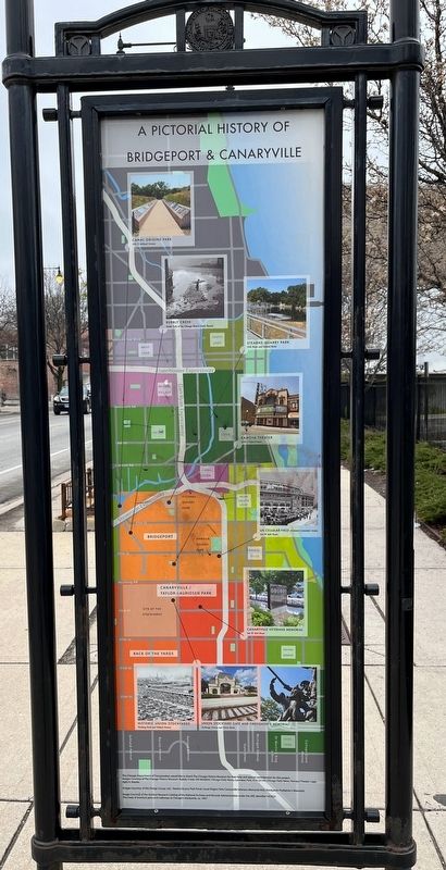
The rear of the marker includes a map of Bridgeport and its surrounding
neighborhoods, with photographs of some of its most famous sites. A similarly designed sign devoted to Canaryville can be found about 7 blocks south of here, not far from the former site of the Union Stock Yards.
This marker is across the street from a Chicago Public Library branch named after Bridgeport's most famous former resident: long-time Chicago mayor Richard J. Daley, who lived in the neighborhood for his entire life, including throughout his 21-year stint as Chicago's mayor.
Also see . . . "Chicago by L": Bridgeport. A profile of the Bridgeport neighborhood on Chicago's South Side, by WTTW-TV Chicago (Channel 11).
Excerpt: "Five of Chicago’s mayors hail from Bridgeport: Edward Kelly, Martin Kennelly, Richard J. Daley, Michael Bilandic, and Richard M. Daley. Part of Chicago’s 'machine' politics, the leadership of these mayors spanned from 1933 to 2011."(Submitted on April 3, 2024, by Sean Flynn of Oak Park, Illinois.)
Credits. This page was last revised on April 3, 2024. It was originally submitted on April 3, 2024, by Sean Flynn of Oak Park, Illinois. This page has been viewed 50 times since then. Photos: 1, 2, 3, 4. submitted on April 3, 2024, by Sean Flynn of Oak Park, Illinois.


