Victoria Park in Kitchener in Waterloo Region, Ontario — Central Canada (North America)
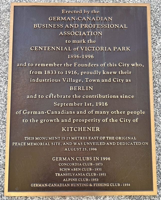
Centennial of Victoria Park (1896-1996)
Photographed by Tim Boyd, March 31, 2024
1. Centennial of Victoria Park Marker
and to remember the founders of this city who, from 1833 to 1916, proudly knew their industrious village, town and city as Berlin
and to celebrate the contributions since September 1st, 1916 of German-Canadians and of many other people to the growth and prosperity of the City of Kitchener
This monument is 25 metres east of the original peace memorial site, and was unveiled and dedicated on August 25, 1996
German clubs in 1996
Concordia Club - 1873
Schwaben Club - 1931
Transylvania Club - 1951
Alpine Club - 1953
German-Canadian Hunting & Fishing Club 1954
Erected 1996 by German-Canadian Business and Professional Association.
Topics. This historical marker is listed in these topic lists: Fraternal or Sororal Organizations • Parks & Recreational Areas • Peace • Settlements & Settlers. A significant historical year for this entry is 1896.
Location. 43° 26.801′ N, 80° 29.698′ W. Marker is in Kitchener, Ontario, in Waterloo Region. It is in Victoria Park. It is at
this page online

Regionally, this marker is in the Huron-Perth-Waterloo-Wellington Area and in Southwestern Ontario. It is also in Central Canada. Globally, it is in North America, the Western Hemisphere, the Western World, and the Anglosphere. Historically, it finds itself in what was once a British colony, the Viceroyalty of New France, the Haudenosaunee (Iroquois) Confederacy, and Rupert’s Land.
Other nearby markers. At least 8 other markers are within walking distance of this marker: Friedensfest 1871 Denkmal (a few steps from this marker); Joseph Schneider Haus (about 210 meters away, measured in a direct line); The Joseph Schneider House 1820 (about 210 meters away); St. Mary Our Lady of the Seven Sorrows Roman Catholic Parish (approx. 0.7 kilometers away); Kitchener Cenotaph (approx. 0.8 kilometers away); Waterloo County (approx. 0.9 kilometers away); Waterloo County Registry Office (approx. one kilometer

Photographed by Tim Boyd, March 31, 2024
2. Centennial of Victoria Park Marker

1899
3. Victoria Park in 1899
Source: City of Kitchener (public domain)

Photographed by Tim Boyd, March 31, 2024
4. Victoria Park, 2024
Credits. This page was last revised on April 10, 2024. It was originally submitted on April 4, 2024, by Tim Boyd of Hamilton, Ontario. This page has been viewed 198 times since then and 18 times this year. Photos: 1, 2, 3, 4. submitted on April 4, 2024, by Tim Boyd of Hamilton, Ontario. • Andrew Ruppenstein was the editor who published this page.
