Columbia in Caldwell Parish, Louisiana — The American South (West South Central)
Columbia
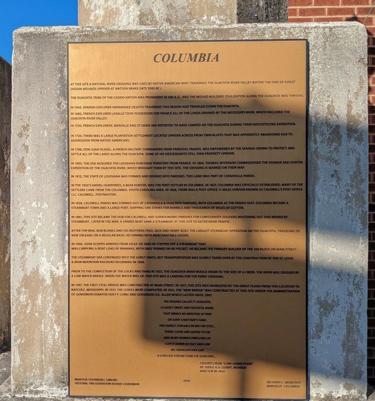
At this site a natural river crossing was used by Native American who traversed the Ouachita River valley before the time of Christ (Indian mounds upriver at Watson Brake date 3500 BC.)
The Ouachita tribe of the Caddo nation was prominent in 400 A.D., and the mound builders' civilization along the Ouachita was thriving.
In 1543, Spanish explorer Hernandez DeSoto traversed this region and traveled down the Ouachita.
In 1682, French explorer LaSalle took possession for France all of the lands drained by the Mississippi river, which included the Ouachita River valley.
In 1700, French explorers, Bienville and St. Denis are reported to have camped on the Ouachita during their Natchitoches expedition.
In 1720, there was a large plantation settlement located upriver across from twin bluffs that was apparently abandoned due to aggression from Native Americans.
In 1788, Don Juan Filhiol, a French military commander from Pargoud, France, was empowered by the Spanish crown to protect and settle all of the lands along the Ouachita. Some of his descendants still own property upriver.
In 1803, the USA acquired the Louisiana purchase territory from France. In 1904, Thomas Jefferson commissioned the Dunbar and Hunter Expedition of the Ouachita River, which brought them by this site. The crossing is marked on their map.
In 1812, the State of Louisiana was formed and divided into parishes. This land was part of Catahoula Parish.
In the 1820's Daniel Humphries, a bear hunter, was the first settler in Columbia. In 1827, Columbia was officially established. Many of the settlers came from the Columbia, South Carolina area. In 1828, there was a post office 11 miles upriver known as Caldwell's post office (J.C. Caldwell, postmaster).
In 1838, Caldwell Parish was formed out of Catahoula & Ouachita parishes, with Columbia as the parish seat. Columbia became a steamboat town and a large port, shipping oak staves for barrels and thousands of bales of cotton.
In 1861, this site became the hub for Caldwell and surrounding parishes for Confederate soldiers mustering out and moved by steamboat. Later in the war, a yankee boat sank a steamboat at this site to deter river traffic.
After the war, Bob Blanks and his brothers Fred, Jack and Henry built the largest steamboat operation on the Ouachita, traveling to New Orleans on a regular basis, returning with merchantable goods.
In 1906, John Schepis arrived from Sicily. He said he stepped off a steamboat that was carrying a boat load of bananas, with only pennies in his pocket. He became the primary builder of the 100 block on Main Street.
The steamboat era continued into the early 1900's, but transportation was slowly taken over by the construction of the St. Louis & Iron Mountain Railroad beginning in 1888.
Prior to the completion of the locks and dams in 1925, the Ouachita River would drain to the size of a creek. The river was crossed by a low water bridge. When the water was up, this site was a landing for the ferry crossing.
In 1907, the first steel bridge was constructed at Main Street. In 1927, this site was inundated by the Great Flood from this location to Natchez, Mississippi. In 1937, the levees were completed. In 1931, the "New Bridge" was constructed at this site under the administration Of Governor/Senator Huey P. Long and Governor O.K. Allen which lasted until 2007.
A lovely sweet and peaceful name,
That brings no mention of war
Or gory chieftain's fame.
The fairest stream e'er met my eyes...
There I lived and hoped to die
And in my humble dwelling lie.
Ilay it down as fact and law
No traveler ever saw
A lovelier stream than the Ouachita...
Excerpt from "Lone Grave Poem"
By Judge A.A. Gunby, Monroe
Written in 1844
Erected 2018.
Topics. This historical marker is listed in these topic lists: Native Americans • Settlements & Settlers • Waterways & Vessels.
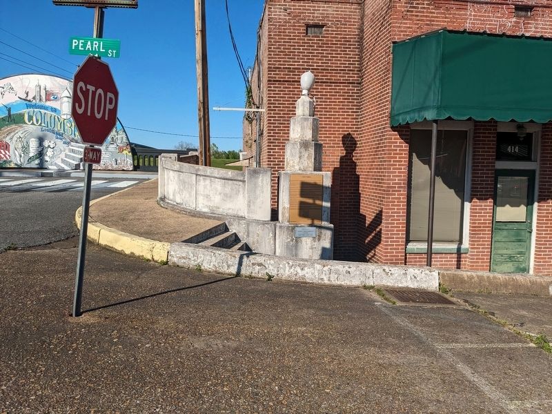
Location. 32° 6.379′ N, 92° 4.515′ W. Marker is in Columbia, Louisiana, in Caldwell Parish. Marker is on Pearl Street near Old Highway 165. Touch for map. Marker is at or near this postal address: 414 Pearl St, Columbia LA 71418, United States of America. Touch for directions.
Other nearby markers. At least 7 other markers are within 18 miles of this marker, measured as the crow flies. Caldwell Parish Veterans Memorial (about 400 feet away, measured in a direct line); Ouachita River Steamboat Era (about 400 feet away); Bobby Bridger (about 400 feet away); First United Methodist Church (about 800 feet away); Wade Landing Mound (approx. 3.9 miles away); Landerneau Mounds (approx. 12½ miles away); Town of Olla (approx. 17.1 miles away).
More about this marker. Located at the old Highway 165 bridge crossing.
Credits. This page was last revised on April 5, 2024. It was originally submitted on April 4, 2024, by Cajun Scrambler of Assumption, Louisiana. This page has been viewed 47 times since then. Photos: 1. submitted on April 4, 2024, by Cajun Scrambler of Assumption, Louisiana. 2. submitted on April 5, 2024, by Cajun Scrambler of Assumption, Louisiana.

