Smithfield in Isle of Wight County, Virginia — The American South (Mid-Atlantic)
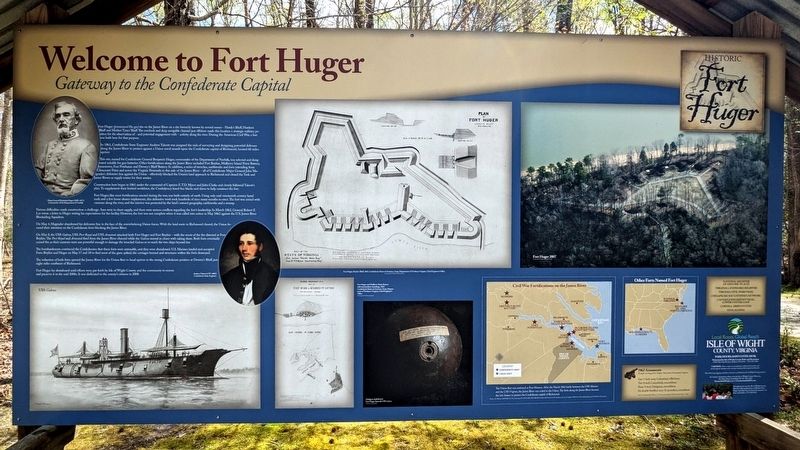
Welcome to Fort Huger
Gateway to the Confederate Capital
— Historic Fort Huger —
In 1861, Confederate State Engineer Andrew Talcott was assigned the task of surveying and designing potential defenses along the James River to protect against a Union naval assault upon the Confederate capital of Richmond, located 60 miles upriver.
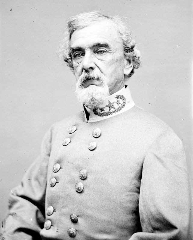
This site, named for Confederate General Benjamin Huger, commander of the Department of Norfolk, was selected and designated suitable for gun batteries. Other fortifications along the James River included Fort Boykin, Mulberry Island Point Battery, Jamestown, Fort Powhatan and Drewry's Bluff Battery. In addition, a series of trenches, earthworks and forts extending from Gloucester Point and across the Virginia Peninsula to this side of the James River — all of Confederate Major General John Magruder's defensive line against the Union - effectively blocked the Union's land approach to Richmond and closed the York and James Rivers as supply routes for their armies.
Construction here began in 1861 under the command of Captains E.T.D. Myers and John Clarke and closely followed Talcott's plan. To supplement their limited workforce, the Confederacy hired free blacks and slaves to help construct the fort.
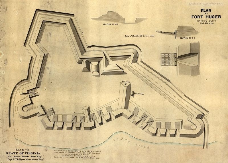
Fort Huger, like most fortifications erected during the war, was built entirely of earth. Using only mid-nineteenth century hand tools and a few horse-drawn implements, this defensive work took hundreds of men many months to erect. The fort was armed with cannons along the river, and the interior was protected by the land's natural geography, earthworks and a swamp.
Various difficulties made construction a challenge. Axes were in short supply, and there were serious conflicts regarding the fort's leadership. In March 1862, General Robert E. Lee wrote a letter to Huger stating his expectations for the facility. However, the fort was not complete when it was called into action in May 1862 against the U.S. James River Blockading Squadron.
On May 4, Magruder abandoned his defensive line in the face of the overwhelming Union forces. With the land route to Richmond cleared, the Union focuscd their attention on the Confederate forts blocking the James River.
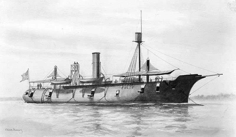
On May 8, the USS Galena, USS Port Royal and USS Aroostook attacked both Fort Huger and Fort Boykin — with the worst of the fire directed at Fort Boykin. The Port Royal and Aroostook fired from the James River channel while the Galena moved in closer with raking shots. Both forts eventually ceased fire as their cannons were not powerful enough to damage the ironclad Galena or to reach the two ships beyond her.
The bombardments convinced the Confederates that these forts were untenable, and they were abandoned. US. Marines landed and occupied Forts Boykin and Huger on May 17 and 18 to find most of the guns spiked, the carriages burned and structures within the forts destroyed.
The reduction of both forts opened the James River for the Union fleet to head upriver to the strong Confederate position at Drewry's Bluff, just eight miles southeast of Richmond.
Fort Huger lay abandoned until efforts were put forth by Isle of Wight County and the community to restore and preserve it in the mid 2000s. It was dedicated to the county's citizens in 2008.
1862 Armaments
Brought via barge from Gosport Navy Yard, Portsmouth, Virginia
One 7-inch army Columbiad, rifled bore
Two 8-inch Columbiads, smoothbore
Three 9-inch Dahlgrens, smoothbore
Six double-fortified navy 32-pounders, smoothbore
Source: Lieutenant John Watters, U.S. Navy, commanding USS Minnesota, May 19, 1863
(captions)
Major
General Benjamin Huger (1805-1877) Commander of the Department of Norfolk
Andrew Talcott (1797-1883) Confederate State Engineer
USS Galena
Fort Huger, Hardy's Bluff, 1863 Confederate States of America, Army, Department of Northern Virginia, Chief Engineer's Office Courtesy of the Virginia Historical Society
Fort Huger and Mulberry Point Battery with intermediate soundings, 1863. Confederate States of America, Army, Department of Northern Virginia, Chief Engineer's Office Courtesy of the Library of Congress
Dahlgren shell fired at Fort Huger from USS Galena Collection of Craig Bell
Fort Huger, 2007 Courtesy of the Virginia Historical Society
The Union fleet was stationed at Fort Monroe. After the March 1862 battle between the USS Monitor and the CSS Virginia, the James River was ceded to the Union. The forts along the James River became the last chance to protect the Confederate capital of Richmond. Sources: Esri Welcome, NAVTEQ, Tom Tom, Intermap, iPC, USGS, FAO, NPS, NRCAN, GeoBase, IGN, Kadas ter NL, Ordnance Survey, Esri Japan, METI, Esri China (Hong Kong) and the GIS User Community
Erected by Isle of Wight County.
Topics. This historical marker is listed in these topic lists: Forts and Castles
• War, US Civil • Waterways & Vessels. A significant historical month for this entry is March 1862.
Location. 37° 6.663′ N, 76° 39.692′ W. Marker is in Smithfield, Virginia, in Isle of Wight County. Marker can be reached from the intersection of Talcott Terrace and Lawnes Neck Drive, on the right when traveling east. Touch for map. Marker is at or near this postal address: 15080 Talcott Ter, Smithfield VA 23430, United States of America. Touch for directions.
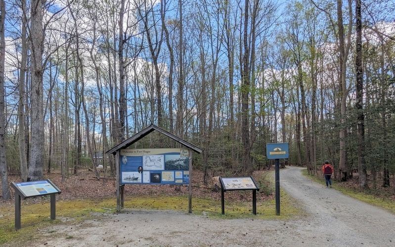
Other nearby markers. At least 8 other markers are within walking distance of this marker. Fort Huger (here, next to this marker); a different marker also named Fort Huger (here, next to this marker); Encampment (within shouting distance of this marker); Fifth Battalion Virginia Infantry (within shouting distance of this marker); Bridge (about 400 feet away, measured in a direct line); Fort Entrance & Defense (approx. 0.2 miles away); The Fort (approx. 0.2 miles away); Hot Shot Furnace & Shell House (approx. ¼ mile away). Touch for a list and map of all markers in Smithfield.
Also see . . . Fort Huger. Isle of Wight County Museum (Submitted on April 6, 2024.)
Credits. This page was last revised on April 6, 2024. It was originally submitted on April 5, 2024, by Bernard Fisher of Richmond, Virginia. This page has been viewed 45 times since then. Photos: 1. submitted on April 5, 2024, by Bernard Fisher of Richmond, Virginia. 2. submitted on April 6, 2024, by Bernard Fisher of Richmond, Virginia. 3, 4, 5, 6. submitted on September 19, 2010, by Bernard Fisher of Richmond, Virginia.
