Broadkill Hundred in Wiltbank Landing in Sussex County, Delaware — The American Northeast (Mid-Atlantic)
The Morris Cemetery
Photographed by Pete Skillman, April 6, 2024
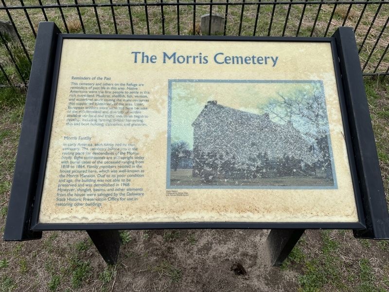
1. The Morris Cemetery Marker
Reminders of the Past
This cemetery and others on the Refuge are reminders of past life in this area. Native American were the first people to settle in this rich marshland. Muskrat, shellfish, fish, venison, and waterfowl were among the many resources that supported inhabitants of the area. Later, European settlers were attracted here because of the rich farmland and diversity of wildlife available for food and trade. Industries began to develop, including farming, timber harvesting, ship and boat building, canneries, and granaries.
Morris Family
In early America, each family had its own cemetery. The cemetery before you is the resting place for descendants of the Morris family. Eight tombstones are still upright today with burial dates of the deceased ranging from 1818 to 1864. Family members resided in the house pictured here, which was well-known as the Morris Mansion. Due to its poor condition and age, the building was not able to be preserved and was demolished in 1968. However, shingles, beams, and other elements from the house were salvaged by the Delaware State Historic Preservation Office for use in restoring
this page online
Erected by Fish and Wildlife Service, U.S. Department of the Interior.
Topics. This historical marker is listed in these topic lists: Cemeteries & Burial Sites • Indigenous Peoples and Communities • Settlements & Settlers. A significant historical year for this entry is 1818.
Location. 38° 49.882′ N, 75° 14.99′ W. Marker is in Wiltbank Landing, Delaware, in Sussex County. It is in Broadkill Hundred. It can be reached from Boardwalk Trail 0.1 miles north of Turtle Pond Road, on the left when traveling north. Touch for map. Marker is at or near this postal address: 11970 Boardwalk Trail, Milton DE 19968, United States of America. Touch for directions.

Regionally, this marker is in the American Mid-Atlantic, on the Delmarva Peninsula, and on the Eastern Seaboard. Globally, it is in the North Atlantic Region, North America, the Western Hemisphere, the Western World, and the Anglosphere. Historically, it finds itself in what was once New Netherland, one of the original Thirteen Colonies, and the Antebellum South.
Other nearby markers. At least 8 other markers are within 3 miles of this marker, measured
Photographed by Pete Skillman, April 6, 2024
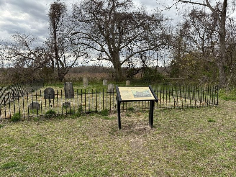
2. The Morris Cemetery Marker wide view
Cemetery in the background.
Credits. This page was last revised on June 5, 2026. It was originally submitted on April 6, 2024, by Pete Skillman of Wilmington, Delaware. This page has been viewed 636 times since then and 112 times this year. Photos: 1, 2. submitted on April 6, 2024, by Pete Skillman of Wilmington, Delaware. • Devry Becker Jones was the editor who published this page.
