Byrdstown in Pickett County, Tennessee — The American South (East South Central)
The Burning of Hale's Mill
September 15, 1862
Photographed by Darren Jefferson Clay, April 7, 2024
1. The Burning of Hale's Mill Marker
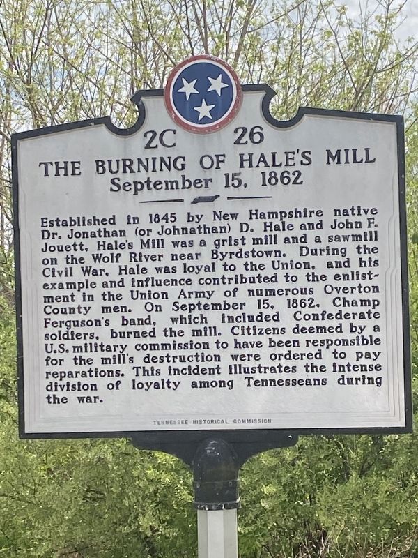
Established in 1845 by New Hampshire native Dr. Jonathan (or Johnathan) D. Hale and John F. Jouett, Hale's Mill was a grist mill and a sawmill on the Wolf River near Byrdstown. During the Civil War, Hale was loyal to the Union, and his example and influence contributed to the enlistment in the Union Army of numerous Overton County men. On September 15. 1862, Champ Ferguson's band, which included Confederate soldiers, burned the mill. Citizens deemed by a U.S. military commission to have been responsible for the mill's destruction were ordered to pay reparations. This incident Illustrates the intense division of loyalty among Tennesseans during the war.
Erected by Tennessee Historical Commission. (Marker Number 2C 26.)
Topics. This historical marker is listed in this topic list: War, US Civil. A significant historical date for this entry is September 15, 1862.
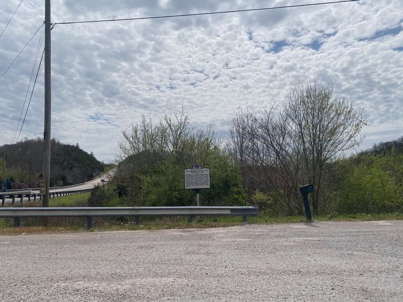
Location. 36° 36.252′ N, 85° 7.206′ W. Marker is in Byrdstown, Tennessee, in Pickett County. It is on Tennessee Route 111 south of Bakers Point Road, on the right when traveling south. Touch for map. Marker is at or near this postal address: 9201 TN-111, Byrdstown TN 38549,
this page online

Regionally, this marker is in the Cumberland Plateau. It is also in the American South, specifically in the Upper South, in Appalachia, and specifically in Southern Appalachia. Globally, it is in North America, the Western Hemisphere, the Western World, and the Anglosphere. Historically, it finds itself in what was once the territory of the Mississippian Culture, one of the Confederate States of America, and the Antebellum South.
Other nearby markers. At least 8 other markers are within 7 miles of this marker, measured as the crow flies: Cordell Hull (approx. 3½ miles away); Clear Fork Baptist Church (approx. 4.9 miles away in Kentucky); "Tennessee Lead" (approx. 5.6 miles away); Pioneer Settler (approx. 6 miles away in Kentucky); Courthouse Burned (approx. 6 miles away in Kentucky); County Named, 1835 (approx. 6 miles away in Kentucky); Civil War Terrorist (approx. 6 miles away in Kentucky); Fentress County / Pickett County (approx. 6.4 miles away).
Another marker is no longer nearby. Governor's Birthplace (was approx. 3½ miles away in Kentucky but has been confirmed
Photographed by Darren Jefferson Clay, April 7, 2024
2. The Burning of Hale's Mill Marker
Credits. This page was last revised on April 12, 2024. It was originally submitted on April 7, 2024, by Darren Jefferson Clay of Duluth, Georgia. This page has been viewed 739 times since then and 78 times this year. Photos: 1, 2. submitted on April 10, 2024, by Darren Jefferson Clay of Duluth, Georgia. • Bernard Fisher was the editor who published this page.
