Centreville in Queen Anne's County, Maryland — The American Northeast (Mid-Atlantic)
Queen Anne's County Museum of Eastern Shore Life

Photographed by Pete Skillman, April 11, 2024
1. Queen Anne's County Museum of Eastern Shore Life Marker
Erected by Historic Sites Consortium of Queen Anne's County, MD.
Topics. This historical marker is listed in these topic lists: Agriculture • Industry & Commerce • Settlements & Settlers.
Location. 39° 1.649′ N, 76° 7.182′ W. Marker is in Centreville, Maryland, in Queen Anne's County. It is at the intersection of Dulin Clark Road and 4-H Park Road (Maryland Route 18), on the right when traveling north on Dulin Clark Road. Touch for map. Marker is at or near this postal address: 1002 Dulin Clark Rd, Centreville MD 21617, United States
this page online

Regionally, this marker is on the Eastern Shore. It is also in the American Mid-Atlantic, on the Delmarva Peninsula, in the Tidewater, in the Chesapeake Bay Region, and on the Eastern Seaboard. Globally, it is in the North Atlantic Region, North America, the Western Hemisphere, the Western World, and the Anglosphere. Historically, it finds itself in what was once one of the original Thirteen Colonies and also the Antebellum South.
Other nearby markers. At least 8 other markers are within 3 miles of this marker, measured as the crow flies: Birthplace of Charles Willson Peale (about 300 feet away, measured in a direct line); "All Gave Some - Some Gave All" (approx. 2.6 miles away); Veterans Memorial (approx. 2.6 miles away); U.S. Army M5/M6 Antitank Gun (approx. 2.6 miles away); The Gift of a Second Railroad (approx. 2.7 miles away); St. Paul's Episcopal Church (approx. 3 miles away); Centreville Wharf (approx. 3 miles away); Shuttled By Ship (approx. 3 miles away). Touch for a list and map of all markers in Centreville.
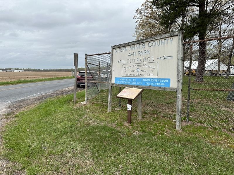
Photographed by Pete Skillman, April 11, 2024
2. Queen Anne's County Museum of Eastern Shore Life Marker wide view
Credits. This page was last revised on April 18, 2024. It was originally submitted on April 11, 2024, by Pete Skillman of Wilmington, Delaware. This page has been viewed 190 times since then and 14 times this year. Photos: 1, 2. submitted on April 11, 2024, by Pete Skillman of Wilmington, Delaware. • Bill Pfingsten was the editor who published this page.
