Marshall Terrace in Minneapolis in Hennepin County, Minnesota — The American Midwest (Upper Plains)
Columbia Park and Golf Course
"It is urged in support of the idea that it would be the favorite Sunday resort for the entire easterly portion of the city."
Minneapolis Tribune, December 19, 1892
Columbia Park
In the early 1890s, William Watts Folwell (1833-1929), a member of the Minneapolis Board of Park Commissioners and President of the University of Minnesota, promoted linking Glenwood Park (Theodore Wirth) in North Minneapolis to a new park across the Mississippi River in Northeast Minneapolis. It was part of the city's encircling boulevard system he called the "Grand Rounds." Board members from Northeast Minneapolis then included Central Avenue real estate dealer Portius Deming and Marshall Street farmer Joseph Ingenhutt.
In 1892, the Park Board acquired 144 acres for $208,000; the hilly parcel included woods, former farmland, and 40-acre Sandy Lake. The property edged the border with Columbia Heights, north of the sprawling Shoreham Yards of the Soo Line. The Minneapolis Tribune called the site "a beautiful one, wild and rugged." The Park Board believed the exceptional wooded hills and spring-fed lake would prove very valuable because Columbia Park was located in an area that was rapidly becoming industrial and would also soon be served by streetcar connections.
Columbia Park land exchange and boulevard design, 1910.
Rope tow on the ski hill, ca. 1940.
Toboggan slide, ca. 1925.
Columbia Park, after Soo Line realignment of Columbia Boulevard, 1914.
View of Columbia Boulevard, 1905.
South Drive, Columbia Park, 1915.
Columbia Boulevard
The Park Board built a north carriage drive (Columbia Boulevard) and a south drive in 1893-94, followed by a graceful iron bridge over a Soo Line right-of-way. In 1910, they obtained six acres of Soo Line land on the "hill commanding a magnificent view of the city." Part of a land exchange allowing the railroad to build a cut-off to north Minneapolis, Columbia Boulevard was realigned with a new concourse at the top of the hill. This spot was already very popular with some early automobile enthusiasts. Hill-climbing contests like one held in June 1907 were sponsored by the American Automobile Association. Thousands of spectators lined the course, which saw the victory of a Stanley Steamer and a Stevens Duryea gasoline car.
"Columbia Park today is in very much the natural state it was in when purchased...."
Minneapolis Morning Tribune, March 3, 1914
New Park Plans
In 1914, Superintendent Theodore Wirth (1863-1949) presented plans
for an athletic field in the park's lower meadow. The plan included ten volleyball courts, four baseball diamonds, two football fields and eight basketball courts. The fields were never realized, but foresters planted a grove at the south end of the park to screen the Shoreham Yards, and four miles of paths were created within the park.
Plans for meadow improvements (not executed), 1914.
With increased capacity, large community gatherings could be held: in July 1915, the New Boston Commercial Club sponsored a celebration attended by more than 10,000 people. Weekly band concerts were very popular during the summer months. Skiing, tobogganing, and horseback riding were among activities offered by 1925.
A Columbia Park picnic, ca. 1915.
Social Room, Columbia Manor. In 1926, 14,614 people used this room furnished with Colonial Revival furniture. Afternoon teas, dances, and bridge parties were among popular activities.
View of recently expanded nine-hold course, 1920.
Columbia Manor (1925), ca. 1935. The Colonial Revival-style golf club house building cost $70,000.
Columbia Golf Course
Columbia's excellent streetcar connections made it an ideal location for the city's second public golf course; the first was at Glenwood (Theodore Wirth) Park. Columbia's 1,800-yard, six-hole course with sand greens was completed in 1919.
Nine holes were added to the popular course in 1922. Columbia Manor, a handsome golf club house and community center, was completed in 1925. During the Depression years of the 1930s, workers funded by the Works Progress Administration (WPA) built a skating rink, added rustic stone fireplaces to three picnic areas and installed clay tennis courts along St. Anthony Parkway. The course was lengthened to 6,200 yards in the 1960s. In the 1990s, the Manor was remodeled and the Columbia Golf Learning Center was built on St. Anthony Parkway.
Patty Berg at Columbia Park Golf Course, ca. 1950. Berg (1918-2006) was a Minneapolis native and founding member and leading player on the Ladies Professional Golf Association (LPGA) Tour. Her career spanned more than three decades.
Topics. This historical marker is listed in these topic lists: Parks & Recreational Areas • Roads & Vehicles • Sports. A significant historical year for this entry is 1892.
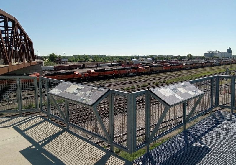
Location. 45° 1.647′ N, 93° 16.14′ W. Marker is in Minneapolis, Minnesota, in Hennepin County. It is in Marshall Terrace. Marker is at the intersection of St. Anthony Parkway and California Street NE, on the right when traveling east on St. Anthony Parkway. The marker is at the Northtown Railyard Overlook. Touch for map. Marker is in this post office area: Minneapolis MN 55418, United States of America. Touch for directions.
Other nearby markers. At least 8 other markers are within walking distance of this marker. Park Planning and the Grand Rounds (here, next to this marker); Northtown and the St. Anthony Parkway Bridge (here, next to this marker); New Bridge Planning Process and Design (here, next to this marker); The 1925 Bridge and the Warren Truss (a few steps from this marker); River, Railroad and Industry (a few steps from this marker); Prairie to Brickyard: The Landscape of Northtown (a few steps from this marker); Carl Ripken, Sr. (approx. ¼ mile away); MLB ★ Minnesota Twins Rod Carew All★Star Field (approx. ¼ mile away). Touch for a list and map of all markers in Minneapolis.
Credits. This page was last revised on April 20, 2024. It was originally submitted on April 20, 2024, by McGhiever of Minneapolis, Minnesota. This page has been viewed 41 times since then. Photos: 1, 2. submitted on April 20, 2024, by McGhiever of Minneapolis, Minnesota.

