Falmouth, Trelawny Parish, Jamaica — Caribbean Region of the Americas (Greater Antilles of the West Indies)
The Water Square
New World Innovation
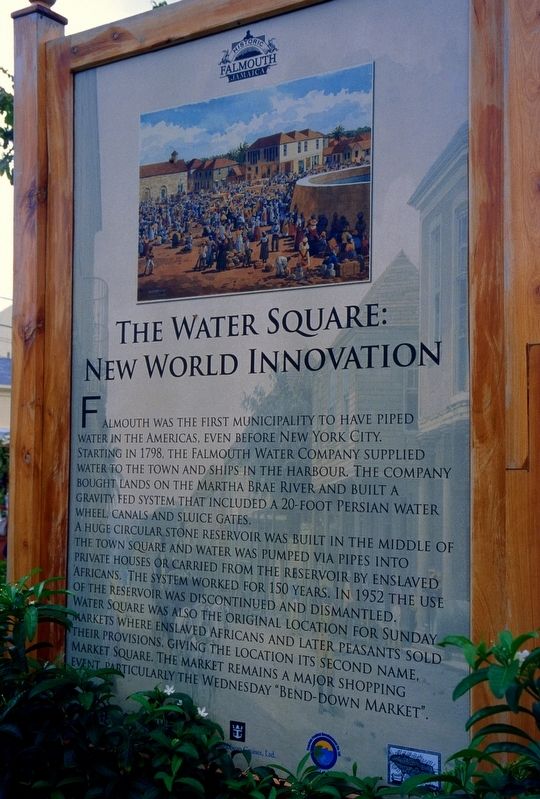
Photographed by Flexible Fotography
1. The Water Square Marker
Falmouth was the first municipality to have piped water in the Americas, even before New York City. Starting in 1798, the Falmouth Water Company supplied water to the town and ships in the harbour. The company bought lands on the Martha Brae River and built a gravity fed system that included a 20-foot Persian water wheel, canals and sluice gates.
A huge circular stone reservoir was built in the middle of the town square and water was pumped via pipes into private houses or carried from the reservoir by enslaved Africans. The system worked for 150 years. In 1952 the use of the reservoir was discontinued and dismantled.
Water Square was also the original location for Sunday markets where enslaved Africans and later peasants sold their provisions, giving the location its second name, Market Square. The market remains a major shopping event particularly the Wednesday "Bend-down Market".
Erected by Port Authority.
Topics. This historical marker is listed in these topic lists: African Americans • Colonial Era • Settlements & Settlers.
Location. 18° 29.529′ N, 77° 39.05′ W. Marker is in Falmouth, Trelawny Parish. It can be reached from Unnamed street east of Seaboard Street, on the left when traveling east. The marker is on an unnamed feeder street for the cruise ship dock. Touch for map. Marker is at or near this postal address: Trelawny St 1, Falmouth, Trelawny Parish, Jamaica. Touch for directions.

Regionally, it is one of the Greater Antilles on the Caribbean Sea, on in the Atlantic Ocean, in North America, in the Western Hemisphere, and in the Anglosphere. Historically, it finds itself in what was once a Spanish colony and specifically also a British colony.
Other nearby markers. At least 2 other markers are within
this page online
Credits. This page was last revised on February 21, 2025. It was originally submitted on April 22, 2024, by Flexible Fotography of San Diego, California. This page has been viewed 250 times since then and 60 times this year. Photo 1. submitted on April 22, 2024, by Flexible Fotography of San Diego, California. • J. Makali Bruton was the editor who published this page.
Editor’s want-list for this marker. A wide view photo of the marker and the surrounding area together in context. • Photos of any of the remnants of the features mentioned in the marker text. • Can you help?
