
Santo Domingo in Tepoztlán, Morelos, Mexico — The Central Highlands (North America)
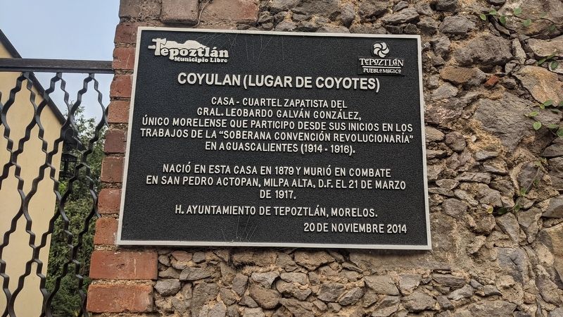
Coyulan (Lugar de Coyotes)
Coyulan (Place of coyotes)
Photographed by Christopher Athanas, March 31, 2024
1. Coyulan (Lugar de Coyotes) Marker

Único morelense que participo desde sus inicios en los trabajos de la "Soberana Convención Revolucionaría" en Aguascalientes (1914-1916).
Nació en esta casa en 1879 y murió en combate en San Pedro Actopan, Milpa Alta, D.F. el 21 de marzo de 1917.
H. Ayuntamiento de Tepoztlán, Morelos, 20 de noviembre 2014
Zapatista House-Barracks of General Leobardo Galván González
The only person from Morelos who participated from the beginning in the work of the "Sovereign Revolutionary Convention" in Aguascalientes (1914-1916).
He was born in this house in 1879 and died in combat in San Pedro Actopan, Milpa Alta, D.F. on March 21, 1917.
Honorable City Council of Tepoztlán, Morelos, November 20, 2014
Erected 2014 by Honorable Ayuntamiento de Tepoztlán, Morelos.
Topics. This historical marker is listed in these topic lists: Patriots & Patriotism • Wars, Non-US. A significant historical date for this entry is March 21, 1917.
Location. 18° 59.411′ N, 99° 5.863′ W. Marker is in Tepoztlán, Morelos. It is in Santo Domingo. It is on Calle Aniceto
this page online

Regionally, this marker is in Central Mexico. Globally, it is in North America, specifically in Mesoamerica, on the Ring of Fire, and in the Western Hemisphere. Historically, it finds itself in what was once New Spain, a Spanish colony, and the Aztec Empire.
Other nearby markers. At least 8 other markers are within 16 kilometers of this marker, measured as the crow flies: First City Council of Tepoztlán (approx. 0.6 kilometers away); El Tepozteco National Park (approx. 0.6 kilometers away); Temple of Tezcatlipoca (approx. 14.6 kilometers away); Teopanzolco (approx. 14.7 kilometers away); Temples of Tlaloc and Huitilopochtli (approx. 14.7 kilometers away); The Temple of Ehécatl (approx. 14.7 kilometers away); Minor Temples (approx. 14.7 kilometers away); Callejón del Cubo (approx. 16.2 kilometers away). Touch for a list and map of all markers in Tepoztlán.
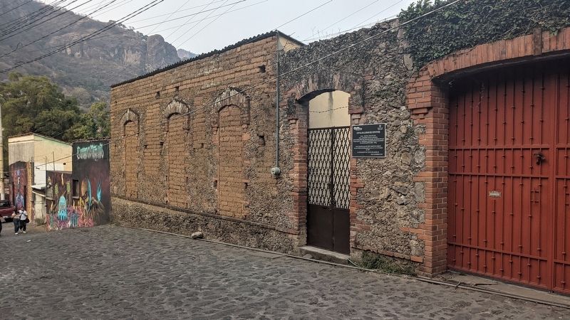
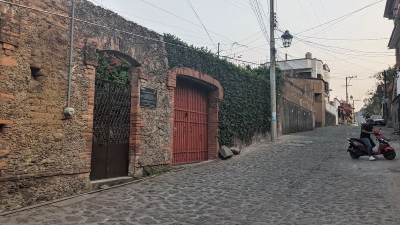
Regarding Coyulan (Lugar de Coyotes). Parts of the original house

Photographed by Christopher Athanas, March 31, 2024
2. Coyulan (Lugar de Coyotes) Marker
Photographed by Christopher Athanas, March 31, 2024
3. Coyulan (Lugar de Coyotes) Marker
Photographed by Christopher Athanas, March 31, 2024
4. Coyulan (Lugar de Coyotes) Marker

Photographed by Christopher Athanas, March 31, 2024
5. Coyulan (Lugar de Coyotes) Marker
Credits. This page was last revised on April 29, 2024. It was originally submitted on April 25, 2024, by Christopher Athanas of Austin, Texas. This page has been viewed 159 times since then and 14 times this year. Photos: 1, 2, 3, 4, 5. submitted on April 25, 2024, by Christopher Athanas of Austin, Texas. • J. Makali Bruton was the editor who published this page.
