Trevilians near Louisa in Louisa County, Virginia — The American South (Mid-Atlantic)
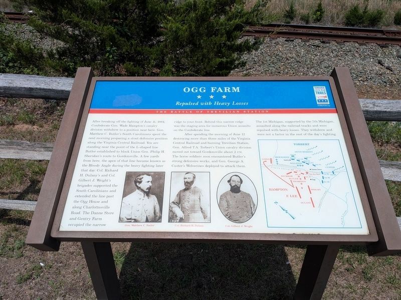
Ogg Farm
Repulsed with Heavy Losses
| — | The Battle of Trevilian Station | — |
Photographed by Evan Dwyer, June 11, 2026
1. Ogg Farm Marker
A new version of the marker with slightly different spacing replaced the aging original.
After spending the morning of June 12 destroying more than three miles of the Virginia Central Railroad and burning Trevilian Station, Gen. Alfred T.A. Torbert’s Union cavalry division moved out toward Gordonsville about 2 P.M. The horse soldiers soon encountered
this page online
(caption) Gen. Matthew C. Butler • Col. Richard H. Dulany • Col. Gilbert J. Wright
Erected by Virginia Civil War Trails.
Topics and series. This historical marker is listed in this topic list: War, US Civil. In addition, it is included in the Virginia Civil War Trails series list. A significant historical date for this entry is June 12, 1864.
Location. 38° 4.093′ N, 78° 5.594′ W. Marker is near Louisa, Virginia, in Louisa County. It is in Trevilians. It is on South Spotswood Trail (U.S. 33) 1.4 miles north of Louisa Road (Virginia Route 22), on the right when traveling west. Touch for map. Marker is in this post office area: Louisa VA 23093, United States of America. Touch for directions.

Regionally, this marker is in the Piedmont and in Central Virginia. It is also in the American South and specifically in the Upper South. Globally, it is in
Photographed by Bernard Fisher, November 15, 2009
2. Ogg Farm CWT Marker
Other nearby markers. At least 8 other markers are within 3 miles of this marker, measured as the crow flies: Battle of Trevilian Station (approx. 1½ miles away); Battle of Trevillians (approx. 1½ miles away); Green Springs (approx. 1.6 miles away); Railroad Rails (approx. 1.6 miles away); Custer's First Last Stand (approx. 1.6 miles away); Custer Rescued (approx. 1.6 miles away); The Netherland's Tavern (approx. 2.2 miles away); Netherland Tavern (approx. 2.2 miles away). Touch for a list and map of all markers in Louisa.
Other markers no longer nearby. Battle of Trevilians (was approx. 1½ miles away but has been replaced with another marker now near it); Trevilian Station Battle (was approx. 1.6 miles away but has been confirmed missing).
Regarding Ogg Farm. This is one of several markers interpreting the Battle of Trevilian Station, June
Photographed by Bernard Fisher, November 15, 2009
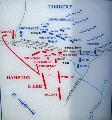
3. Fighting at the Ogg Farm, June 12, 1864
Also see . . .
1. American Battlefield Trust Page on Trevilian Station. An authoritative source for information on the battle and battlefield preservation. (Submitted on November 15, 2009.)
2. Trevilian Station Battlefield Foundation. The foundation has worked to preserve the remaining sections of the battlefield. A detailed self-guided driving tour of the battlefield is offered. This marker is at stop eight (now seven, with the deletion of the intended Poindexter Farm marker) of the tour. (Submitted on November 15, 2009.)
3. Battle of Trevilian Station Virtual Tour by Markers. A set of markers that document the Battle of Trevilian Station, June 11-12, 1864. The order of appearance is generally aligned to the Trevilian Station Battlefield Foundation driving tour, with accommodations made for convenience both in the town of Louisa at the beginning of the tour, and on the eastbound side of Route 33 headed back towards the cemetery. Because the C.G. Trevilian House at the 'modern' station
Photographed by Bernard Fisher, November 15, 2009
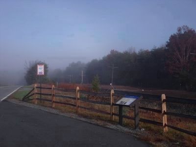
4. Civil War Trails pullover on US-33 W
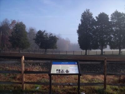
Photographed by Bernard Fisher, November 15, 2009
5. Ridgeline across the railroad tracks (facing east)
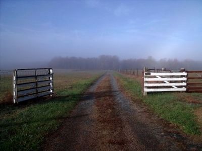
Photographed by Bernard Fisher, November 15, 2009
6. The Ogg Farm (facing west)
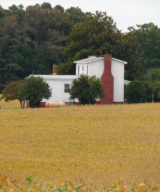
Photographed by Bradley Owen, October 16, 2018
7. Ogg Farmhouse
Louisa County GIS does not give a date for the construction of the house. It is private property.
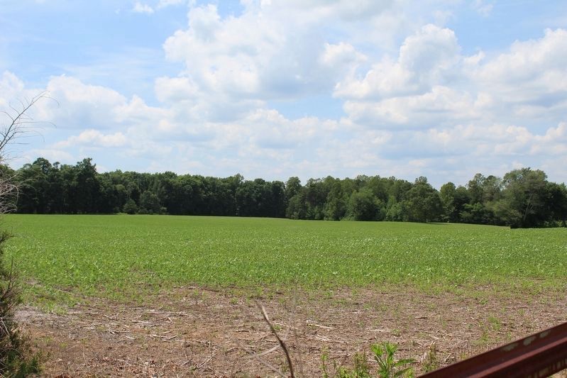
Photographed by Evan Dwyer, June 11, 2026
8. Trevilians Bloody Angle
Based on the topography, this ground just to the north of the Ogg Farm's gravel driveway, viewed from the fence, appears to be where the Confederate line was formed. To the immediate south the ground tapers away into a watershed, and the map on the marker indicates the Ogg farmhouse itself was outside of the Confederate works - so to bend the line west and not encompass the house, the line should have had a natural flank on which to do this. The beginning of that ravine accomplishes that purpose. If that is indeed the case, this slight rise shown in this photograph would be the natural point on which to make a stand; this strip of ground runs about northwest in a slight semicircle before following a much more mellow decline than that to the south.
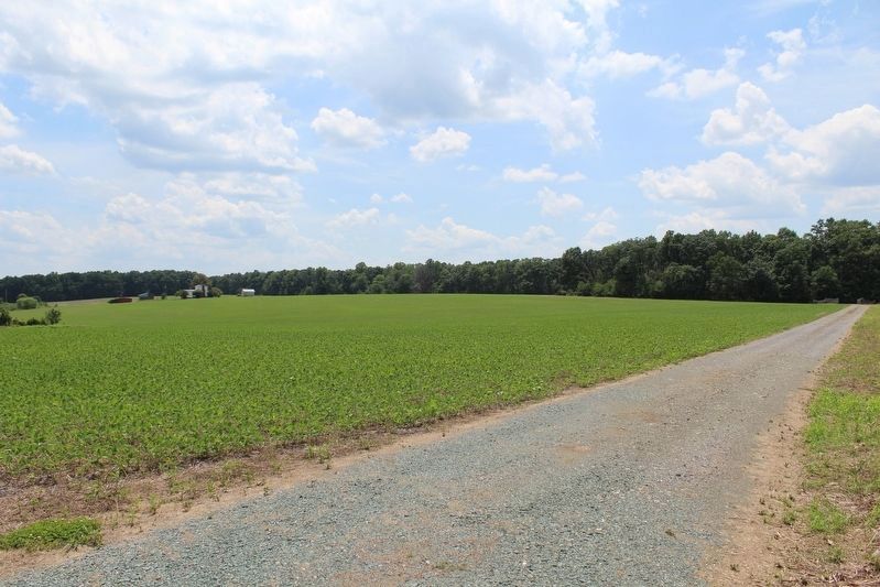
Photographed by Evan Dwyer, June 11, 2026
9. Ogg Farm
This view, from the gate of the driveway to the farm, shows how the ground slopes downwards to the south of the gravel drive, as described in the previous image. This feature and the exclusion of the house from the Confederate line would seem to indicate that the "L" bent right about where the ground starts sloping downwards, just left of the current driveway, if not just before.
Credits. This page was last revised on August 15, 2026. It was originally submitted on November 15, 2009, by Bernard Fisher of Richmond, Virginia. This page has been viewed 2,627 times since then and 60 times this year. Last updated on September 16, 2024, by Carl Gordon Moore Jr. of North East, Maryland. Photos: 1. submitted on August 14, 2026, by Evan Dwyer of Richmond, Virginia. 2, 3, 4, 5, 6. submitted on November 15, 2009, by Bernard Fisher of Richmond, Virginia. 7. submitted on January 21, 2021, by Bradley Owen of Morgantown, West Virginia. 8, 9. submitted on August 14, 2026, by Evan Dwyer of Richmond, Virginia.
