Phillips in Minneapolis in Hennepin County, Minnesota — The American Midwest (Upper Plains)
Passed by a Bus
The Streetcar Era Ends
Photographed by McGhiever, May 20, 2023
1. Passed by a Bus Marker
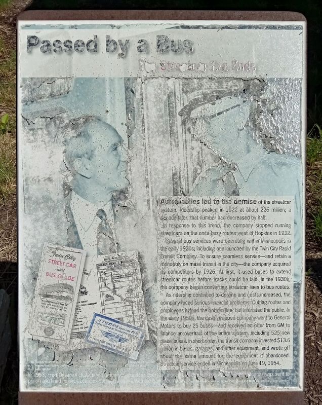
Automobiles led to the demise of the streetcar system. Ridership peaked in 1922 at about 226 million; a decade later that number had decreased by half.
In response to this trend, the company stopped running streetcars on the once busy routes west of Hopkins in 1932.
Several bus services were operating within Minneapolis in the early 1920s, including one launched by the Twin City Rapid Transit Company. To ensure seamless service—and retain a monopoly on mass transit in the city—the company acquired its competitors by 1926. At first, it used buses to extend streetcar routes before tracks could be laid. In the 1930s, the company began converting streetcar lines to bus routes.
As ridership continued to decline and costs increased, the company faced serious financial problems. Cutting routes and employees helped the bottom line, but infuriated the public. In the early 1950s, the cash-strapped company went to General Motors to buy 25 buses—and received an offer from GM to finance an overhaul of the entire system, including 525 new diesel buses. In short order, the transit company invested $13.6 million in buses, garages,
this page online
[Caption:] In 1953, Fred Ossanna chatted with a former streetcar operator, now a bus driver. Seven years later, Ossanna was sent to prison and fined for illicit activities during his tenure with the transit company. Credit: Saint Paul Dispatch and Pioneer Press. Photograph: Minnesota Historical Society Collections
Topics. This historical marker is listed in these topic lists: Railroads & Streetcars • Roads & Vehicles. A significant historical date for this entry is June 19, 1954.
Location. 44° 57.342′ N, 93° 15.768′ W. Marker is in Minneapolis, Minnesota, in Hennepin County. It is in Phillips. It is at the intersection of Chicago Avenue and E. 26th Street, on the right when traveling south on Chicago Avenue. Touch for map. Marker is at or near this postal address: 720 E 26th Street, Minneapolis MN 55404, United States of America. Touch for directions.

Regionally, this marker is in the Twin Cities Metropolitan Area. It is also in the American Midwest, in the Corn Belt, and in the Great River

Photographed by McGhiever, May 20, 2023
2. Passed by a Bus Marker (far right) at the northwest corner of 26th and Chicago
Other nearby markers. At least 8 other markers are within walking distance of this marker: Horse Car, Streetcar, Bus (here, next to this marker); Fun Fare (here, next to this marker); Crosstown (here, next to this marker); Tracking Growth (here, next to this marker); The Man Behind the Name (here, next to this marker); An Era of New Business on the Rail Corridor (approx. 0.4 miles away); 2845 10th Avenue South: Elevator X (approx. half a mile away); Minneapolis in the Age of Grade Separation (approx. half a mile away). Touch for a list and map of all markers in Minneapolis.
Credits. This page was last revised on April 25, 2024. It was originally submitted on April 25, 2024, by McGhiever of Minneapolis, Minnesota. This page has been viewed 157 times since then and 12 times this year. Photos: 1. submitted on April 25, 2024, by McGhiever of Minneapolis, Minnesota. 2. submitted on February 9, 2024, by McGhiever of Minneapolis, Minnesota.
