
Hopkinsville in Christian County, Kentucky — The American South (East South Central)
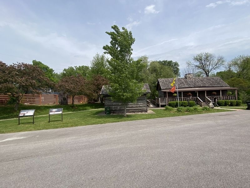
A Winter Camp

Photographed by Darren Jefferson Clay, April 27, 2024
1. A Winter Camp Marker
"We met several detachments in the southern part of Kentucky... two thousand Indians with horses and mules in proportion. The forward part of the train we found just pitching their tents for the night, and notwithstanding some thirty or forty wagons were already stationed, we found the road literally filled with the procession for about three miles in length."
1830s Indian Removal Policy
For Cherokees, homelands are a place of origin with high spiritual and cultural value embedded in the land and waterways. Federal Indian removal policy became a divisive tool that forced Tribes west of the Mississippi River. Some supporters of these policies believed that Tribes could not coexist in States. Ultimately, Jacksonian era policies removed Tribes to create a pathway for rapid growth, wealth, and power for white settlers in the east.
The
this page online
Today
Members of the five removed tribes endured starvation, exposure, and disease during removal. Those who survived established new lives in Indian Territory. Today, these Tribes continue as sovereign nations, preserving culture and traditions for generations to come.
Cherokees who survived the Trail of Tears joined those who moved earlier to reunite as the Cherokee Nation in Indian Territory, now the Cherokee Nation reservation. Some Cherokees remained in North Carolina and formed the Eastern Band of Cherokee Indians.
Erected by National Park Service.
Topics. This historical marker is listed in this topic list: Indigenous Peoples and Communities.
Location. 36° 51.198′ N, 87° 28.216′ W. Marker is in Hopkinsville, Kentucky, in Christian County. It is on Trail of Tears Dr. north of East 9th Street. Touch for map. Marker is in this post office area: Hopkinsville KY 42240, United States of America. Touch for directions.

Regionally,
Photographed by Darren Jefferson Clay, April 27, 2024
2. A Winter Camp Marker
Other nearby markers. At least 8 other markers are within one mile of this marker, measured as the crow flies: Mourning at Camp (here, next to this marker); The Cherokee A Civilized People (within shouting distance of this marker); Whitepath and Fly Smith (within shouting distance of this marker); Cherokee "Trail of Tears" (about 300 feet away, measured in a direct line); Trail of Tears Indian Camping Grounds (approx. ¼ mile away); The Trail of Tears (approx. ¼ mile away); The Knight House (approx. 0.7 miles away); Peace Park (approx. 1.1 miles away). Touch for a list and map of all markers in Hopkinsville.
Credits. This page was last revised on May 3, 2024. It was originally submitted on April 28, 2024, by Darren Jefferson Clay of Duluth, Georgia. This page has been viewed 344 times since then and 25 times this year. Photos: 1, 2. submitted on April 30, 2024, by Darren Jefferson Clay of Duluth, Georgia. • James Hulse was the editor who published this page.
