
Near Dinwiddie in Dinwiddie County, Virginia — The American South (Mid-Atlantic)
"My command had to lament the loss of some of it's bravest and best..." General Charles Griffin
| — | Petersburg National Battlefield | — |
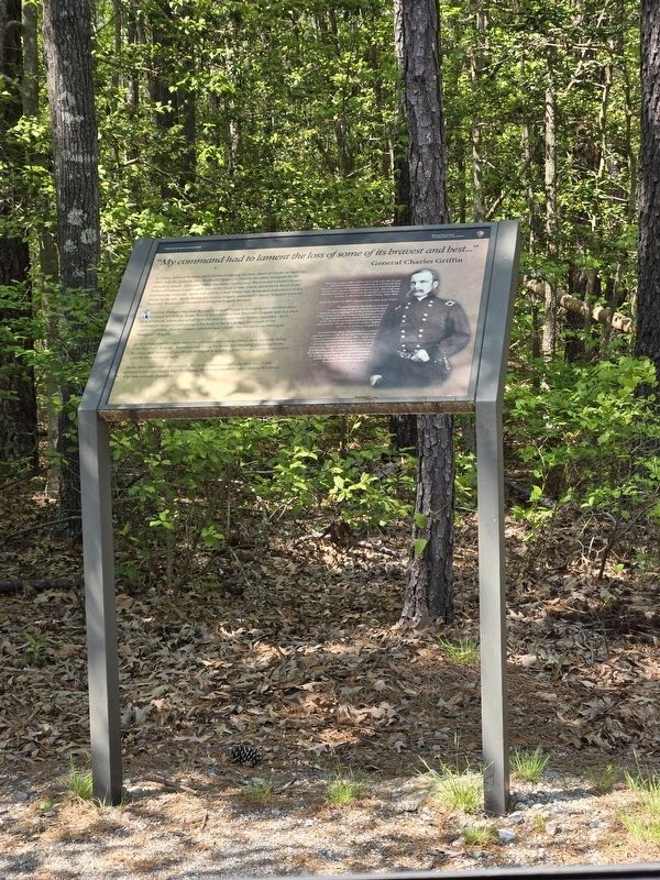
Photographed by Mike McKeown, April 26, 2024
1. "My command had to lament the loss of some of it's bravest and best..." Marker
Confederate General Matthew Ransom's brigade began to fire on Ayres's division after it crossed White Oak Road. Warren later recalled that Ransom's brigade was in a thick belt of woods, which disrupted their aim and reduced Union causalities. Ayres realized the situation and changed his front to the left to face the return of the southerner's line. The movement opened a space in the line which Ayres filled with Winthrop's Brigade.
Ayres men faltered briefly when they became exposed to closer, more accurate firing from Ransom's brigade. Sheridan rode
this page online
Ayres' men would take the position, key to the entire Confederate line, over 1,000 prisoners and eight battle flags but among the Union casualties was General Winthrop who was mortally wounded.
(sidebar)
Born on August 3rd, 1839 in New York City, the 25 year old Winthrop would be taken back to Gravelly Run Church, which was now transformed into a field hospital. It was there he succumbed to his wounds. His body was transported back to New York for burial at Green Wood Cemetery, Brooklyn, Kings County New York.
From his April 13, 1865 obituary in the New York Times,
"From private in the ranks to General commanding a brigade, his record has been stainless. Participating in all the principal battles fought in the East, his conduct in each was worthy of the man who in the heat of battle could die as he die in an act of quiet heroism and noble self-sacrifice. He was a splendid soldier, skillful gallant, cool and accomplished.
But this who knew him as a soldier were ignorant of the things that most endeared him to a multitude of friends. How many who served with his in the army of the Potomac or who met in in his brief interlude of recreation will mournfully remember his kind genial manners, his generous love of pleasure, his frank hearted bearing and gentle courtesy in act and word, long after the victory with his manner is connected shall have become a tradition in the land."
Erected by National Park Service, U.S. Department of the Interior.
Topics. This historical marker is listed in this topic list: War, US Civil. A significant historical date for this entry is April 1, 1865.
Location. 37° 8.401′ N, 77° 36.638′ W. Marker is near Dinwiddie, Virginia, in Dinwiddie County. It is on White Oak Road (Route 613) east of Courthouse Road (Virginia Route 627), on the right when traveling west. Touch for map. Marker is in this post office area: Dinwiddie VA 23835, United States of America. Touch for directions.

Regionally, this marker is in Virginia’s Piedmont, in Southside Virginia, and specifically in Central Virginia. It is also in the American South and specifically in the Upper South. Globally, it is in North America, the Western Hemisphere, the Western World, and the Anglosphere. Historically, it finds itself in what was once the territory of the Mississippian Culture, one of the original Thirteen Colonies, one of the Confederate States of America, and the Antebellum South.
Other nearby markers. At least 8 other markers are within walking distance of this marker: Attack on the Angle (within shouting distance of this marker); "I was exceeding anxious to attack at once…" (approx. half a mile away); Siege of Petersburg — The Linchpin is Pulled (approx. 0.6 miles away); The Siege of Petersburg (approx. 0.6 miles away); "Advanced…repulsed…charged again…" (approx. 0.6 miles away); "The woods were quite heavy..." (approx. 0.7 miles away); The Battle of Five Forks (approx. 0.7 miles away); Five Forks Battlefield (approx. 0.7 miles away). Touch for a list and map of all markers in Dinwiddie.
Another marker is no longer nearby. The Union Cavalry Attacks (was approx. half a mile away but has been replaced with another marker now near it).
Also see . . .
1. Petersburg National Battlefield. National Park Service (Submitted on April 30, 2024.)
2. Battle of Five Forks. Wikipedia (Submitted on April 30, 2024.)
3. Frederick Winthrop. Find A Grave (Submitted on April 30, 2024.)
Credits. This page was last revised on April 30, 2024. It was originally submitted on April 29, 2024, by Mike McKeown of Baltimore, Maryland. This page has been viewed 266 times since then and 11 times this year. Photo 1. submitted on April 29, 2024, by Mike McKeown of Baltimore, Maryland. • Bernard Fisher was the editor who published this page.
