North Central in Pasadena in Los Angeles County, California — The American West (Pacific Coastal)
The Washington Square Neighborhood

Photographed by Craig Baker, April 1, 2024
1. Washington Square Marker
Early in the 20th century, neighbors in the new community surrounding the undeveloped land at El Molino Avenue and Washington Boulevard recognized the need for a park and petitioned the City to procure the 3.1-acre vacant lot for a public park. The land eventually was purchased in 1921 for $8,500, one-fifth of which was contributed by residents. It was dedicated on April 30, 1921, as Washington Park with the planting of six "Memorial Oaks," three of which still stand.
Washington Park is an integral part of the Washington Square Landmark District, which was formed in 2003. This district recognizes and protects the park along with the historic homes and churches that line its streets. This community includes 247 contributing homes built from 1885 through 1942. These include a two-story Settlement House from 1885, 35 craftsman-style homes built before World War I, and a variety of revival styles built from the 1920s to 1942.
The earliest residents of this diverse neighborhood included middle and working-class families. In addition to the historic architecture of this neighborhood, Washington Square
this page online
Erected 2024 by City of Pasadena.
Topics. This historical marker is listed in these topic lists: Parks & Recreational Areas • Settlements & Settlers. A significant historical date for this entry is April 30, 1921.
Location. 34° 10.126′ N, 118° 8.153′ W. Marker is in Pasadena, California, in Los Angeles County. It is in North Central. It can be reached from the intersection of Washington Boulevard and El Molino Avenue, on the left when traveling west. Located in Washington Park, on the new Community Building, to the right of the doors. Touch for map. Marker is at or near this postal address: 725 E Washington Blvd, Pasadena CA 91104, United States of America. Touch for directions.

Regionally, this marker is in Greater Los Angeles and in the Transverse Ranges. It is also on the American Pacific Coast. Globally, it is in North America, on the Ring of Fire, on the Pacific Rim, in the Western Hemisphere, in the Western World, and in the Anglosphere. Historically, it

Photographed by Craig Baker, April 1, 2024
2. Washington Square Neighborhood Marker
Other nearby markers. At least 8 other markers are within walking distance of this marker: Washington Park (here, next to this marker); Bungalow Heaven (approx. half a mile away); 1141 North Chester Ave (approx. 0.7 miles away); First Lutheran Church (approx. 0.7 miles away); Grace United Methodist Church (approx. 0.7 miles away); La Pintoresca Library (approx. 0.8 miles away); Cypress Court (approx. 0.8 miles away); Pasadena Motorcycle Club Quonset Hut (approx. 0.9 miles away). Touch for a list and map of all markers in Pasadena.
Regarding The Washington Square Neighborhood. This is a city-designated landmark district.

Photographed by Craig Baker, March 19, 2024
3. Washington Park Community House
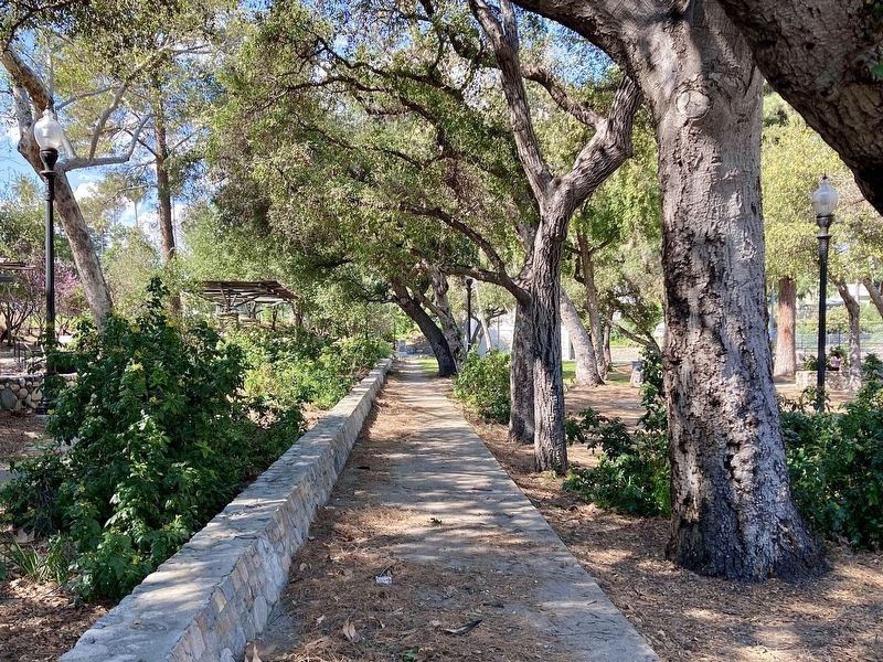
Photographed by Craig Baker, March 19, 2024
4. Washington Park Trees
Credits. This page was last revised on April 3, 2026. It was originally submitted on April 29, 2024, by Craig Baker of Sylmar, California. This page has been viewed 431 times since then and 58 times this year. Photos: 1, 2. submitted on April 29, 2024, by Craig Baker of Sylmar, California. 3, 4. submitted on March 19, 2024, by Craig Baker of Sylmar, California.
